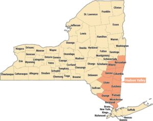
Florida Everglades Map
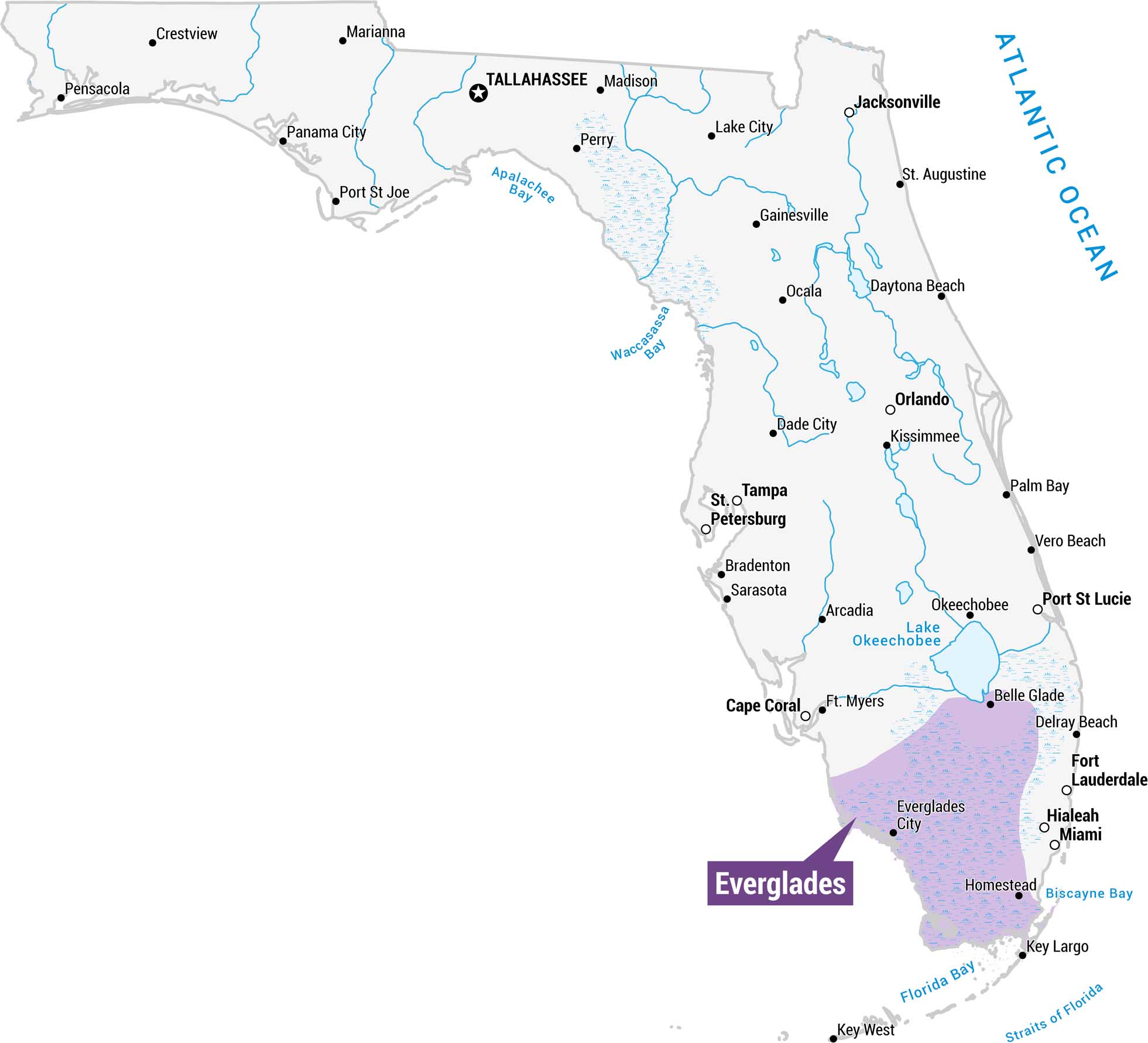
Get to know the Everglades with our Florida state map. You’ll find it in lavender across the southern tip of the state. It spans from Lake Okeechobee south through the Florida Keys.
Map Information
On the Map
Everglades Cities: Everglades City, Homestead, Miami, Hialeah, Fort Lauderdale, Delray Beach, Belle Glade, Key Largo, Key West Other Florida Cities: Jacksonville, St. Augustine, Daytona Beach, Orlando, Kissimmee, Palm Bay, Gainesville, Ocala, Lake City, Madison, Perry, Dade City, Tampa, St. Petersburg, Bradenton, Sarasota, Arcadia, Ft. Myers, Cape Coral, Vero Beach, Port St. Lucie, Okeechobee, Belle Glade, Delray Beach, Fort Lauderdale, Hialeah, Miami, Everglades City, Homestead, Key Largo, Key West Waterways: Atlantic Ocean, Apalachee Bay, Waccasassa Bay, Lake Okeechobee, Biscayne Bay, Florida Bay, Straits of FloridaReferences
Natural Region Maps
Geographic landforms, wilderness zones, deserts, mountain ranges, and terrain.
