Mississippi River Delta Map
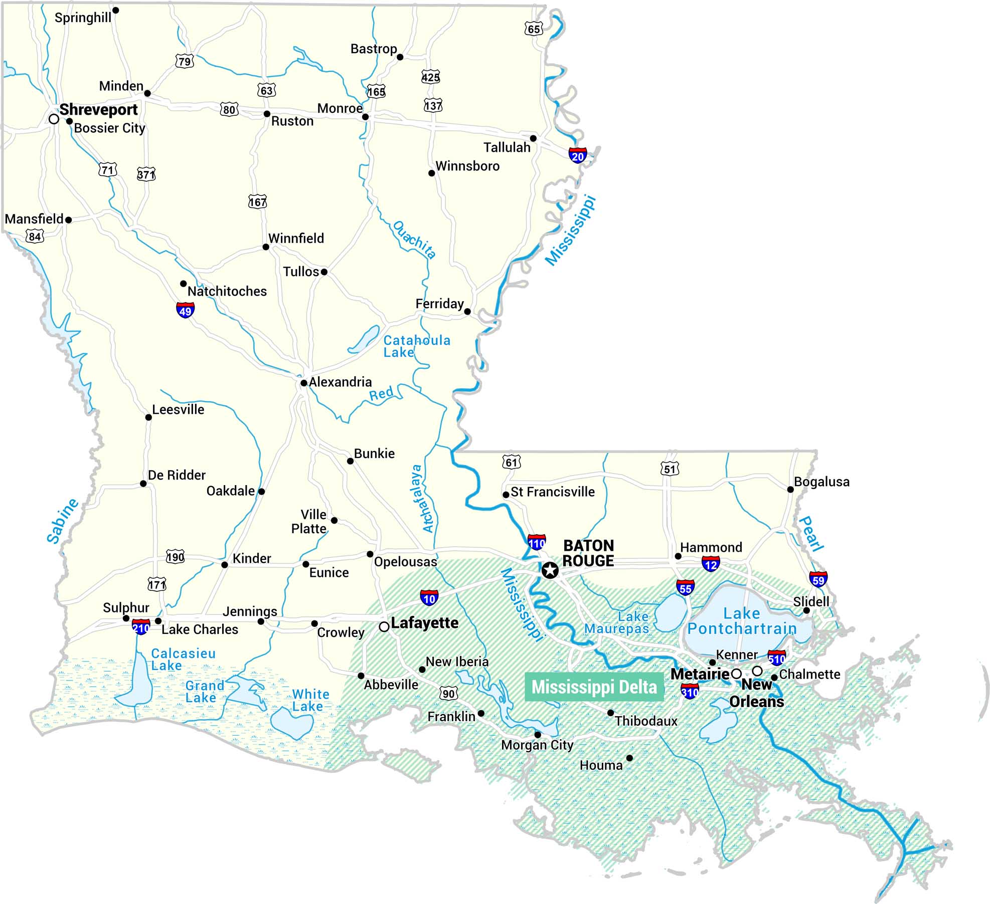
Here’s our map map of Louisiana’s Mississippi Delta region in teal. This regions stretches along the southeastern portion of the state. Our map includes the full state with cities, highways, rivers, and lakes.
Map Information
On the Map
Main Feature: Mississippi Delta (southeastern Louisiana, fanning out from Baton Rouge and New Orleans to the Gulf coast) Cities Within or Adjacent to the Delta: Baton Rouge, New Orleans, Metairie, Kenner, Chalmette, Lafayette, Thibodaux, Houma, Morgan City, Franklin, New Iberia, Abbeville, St. Francisville, Hammond, Slidell Other Louisiana Cities: Shreveport, Bossier City, Minden, Monroe, Bastrop, Ruston, Tallulah, Winnsboro, Springhill, Mansfield, Natchitoches, Winnfield, Tullos, Ferriday, Alexandria, Leesville, De Ridder, Oakdale, Bunkie, Ville Platte, Kinder, Eunice, Opelousas, Crowley, Jennings, Lake Charles, Sulphur, Bogalusa Highways: I-20, I-49, I-10, I-55, I-59, I-110, I-12, US-61, US-51, US-65, US-79, US-80, US-63, US-84, US-71, US-167, US-171, US-190, LA-371, LA-425, LA-137, LA-310, LA-510 Bodies of Water: Mississippi River, Ouachita River, Red River, Atchafalaya River, Sabine River, Pearl River, Catahoula Lake, Lake Pontchartrain, Lake Maurepas, Calcasieu Lake, Grand Lake, White LakeReferences
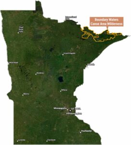
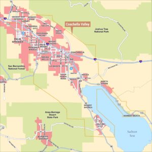
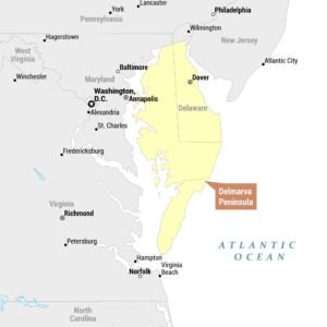
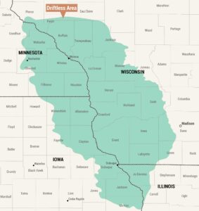
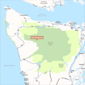
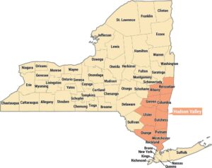
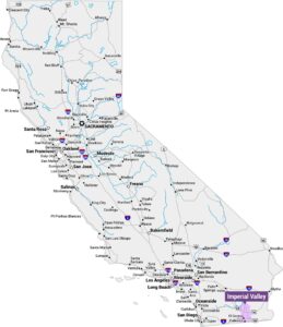
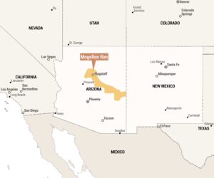
Natural Region Maps
Geographic landforms, wilderness zones, deserts, mountain ranges, and terrain.