Map of Sandusky, Ohio
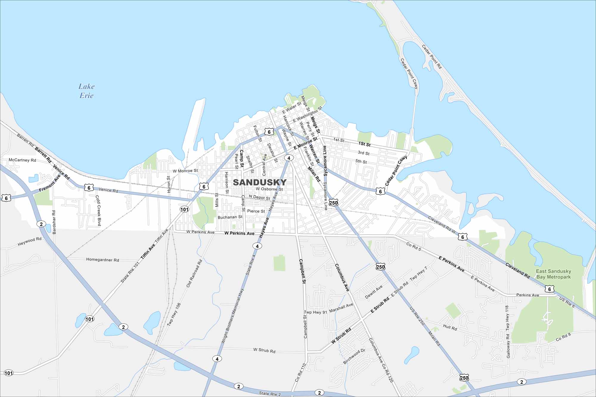
Our map of Sandusky shows the waterfront and the roads leading to Cedar Point. It’s a lakefront town that draws visitors all summer long to its location along Lake Erie.
Map Information
On the Map
Interstates/Highways: US Hwy 6, US Hwy 250, State Rte 101, State Rte 4, State Rte 2 Major Roads: Perkins Ave, Venice Rd, Cleveland Rd, Columbus Ave, Hayes Ave, Tiffin Ave, Milan Rd, Strub Rd, Campbell St, Water St, Washington St, Monroe St, Hancock St, Meigs St, Sycamore Line, Butler St, Parish St, Shoreline Dr, First St, Cedar Point Dr Lakes and Reservoirs: Lake Erie Parks and Preserves: East Sandusky Bay MetroparkOhio State Maps
Check out our maps covering farmland or any of Ohio’s major cities.


City Maps of Ohio
Here are maps of Columbus and Ohio’s major cities


