Arizona Counties and Cities Map
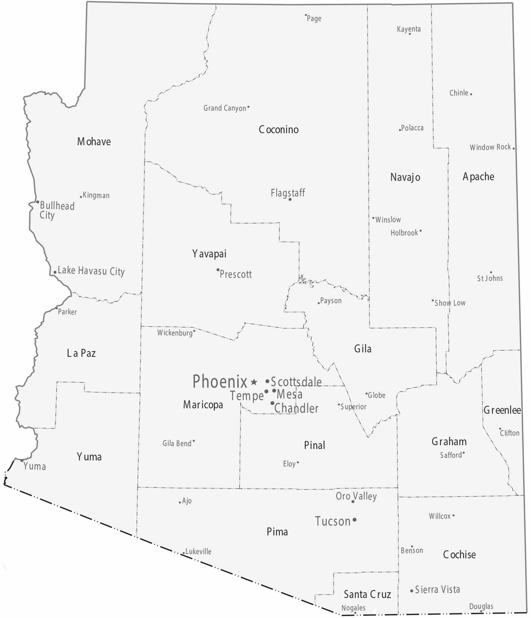
County boundaries are large and expansive, especially in the north of Arizona. Most cities sit in Maricopa and Pima counties, following desert valleys and water access. Northern counties are sparsely settled by comparison.
Map Information
On the Map
|
Name |
Population 2024 |
Total Area (sq mi) |
FIPS Code |
|
Apache County |
64,800 |
11,218.30 |
04-001 |
|
Cochise County |
125,773 |
6,217.40 |
04-003 |
|
Coconino County |
145,161 |
18,661.10 |
04-005 |
|
Gila County |
54,073 |
4,795.50 |
04-007 |
|
Graham County |
40,242 |
4,641.00 |
04-009 |
|
Greenlee County |
9,410 |
1,847.30 |
04-011 |
|
La Paz County |
16,992 |
4,513.70 |
04-012 |
|
Maricopa County |
4,673,096 |
9,224.00 |
04-013 |
|
Mohave County |
226,479 |
13,460.50 |
04-015 |
|
Navajo County |
109,516 |
9,959.10 |
04-017 |
|
Pima County |
1,080,149 |
9,189.20 |
04-019 |
|
Pinal County |
513,862 |
5,374.40 |
04-021 |
|
Santa Cruz County |
50,508 |
1,238.10 |
04-023 |
|
Yavapai County |
252,013 |
8,127.90 |
04-025 |
|
Yuma County |
220,310 |
5,519.10 |
04-027 |
Counties and Cities Maps
Select any state map below to view its counties and cities map.


Arizona State Maps
Check out our Arizona state maps we’ve put together


