Home » State Maps » South Carolina Lakes and Rivers Map

South Carolina Lakes and Rivers Map

South Carolina Lakes and Rivers Map

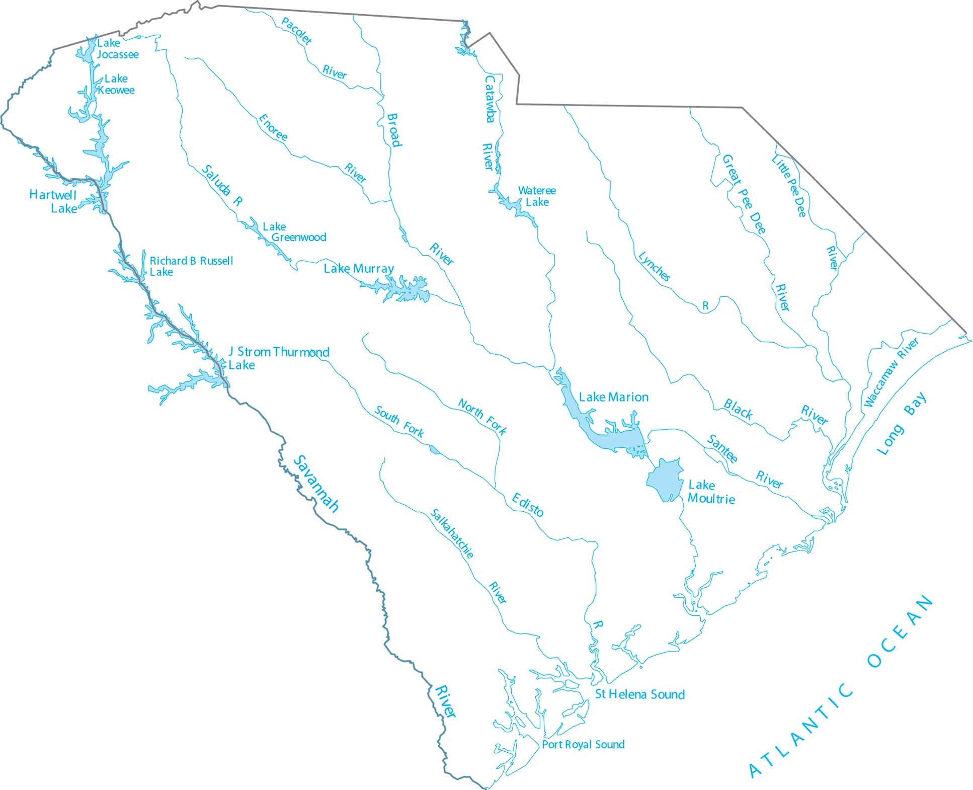
Familiarize yourself with the “Lowcountry” where rivers turn into wide, tidal marshes near the sea. Our lakes and rivers map of South Carolina follows the Pee Dee and Santee river systems. It’s bordered by the Savannah River and is home to Lake Marion, the largest lake in the state.

Map Information

  • Lakes and Rivers Map of South Carolina
  • Original map provided by National Map. Map updated by our team.
  • Free for personal and commercial purpose. Attribution is required. How to attribute?

On the Map

South Carolina Location Map
Lakes/Reservoirs: Hartwell Lake, J Strom Thurmond Lake, Lake Greenwood, Lake Jocassee, Lake Keowee, Lake Marion, Lake Moultrie, Lake Murray, Richard B Russell Lake, Wateree Lake Major Rivers: Black River, Broad River, Catawba River, Edisto River, Enoree River, Great Pee Dee River, Little Pee Dee River, Lynches River, Pacolet River, Salkahatchie River, Saluda River, Santee River, Savannah River, Waccamaw River Rivers and Creeks: Atlantic Ocean, Long Bay, Port Royal Sound, St Helena Sound

Leave a Reply

Your email address will not be published. Required fields are marked *