Map of Upper Arlington, Ohio
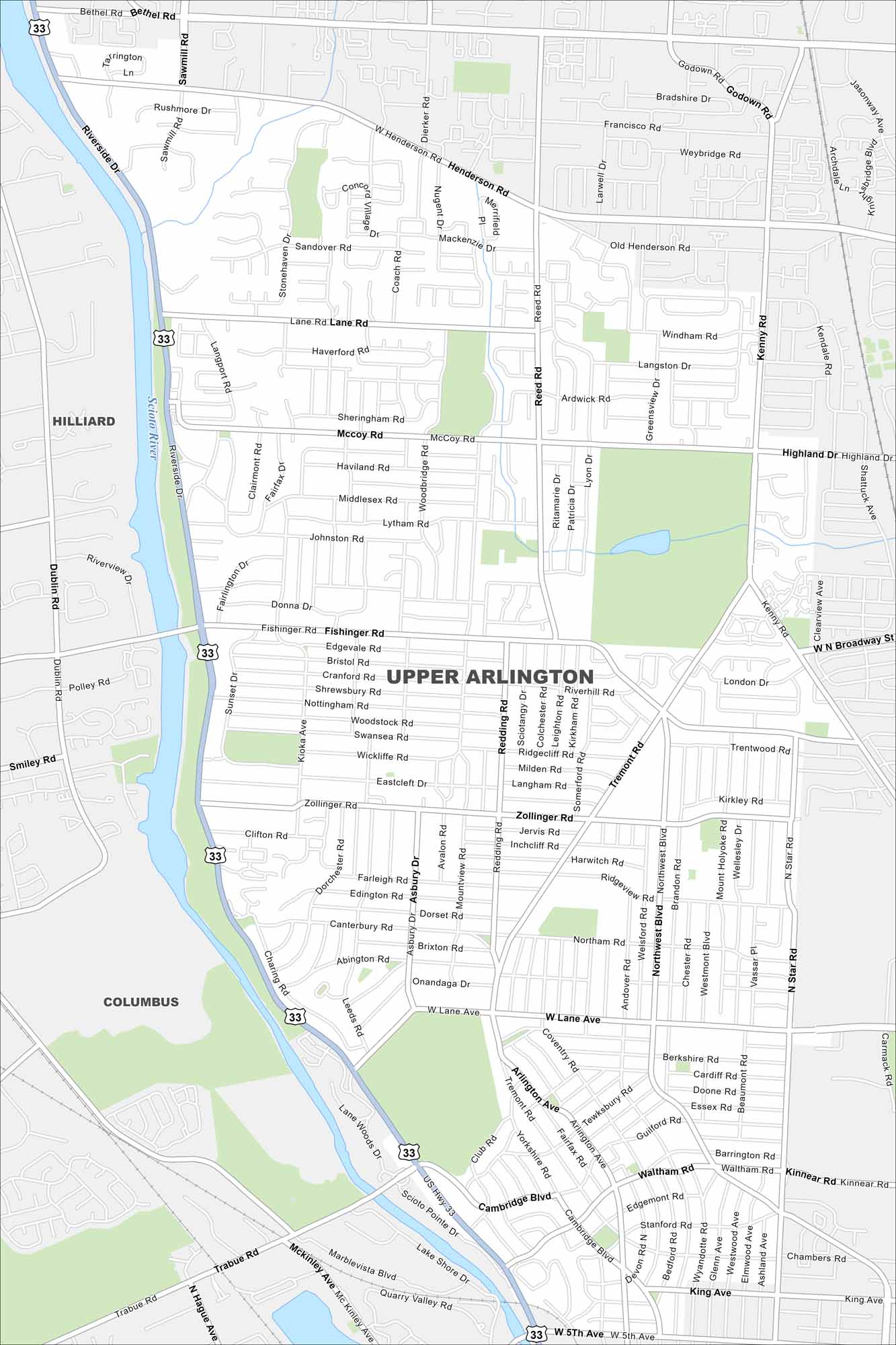
Get around Upper Arlington, a leafy suburb near Columbus. Our map highlights neighborhoods, parks, roads and the Scioto River.
Map Information
On the Map
Interstates/Highways: US Hwy 33 Major Roads: Lane Rd, Henderson Rd, Fishinger Rd, Zollinger Rd, Lane Ave, Reed Rd, Riverside Dr, McCoy Rd, Kenny Rd, Tremont Rd, Northwest Blvd, Cambridge Blvd, Lytham Rd, Kioka Ave, Mountview Rd, Redding Rd, Coventry Rd, Brandon Rd, Ridgeview Rd, Kingsbury Blvd Major Rivers: Scioto River Nearby Communities: Columbus, HilliardOhio State Maps
Check out our maps covering farmland or any of Ohio’s major cities.


City Maps of Ohio
Here are maps of Columbus and Ohio’s major cities


