Map of Florida
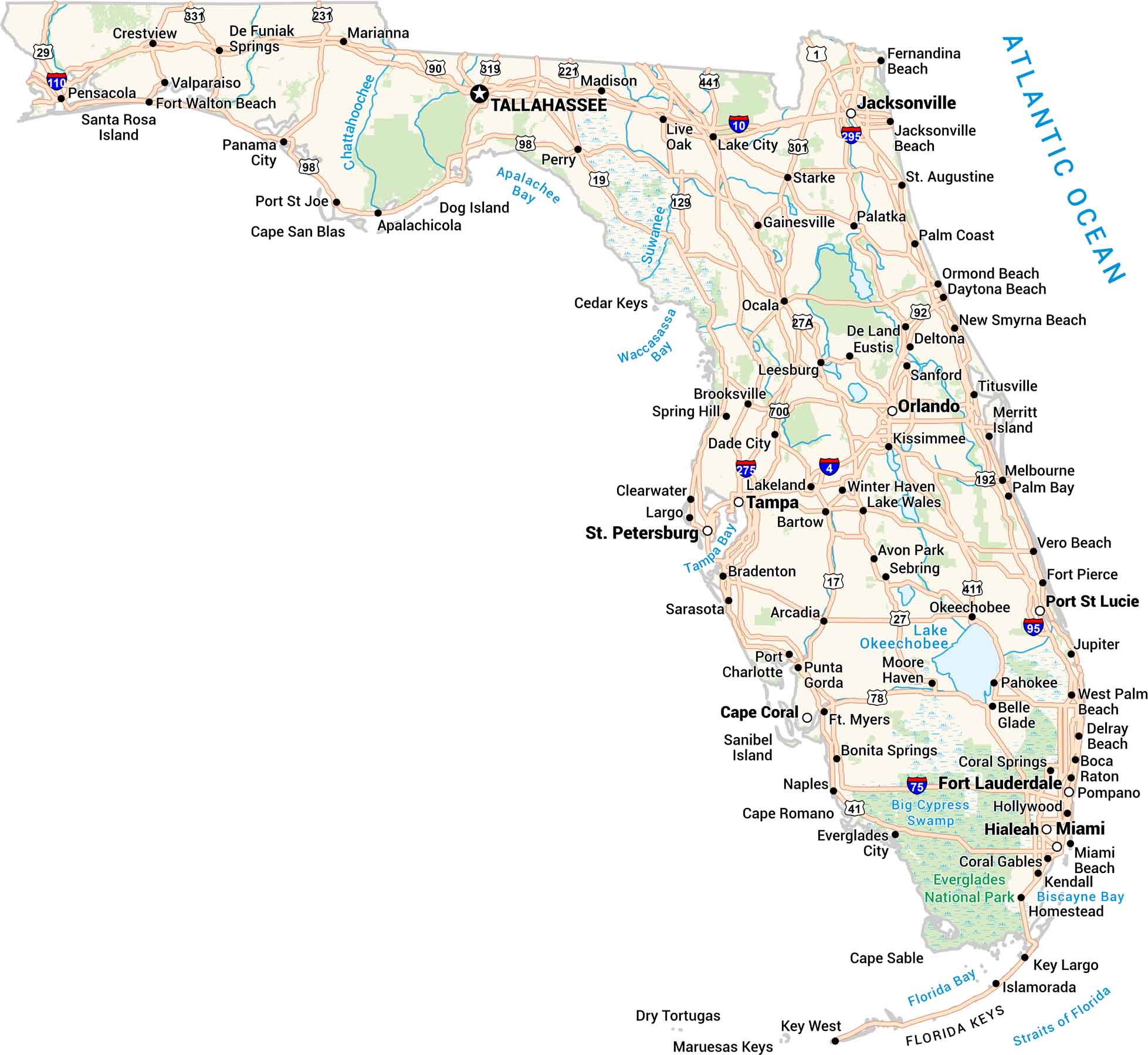
Our Florida map shows the Sunshine State, from the Keys to the Panhandle. Cities line up along the coasts, and highways travel along the edge of the Everglades. You’ll spot Orlando in the middle, surrounded by lakes and green stretches of land. It’s bold and full of motion, just like Florida itself.
Florida State Maps
Discover Florida through our state maps


Map Information
On the Map
Florida City Maps
Chart your course through Miami and Florida’s cities


