West Virginia National Parks and Forests Map
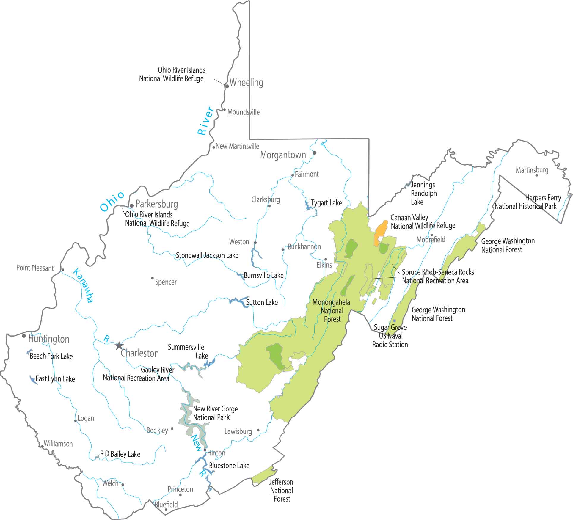
Our map reveals a strong forest presence. Monongahela National Forest covers much of the eastern highlands. But federal land here isn’t forest-first. It’s home to the newly designated New River Gorge National Park and Preserve, which holds one of the oldest rivers in North America.
Map Information
On the Map
Parks, Forests and Federal Lands
National Forests (NF): George Washington NF, Jefferson NF, Monongahela NF National Wildlife Refuges (NWR): Canaan Valley NWR, Ohio River Islands NWR National Recreational Areas (NRA): Gauley River NRA, Spruce Knob-Seneca Rocks NRA Other Federal Lands: Harpers Ferry National Historical Park, New River Gorge National RiverLand Information
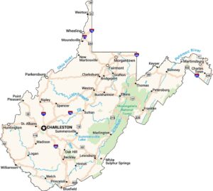
State Capital: Charleston Major Cities: Huntington, Martinsburg Cities and Towns: Beckley, Bluefield, Buckhannon, Clarksburg, Elkins, Fairmont, Hinton, Lewisburg, Logan, Moorefield, Morgantown, Moundsville, New Martinsville, Parkersburg, Point Pleasant, Princeton, Spencer, Welch, Weston, Wheeling, Williamson Lakes and Reservoirs: Beech Fork Lake, Bluestone Lake, Burnsville Lake, East Lynn Lake, Jennings Randolph Lake, R D Bailey Lake, Stonewall Jackson Lake, Summersville Lake, Sutton Lake, Tygart Lake Rivers and Streams: Kanawha River, New River, Ohio RiverWest Virginia State Maps
Browse our maps of the state of West Virginia.