Map of Green Bay, Wisconsin
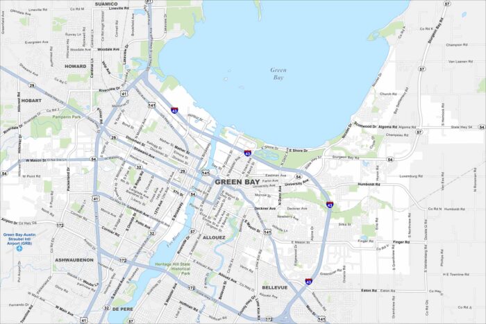
Our map of Green Bay shows it at the mouth of the Fox River. Green Bay defines its geography. But the Green Bay Packers is the lifeblood.
Our map of Green Bay shows it at the mouth of the Fox River. Green Bay defines its geography. But the Green Bay Packers is the lifeblood.
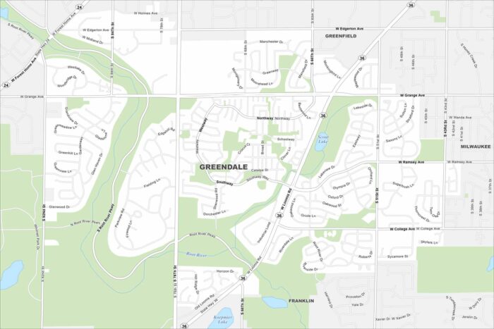
Greendale is a planned community just southwest of Milwaukee. Our map shows neat neighborhoods with parks and green space. Highways tie it directly into the metro area. Map Information
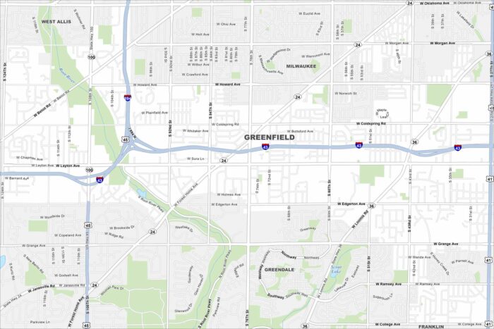
Our map of Greenfield highlights its spot south of Milwaukee. The street layout mixes older subdivisions with newer ones.
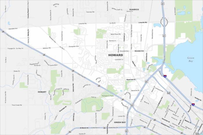
Howard sits along the bay near Green Bay itself. The map shows residential areas mixed with open land. Highways connect it into the city.
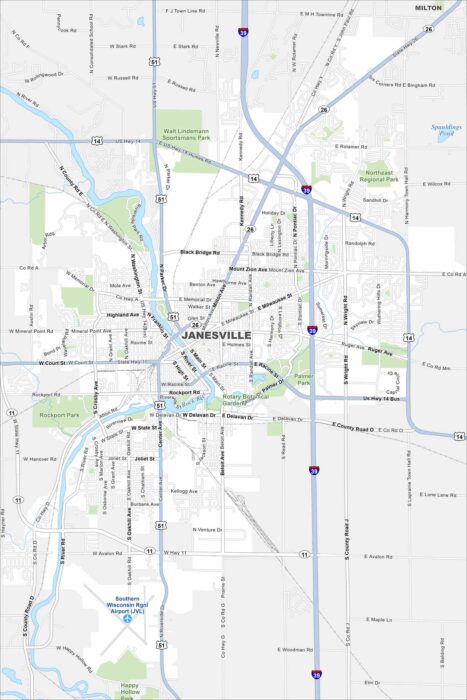
Janesville is built along the Rock River. The map shows parks and trails running beside the water. Highways connect it to Madison.
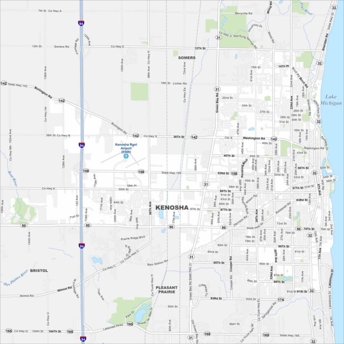
Kenosha sits along Lake Michigan’s shoreline. Highways stretch north toward Milwaukee and south to Chicago.
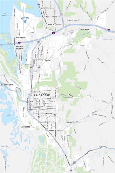
La Crosse, Wisconsin is perched along the Mississippi River. Our map highlights bluffs rising from the riverbanks.
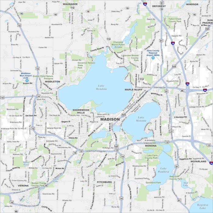
Our map of Madison highlights its setting between Lake Mendota and Lake Monona. Highways wrap around the isthmus.
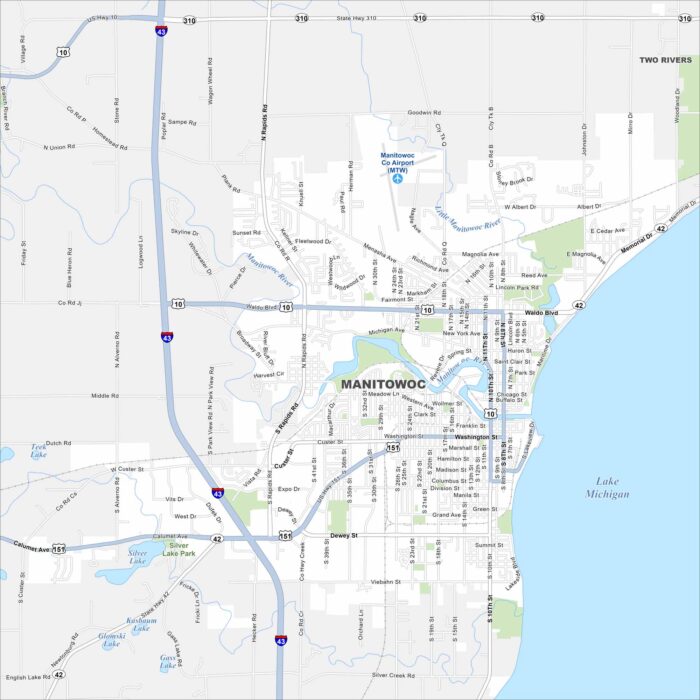
See Manitowoc, Wisconsin on our map along Lake Michigan. Highways connect the city to Green Bay and Milwaukee.
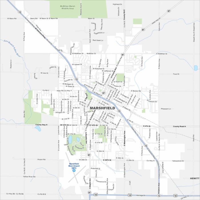
See Marshfield on our map, located in central Wisconsin. Our detailed map includes its roads, parks and waterways.
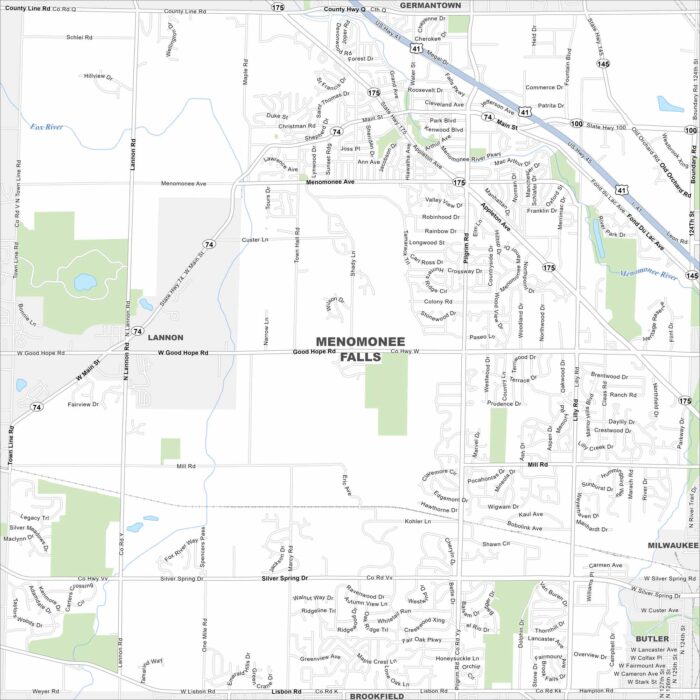
Our map of Menomonee Falls highlights its suburban layout northwest of Milwaukee. The village combines residential areas with light industry.
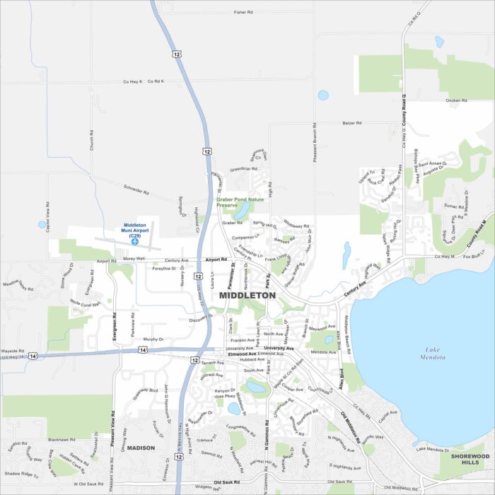
Check out Middleton, Wisconsin using our road map. The city sits just west of Madison, with Lake Mendota on the east side.
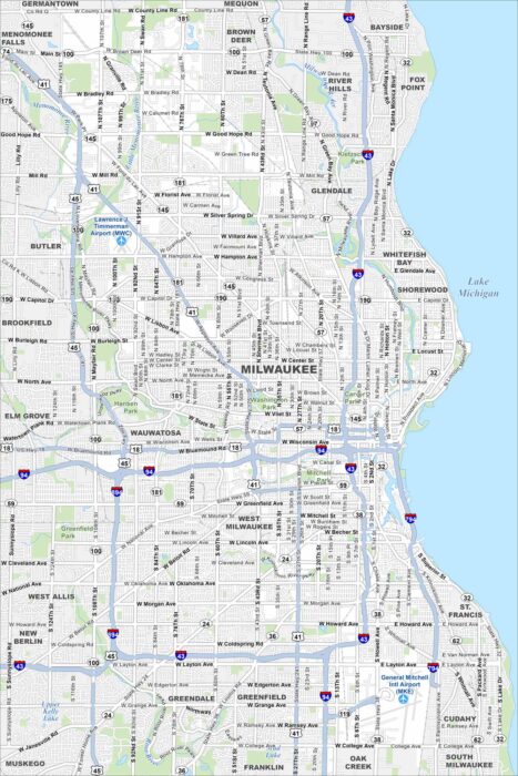
Our map of Milwaukee displays this city along Lake Michigan. The Milwaukee River cuts through downtown. Brewing heritage runs deep here.
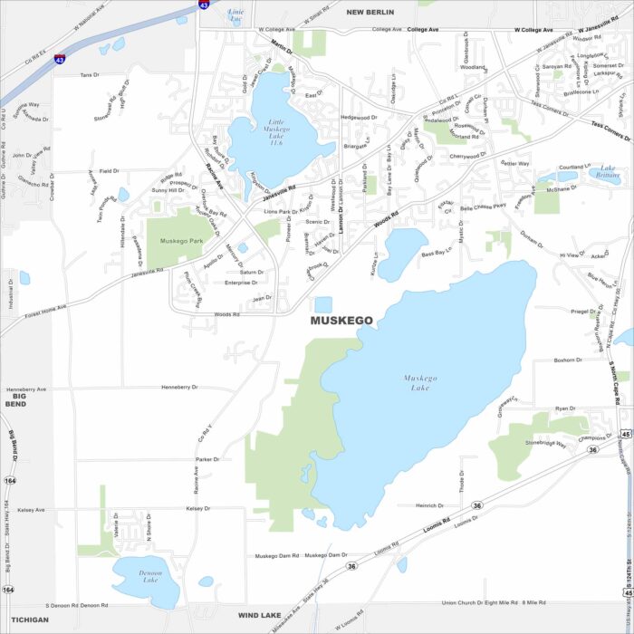
Our map of Muskego outlines a city southwest of Milwaukee. Lakes and wetlands break up much of the suburban layout.
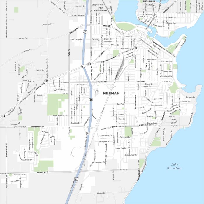
Our map of Neenah shows a city on Lake Winnebago. The Fox River runs through its center and has long defined the area.