Texas Biomes Map
Texas is big, and the biomes prove it. We’ve mapped deserts, plains, and forests across the state. The west-to-east shift is especially clear.
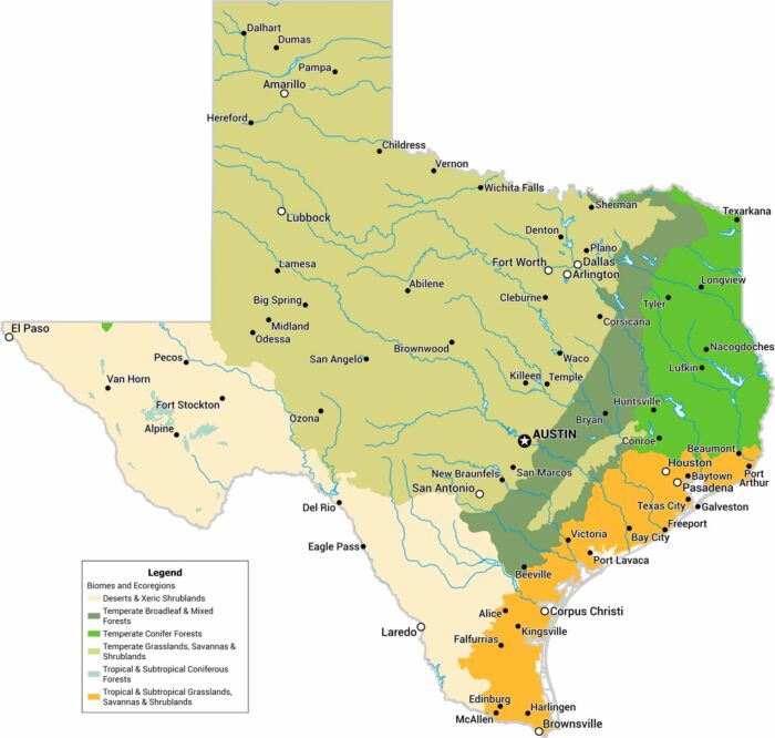
Texas is big, and the biomes prove it. We’ve mapped deserts, plains, and forests across the state. The west-to-east shift is especially clear.
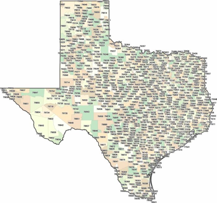
Texas zip codes mostly fall within the 750XX to 799XX range. Our Texas zip code map shows just how massive postal areas can be.
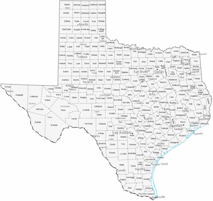
Our map of Texas is the most complex, featuring 254 counties. Major cities are spread statewide rather than concentrated in one area.
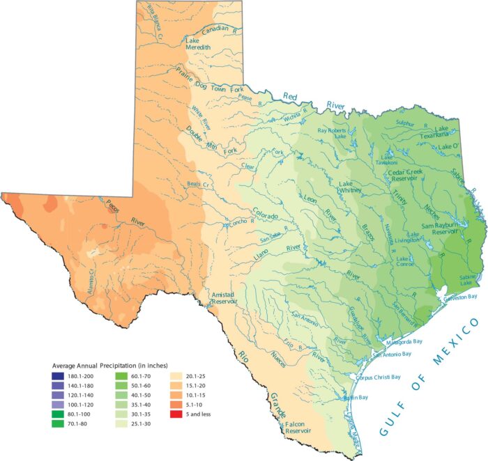
From its wet eastern forests to the bone-dry deserts, Texas shows maybe the most dramatic precipitation gradient in the country.
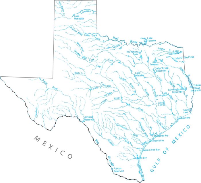
See how Texas’ rivers span a massive landscape. Our map of Texas shows the Rio Grande, Brazos, and Colorado Rivers across the vast plains.
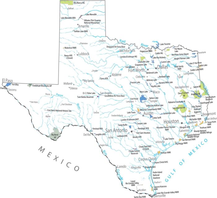
Check out our map to see how Texas spans diverse geography. Big Bend National Park is a rugged masterpiece in the Chihuahuan Desert.
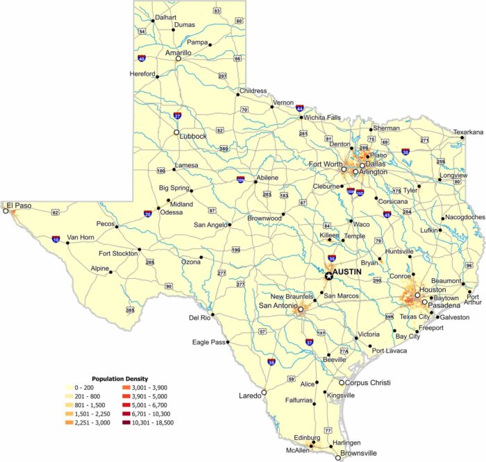
Texas shows strong population concentration around major metro areas. Our map highlights dense clusters and wide rural regions.
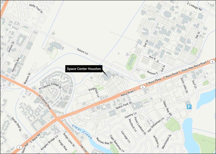
Space Center Houston is the official visitor center for NASA’s astronaut training. Our map shows its headquarters on the Texas Gulf Coast.
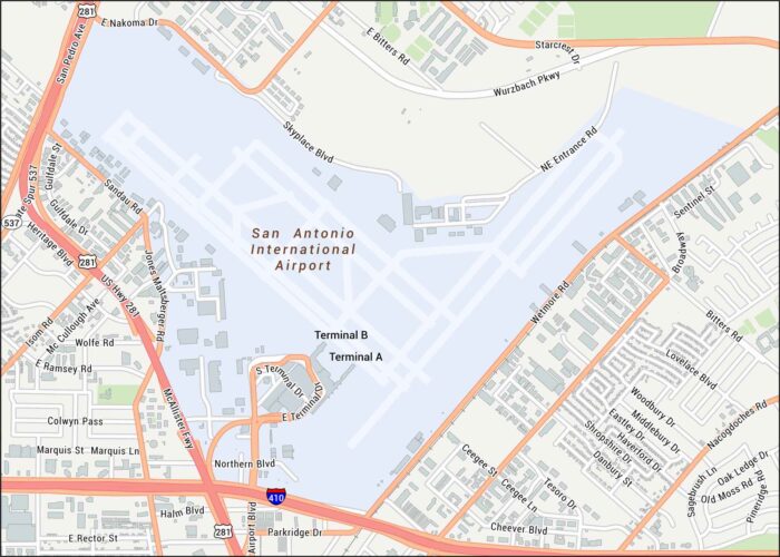
See the streets close to San Antonio Airport. Our map shows terminals, runways, and the nearby interchanges.
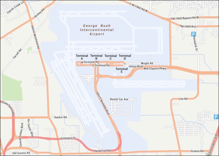
Our George Bush Airport map guides you to Houston’s busy airport. Highways, terminals, runways, and parking areas are all clearly marked.
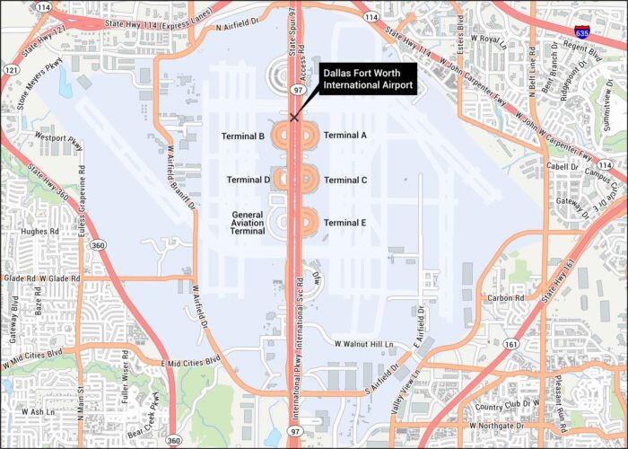
Our map of Dallas International Airport gives a clear overview with terminals and runways. The airport sits between Dallas and Fort Worth.
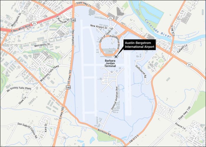
Our map shows the layout at Austin’s main airport that sits off Highway 71. You can see highways, runways and the main terminal.
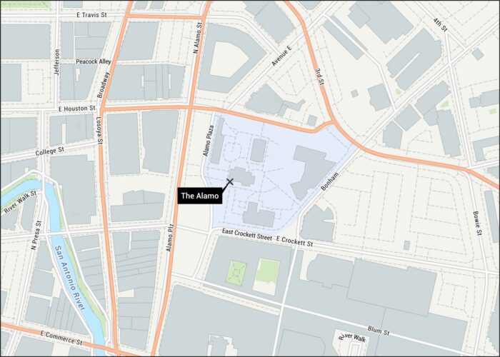
This map shows the Alamo grounds in downtown San Antonio. You’ll see all the surrounding streets, paths and the San Antonio River.
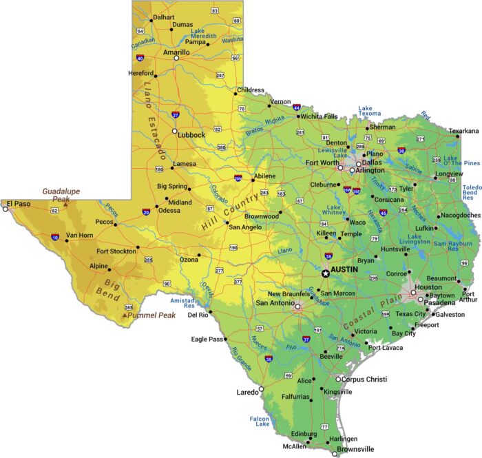
Everything’s bigger in Texas, including the geography. Our physical map of Texas shows a state with more variety than most countries.
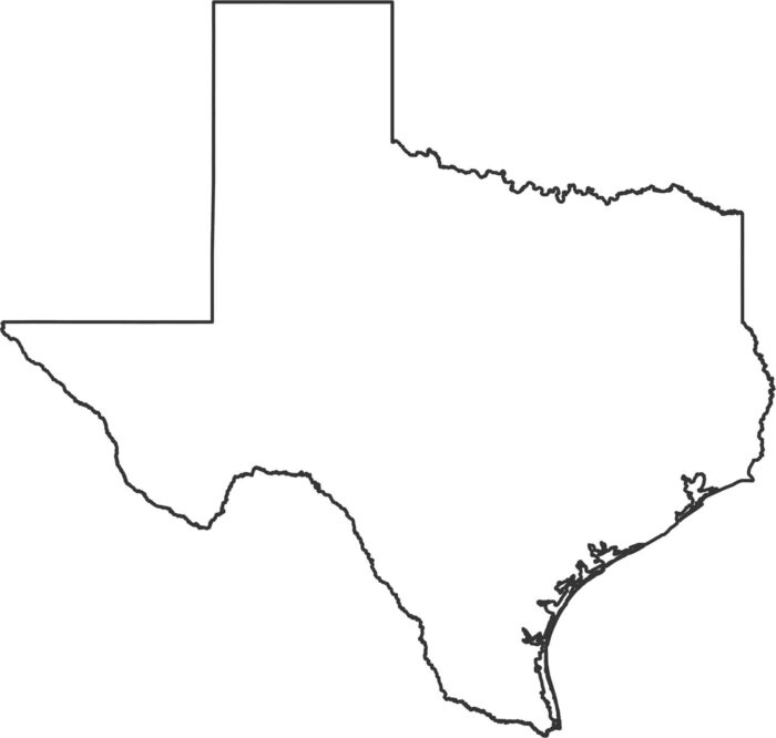
Texas has sharp angles, long borders, and a wide curve along the Gulf Coast. The outline is large and very recognizable for US states.