New River Map
Despite its name, the New River is one of the oldest on the continent. Our map tracks its course through the mountains of three states.
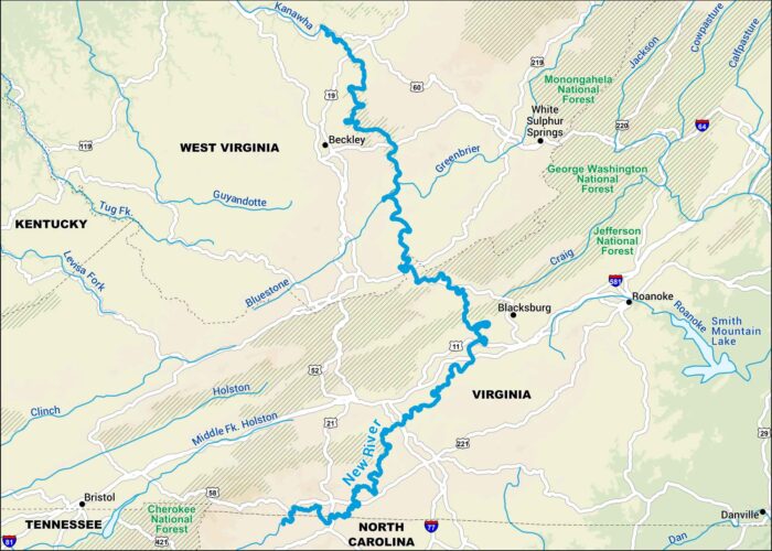
Despite its name, the New River is one of the oldest on the continent. Our map tracks its course through the mountains of three states.
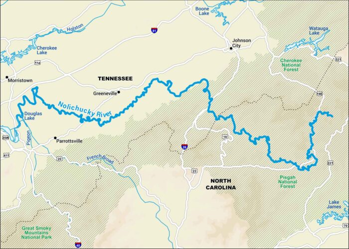
The Nolichucky River runs through the mountains of Tennessee and North Carolina. Our map shows its stretches surrounded by Appalachian forest.
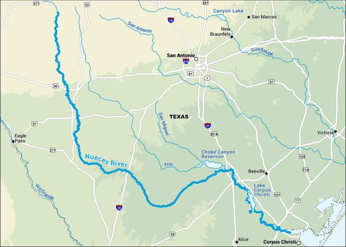
Our map of the Nueces River shows its flow down to Corpus Christi Bay. It cuts through dry ranchland before opening to the Gulf.
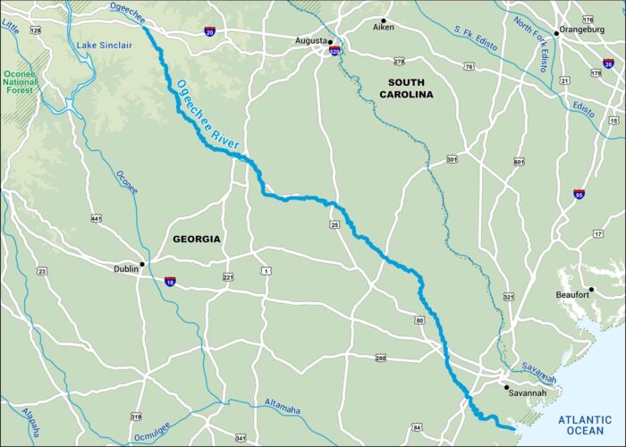
This map shows the Ogeechee River flowing across southeast Georgia to the Atlantic. It still runs mostly free and natural.
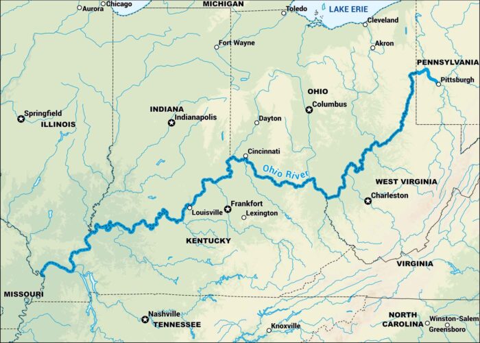
Our Ohio River map shows it from Pittsburgh to the Mississippi. It forms the borders of Illinois, Kentucky, Indiana, Ohio and West Virginia.
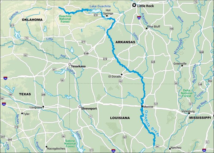
This map shows the Ouachita River running through western Arkansas and Louisiana. Its path passes through the Ouachita National Forest.
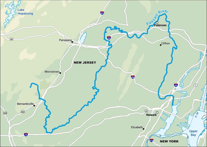
The Passaic River flows through northern New Jersey. It’s a historic river, looping around cities like Paterson and Newark.
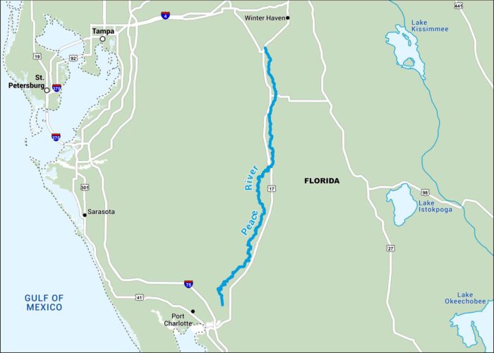
The Peace River flows through southwest Florida through farmland and swampland. Our map highlights its bends all the way to Port Charlotte.
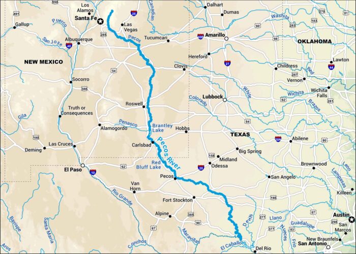
Our map of the Pecos River runs from the mountains of New Mexico through the dry plains of West Texas. It twists its path across the Southwest.
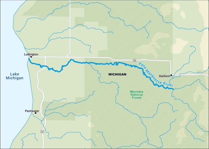
Our map of the Pere Marquette River shows its winding route through western Michigan. Eventually, it meets Lake Michigan near Ludington.
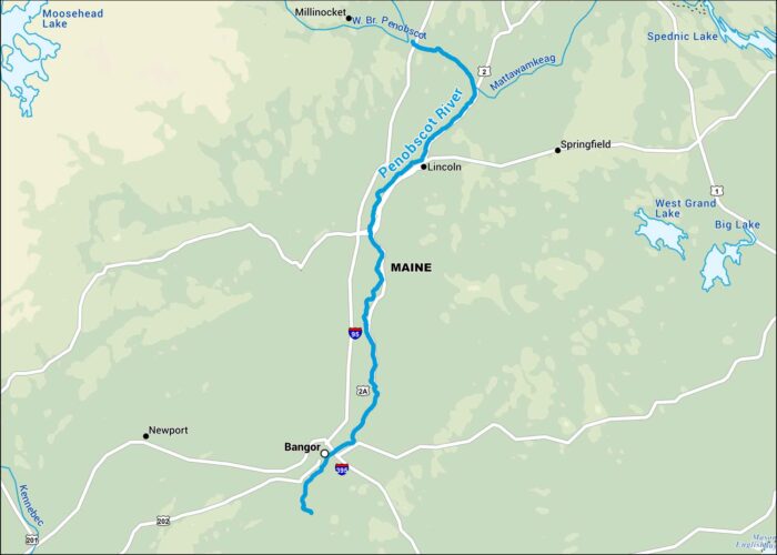
This map follows the Penobscot River through central Maine all the way to Penobscot Bay. It’s one of New England’s great waterways.
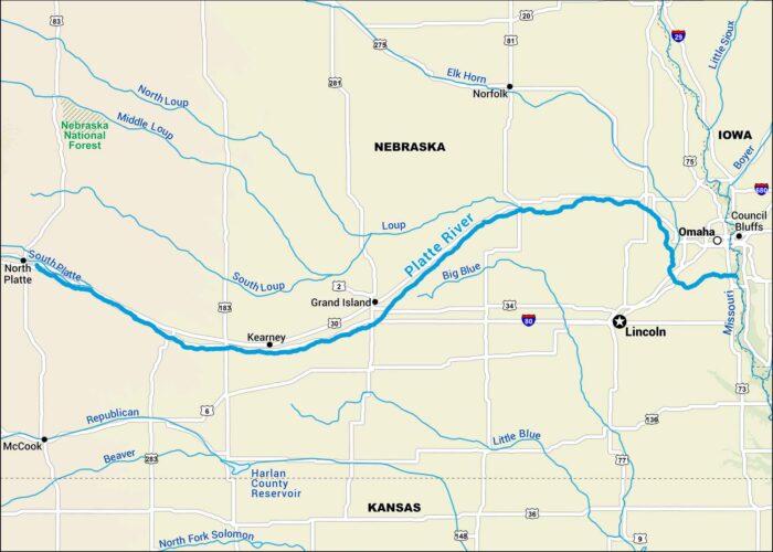
Our map of the Platte River shows its broad, shallow course across Nebraska. Sandhill cranes use it as a migration route in the Great Plains.
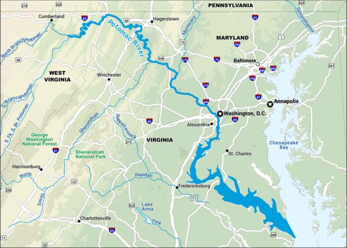
This map follows the Potomac River as it winds between Maryland and Virginia, right past Washington, D.C. It flows to Chesapeake Bay.
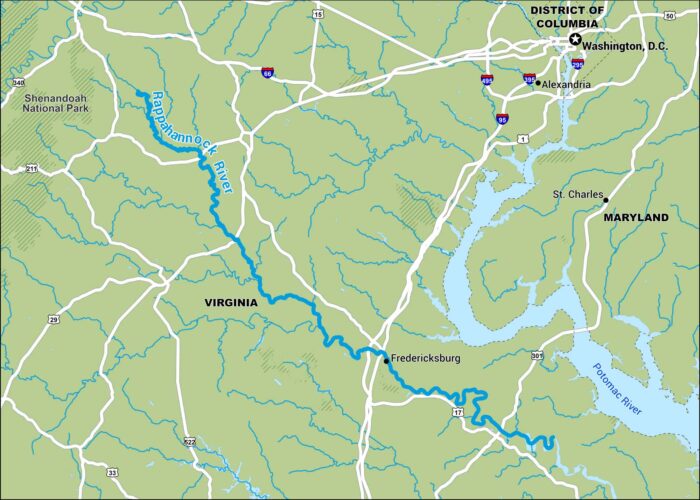
Our map of the Rappahannock River runs from the Blue Ridge and eventually to the Chesapeake Bay. It flows past lots of old Virginia towns.
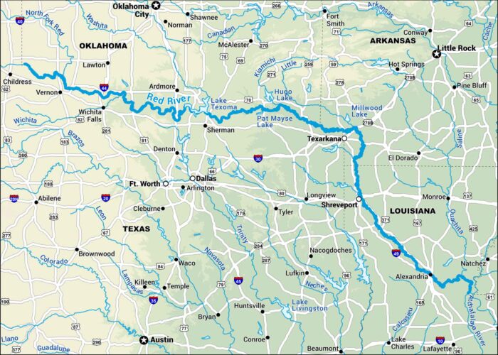
This map shows the Red River stretching between Texas and Oklahoma before turning through Arkansas and Louisiana.