Illinois River Map
Cutting across the heart of Illinois, our map of the Illinois River shows how it connects small towns and wide stretches of farmland.

Cutting across the heart of Illinois, our map of the Illinois River shows how it connects small towns and wide stretches of farmland.
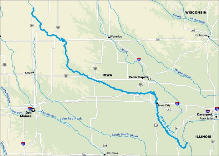
The Iowa River runs straight through the center of the state, passing Iowa City. Our map shows its course on its way to the Mississippi.
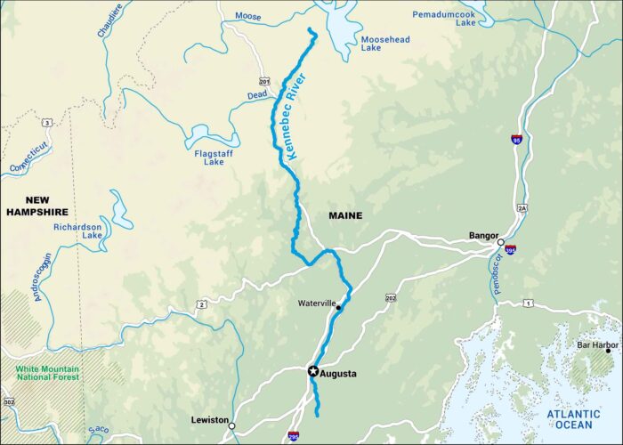
The Kennebec cuts straight through the heart of Maine. Our map shows it running from Moosehead Lake down through Augusta.
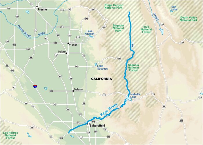
The Kern runs fast out of the southern Sierra Nevada and drops into Bakersfield. Our map shows the sharp turns that make it beautiful.
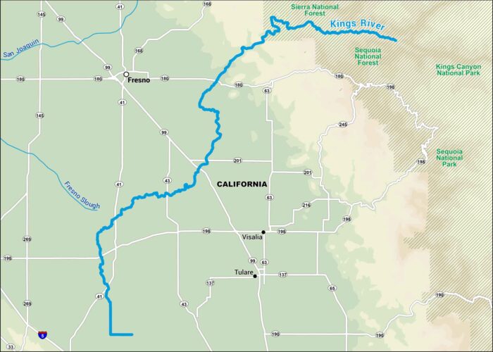
Fed by snowmelt from the Sierra, the Kings River flows through deep gorges before flattening out into California farmland.
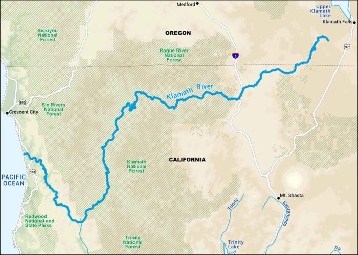
The Klamath starts in southern Oregon and winds through northern California before meeting the Pacific Ocean.
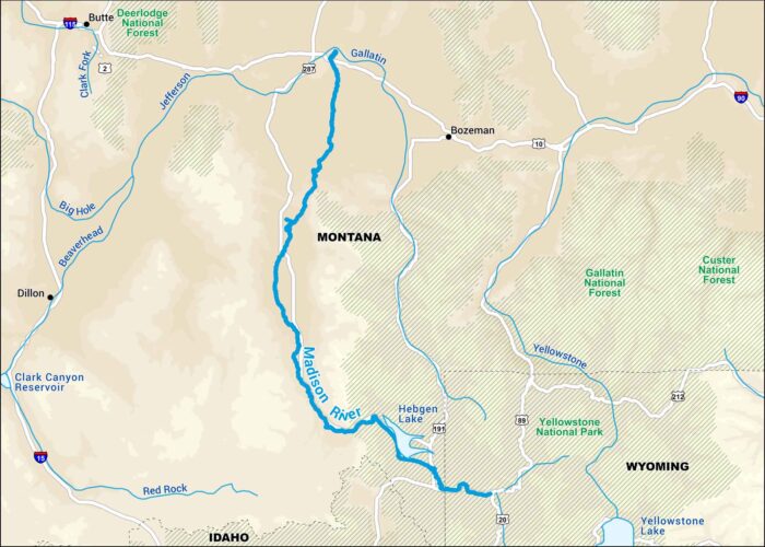
The Madison begins inside Yellowstone and flows through open Montana. Our map shows its wide turns and local roads.
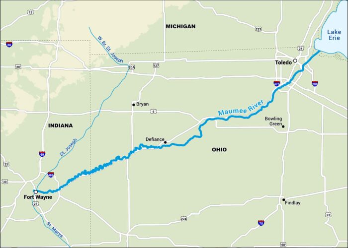
The Maumee River runs from Fort Wayne to Toledo, cutting through mostly flat farmland. Our map lays out its path all the way to Lake Erie.
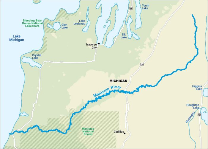
Flowing through northern Michigan pine country, the Manistee moves slow and steady toward Lake Michigan. Our map shows all of its bends.
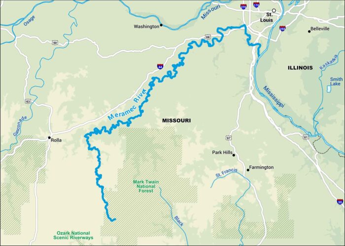
The Meramec winds through the hills of eastern Missouri before joining the Mississippi near St. Louis. Our map lays out the river’s bends.

From Minnesota to the Gulf of Mexico, the Mississippi defines half the country. Our map focuses on all the states that it crosses and borders.

The Missouri runs more than two thousand miles. On our map, you’ll see its wide bends through Montana, the Dakotas, and the plains beyond.
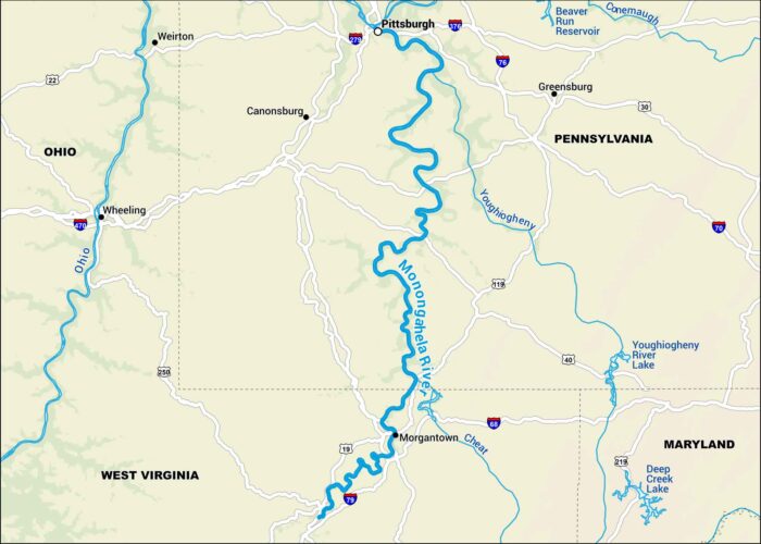
The Monongahela flows north from West Virginia into Pittsburgh. This is where it meets the Allegheny to form the Ohio.
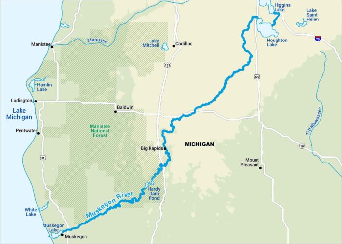
The Muskegon River winds through Michigan, flowing from Houghton Lake to Lake Michigan. It’s one of those rivers that still feels quiet.
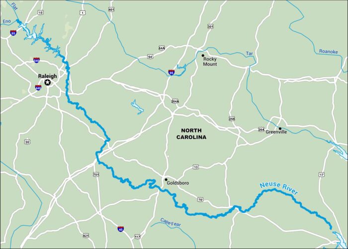
The Neuse runs in eastern North Carolina from the Piedmont towards the Pamlico Sound. Follow its long, slow path through Raleigh and beyond.