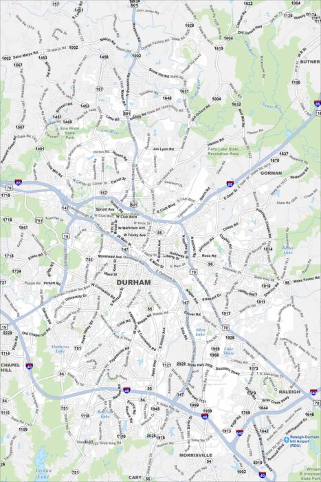
Map of Durham, North Carolina
Check out our map of Durham in the state’s Piedmont region. Rolling terrain, creeks, and a growing downtown stand out.
Check out our map of Durham in the state’s Piedmont region. Rolling terrain, creeks, and a growing downtown stand out.
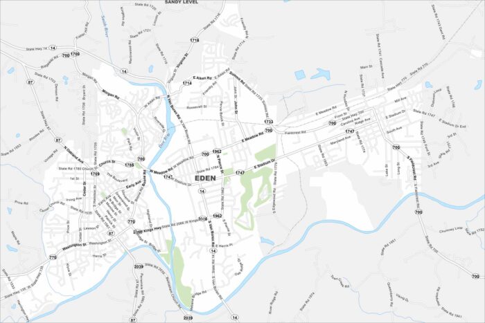
Eden sits near the Virginia border where the Dan and Smith Rivers meet. This map outlines these two waterways and roadways.
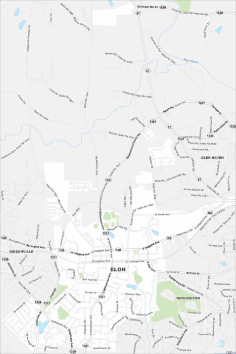
See Elon on our map with S Williamson Ave as the main route here. The town has a small, walkable street network.
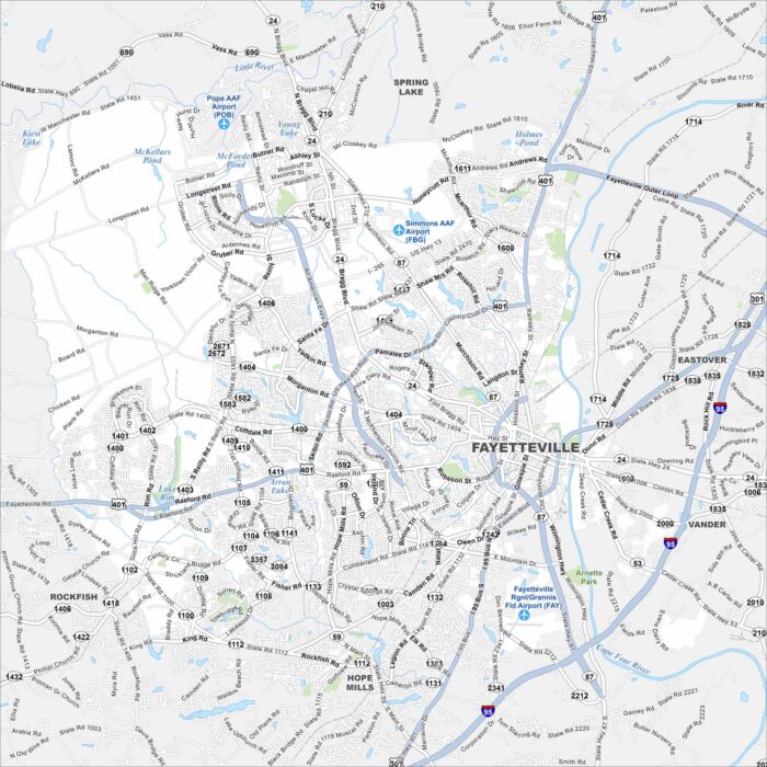
Our map of Fayetteville shows it along the Cape Fear River. Major highways like I-95 run just east of the city. It has a hub-like feel.
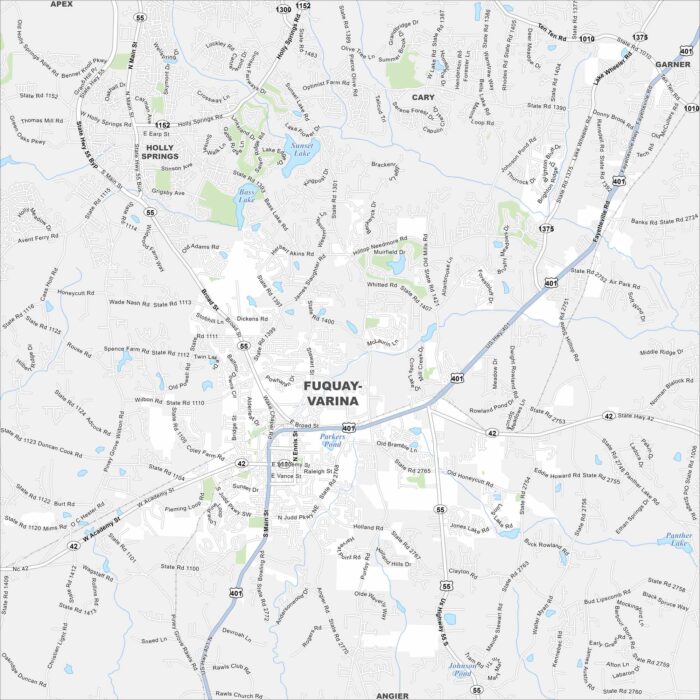
Check out our map of Fuquay-Varina, just south of Raleigh. Highways cross the town, with streams and green areas in between.
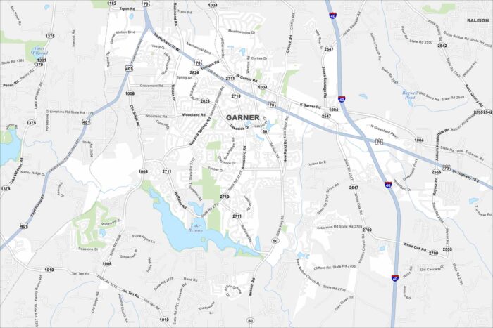
Garner is shown with its roadways, parks, and nearby waterways. You can see how the highways connect to Raleigh.
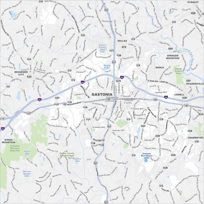
Our map of Gastonia lays out the city streets, highways, and local parks. The roads tie into the larger Charlotte area.
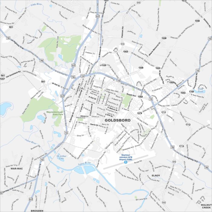
Goldsboro stretches along the Neuse River in eastern North Carolina. It’s tied closely to Seymour Johnson Air Force Base.
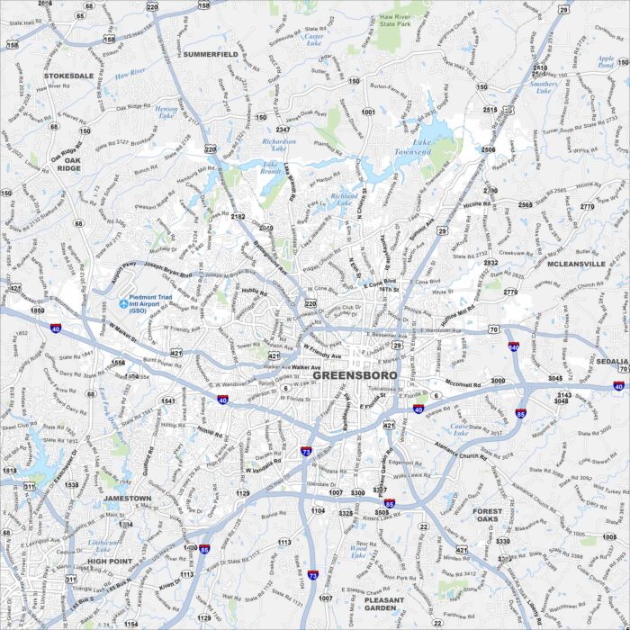
Explore our map of Greensboro in central North Carolina. Interstates 40, 85, and 73 all meet here. Lakes and green spaces surround the area.
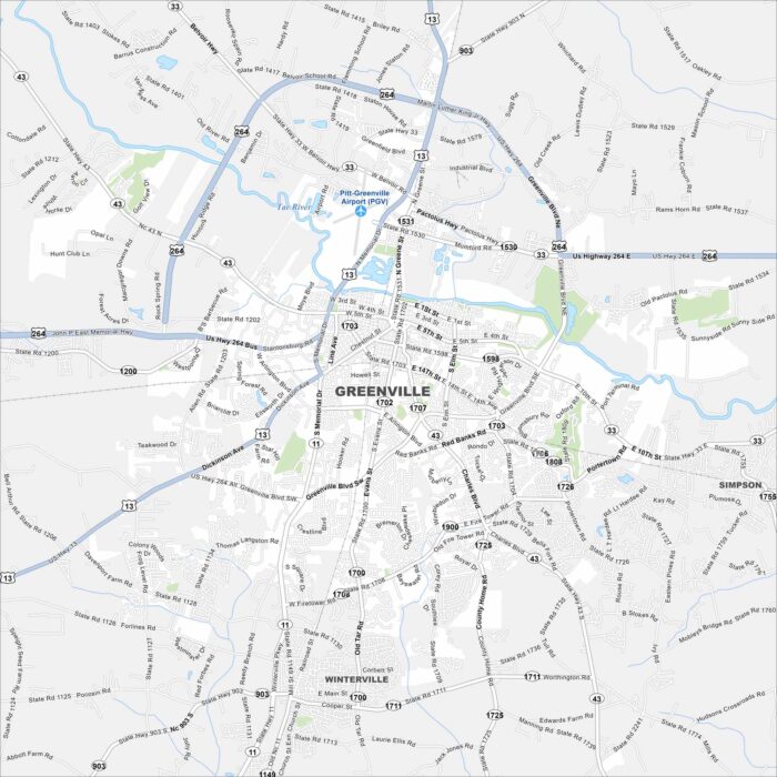
Greenville is in eastern North Carolina along the Tar River. Our map shows the river running near the center of town.
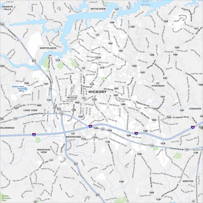
Hickory is in western North Carolina near Lake Hickory. Our map shows winding roads leading into the foothills.
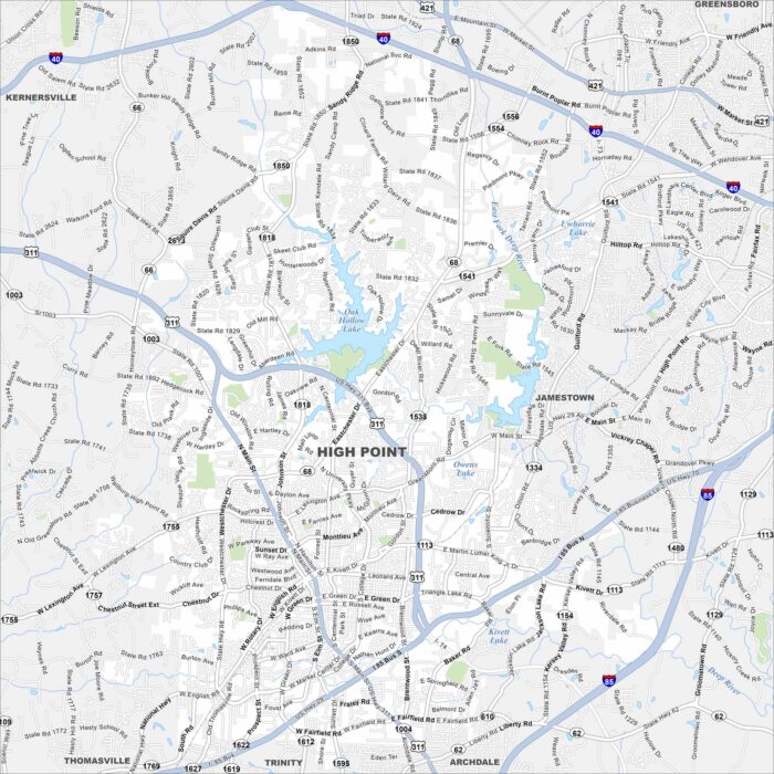
High Point is in central North Carolina between Greensboro and Winston-Salem. This map highlights highways and rivers crossing the city.
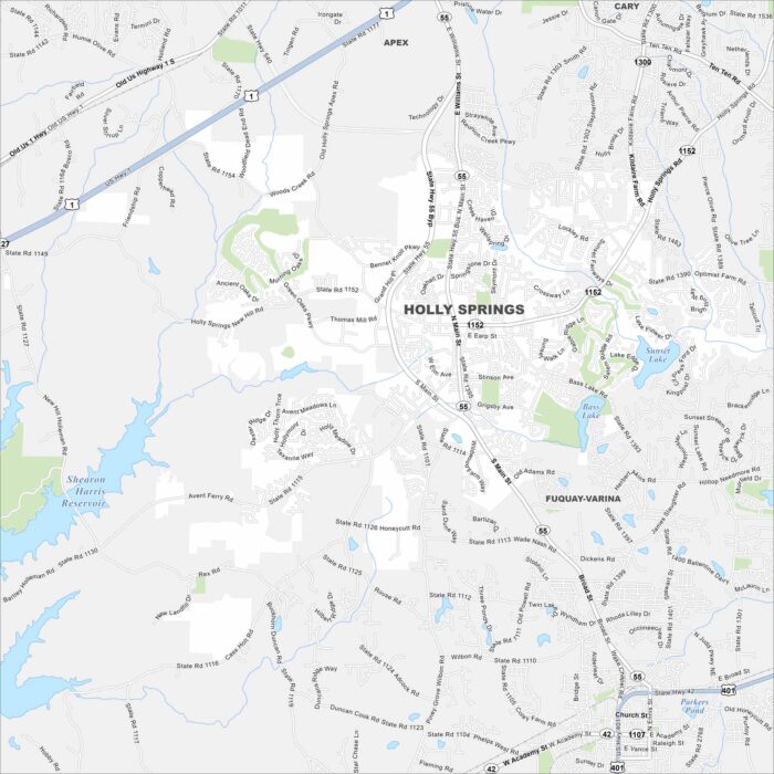
Holly Springs is southwest of Raleigh in the Research Triangle region. Our map shows a mix of lakes, greenways and residential areas.
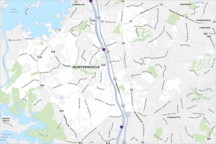
Our map of Huntersville highlights its prime spot just north of Charlotte. Lake Norman stretches out to the west.
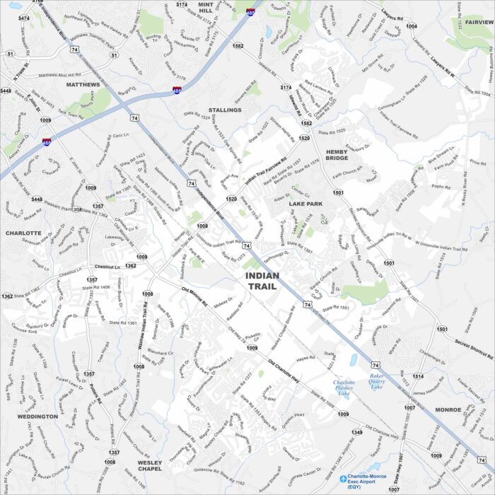
Indian Trail is a fast-growing suburb southeast of Charlotte. Neighborhoods go outward from the main highway.