North Carolina Zip Code Map
Follow zip codes across North Carolina’s varied landscape. We’ve mapped each postal area clearly in the 270XX to 289XX range.
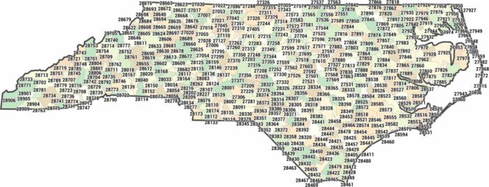
Follow zip codes across North Carolina’s varied landscape. We’ve mapped each postal area clearly in the 270XX to 289XX range.
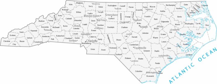
There are 100 counties in North Carolina and they’re fairly uniform in size. Our map shows cities spread from mountains to the coastal plain.
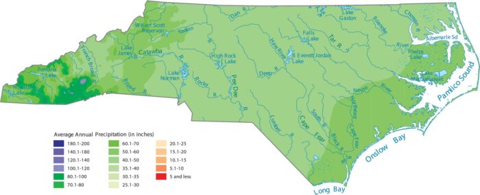
North Carolina gets a lot of rain because of its geography. Our precipitation map of North Carolina shows its mountains are the wettest spot.
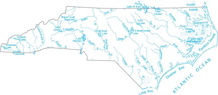
North Carolina is blessed with rivers flowing from to the Atlantic coast. Our map shows the Cape Fear River, Neuse River, and its tributaries.
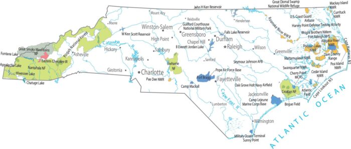
Great Smoky Mountains National Park dominates the west, with Pisgah and Nantahala spreading out around it.
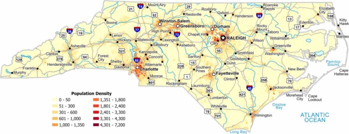
Check out our map to see the population density of North Carolina. Charlotte and Raleigh stick out the most with the highest density.
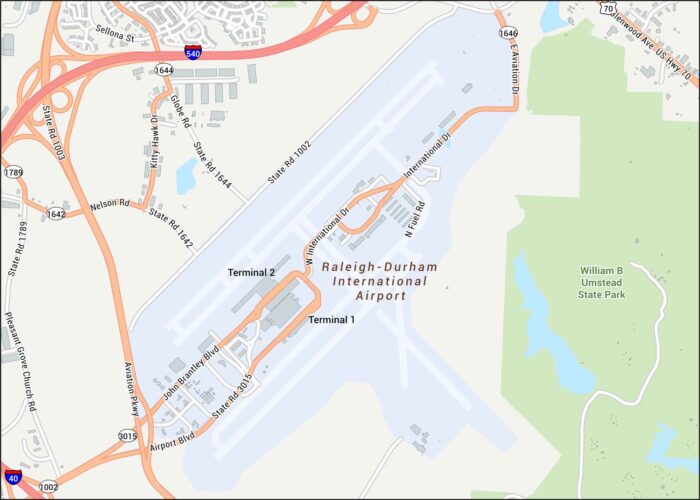
Check out RDU Airport with its two major runways, terminal loops, and the highway connectors that tie Raleigh and Durham together.
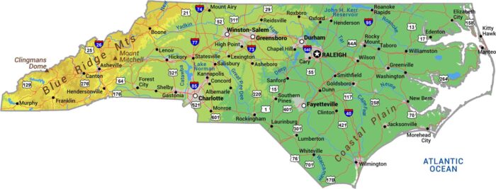
Our physical map of North Carolina shows three worlds stacked with the Blue Ridge Mountains all the way to the Atlantic coast.
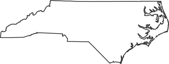
Our outline map of North Carolina shows it spread out toward the Atlantic with a long shape. The western side climbs into the Blue Ridge.
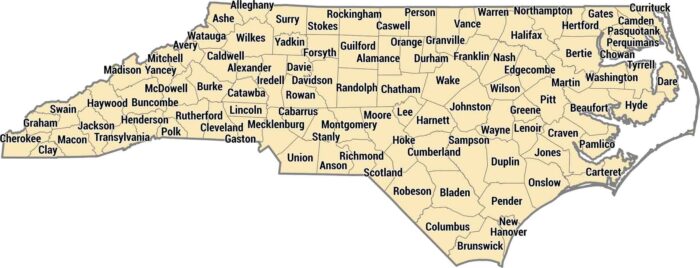
All 100 counties here run from the Smoky Mountains to the Outer Banks. Mecklenburg County has Charlotte in the piedmont.
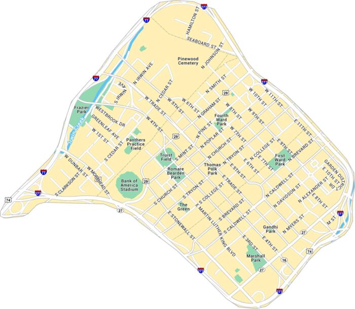
Our map of Downtown Charlotte outlines the blocks around Trade and Tryon Street. It includes main roads, green spaces, and highways.
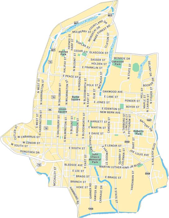
Our map of Downtown Raleigh shows the city center spread around Fayetteville Street. It’s a compact downtown with plenty of green space.
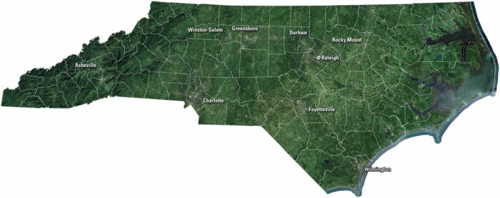
Our satellite map of North Carolina shows rivers, forests, and farmland. Mountains roll in the west, while the coast opens to the Atlantic.
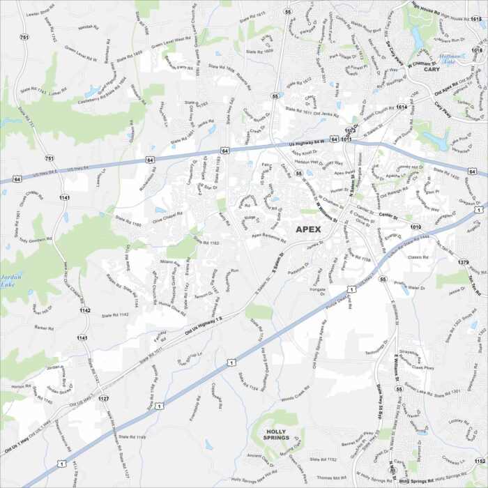
Our map of Apex shows its highways, rivers, and parks. Roads tie into Raleigh not too far away. Apex is also part of the Research Triangle.
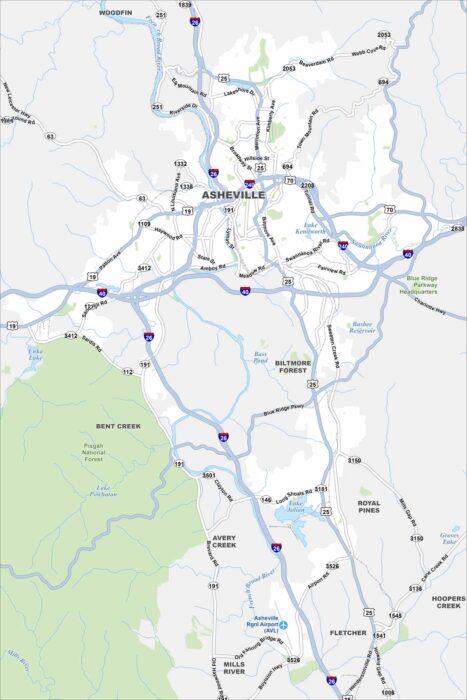
Asheville is mapped with its highways, streets, and riverside routes. Roads wind here because the city sits in the Blue Ridge Mountains.