Map of Indian Trail, North Carolina
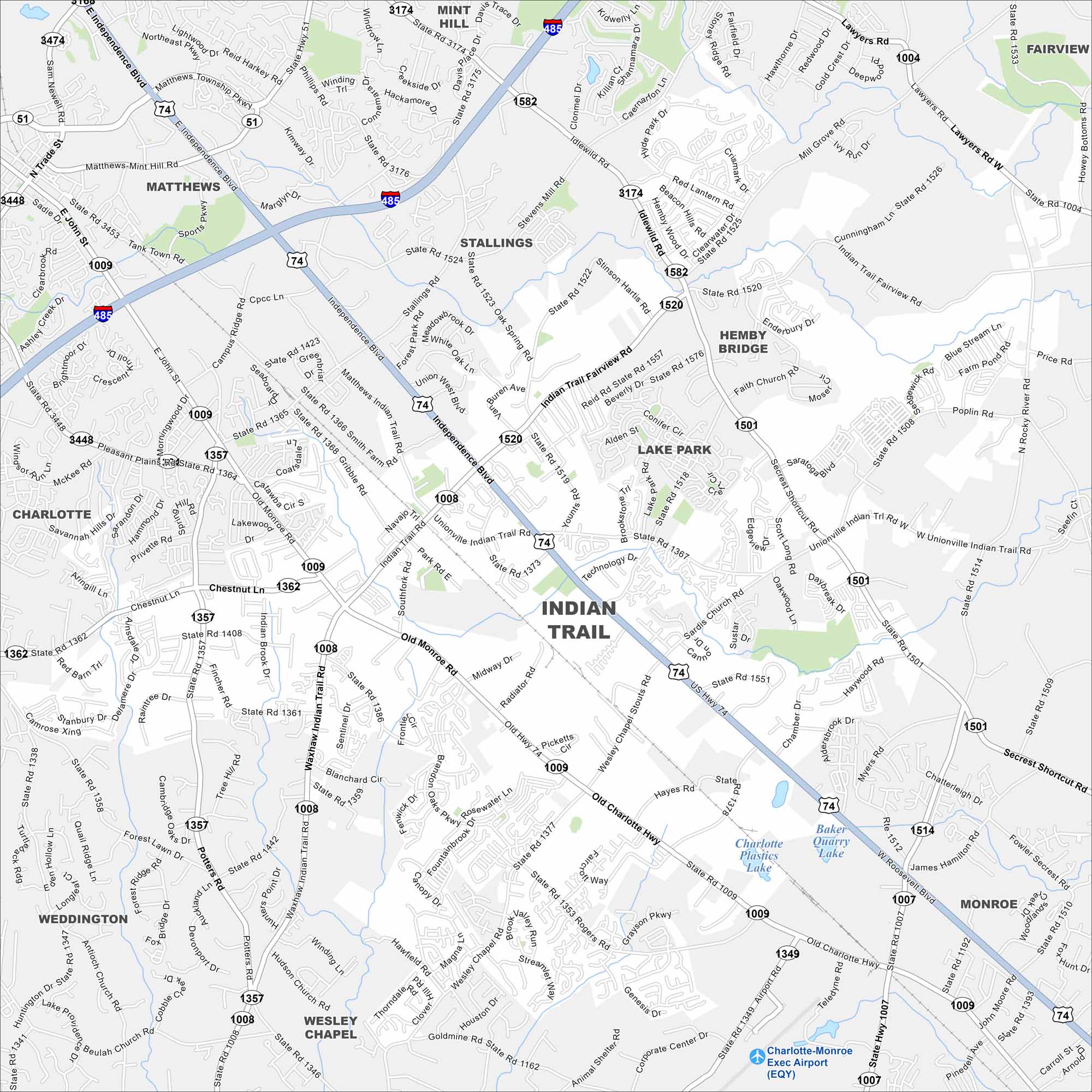
Indian Trail is a fast-growing suburb southeast of Charlotte. Neighborhoods go outward from the main highway. Green spaces and parks break up the development.
Map Information
On the Map
Interstates/Highways: I-485, US Hwy 74 Major Roads: Independence Blvd, Indian Trail Rd, Old Monroe Rd, Matthews Indian Trail Rd, Stallings Rd, Wesley Chapel Stouts Rd, Sardis Church Rd, Unionville Indian Trail Rd, Chestnut Ln, Rogers Rd, Idlewild Rd, Hemby Rd, Poplar Rd, Secrest Shortcut Rd, Gribble Rd, Faith Church Rd, Waxhaw Indian Trail Rd, Sun Valley Way, Airport Rd Airports: Charlotte-Monroe Exec Airport (EQY) Lakes and Reservoirs: Baker Quarry Lake, Charlotte Plastics Lake Nearby Communities: Stallings, Matthews, Hemby Bridge, Lake Park, Mint Hill, Wesley Chapel, Monroe, WeddingtonNorth Carolina State Maps
Get to know the mountains and coastlines of North Carolina.


City Maps of North Carolina
Journey through North Carolina with our city maps


