Map of Huntersville, North Carolina
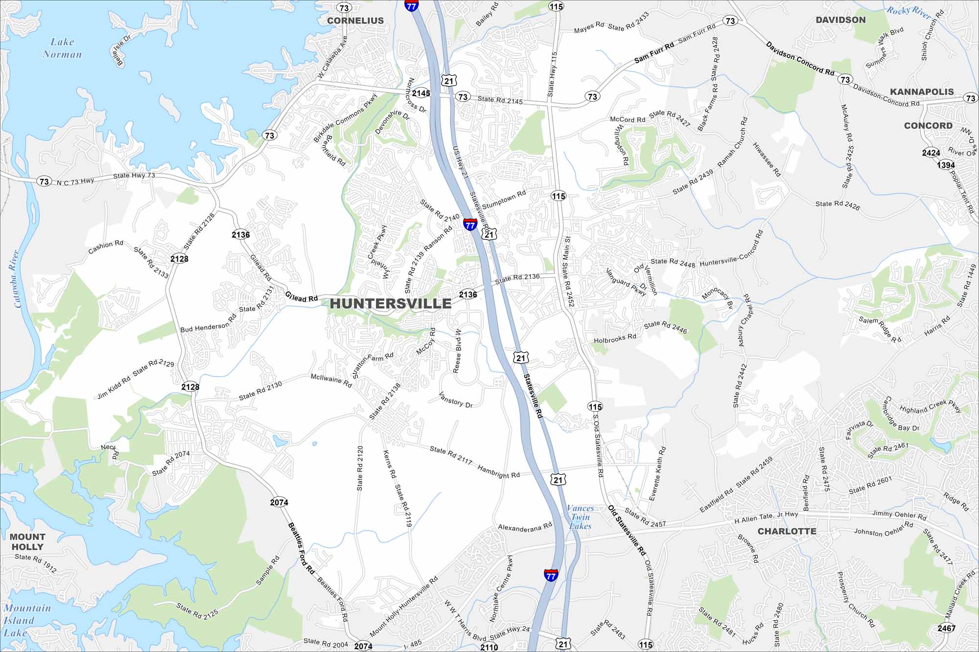
Our map of Huntersville highlights its prime spot just north of Charlotte. Lake Norman stretches out to the west. Suburban growth and green space balance the layout.
Map Information
On the Map
Interstates/Highways: I-77, State Rte 73, State Rte 115, State Rte 21, State Rte 24 Major Roads: Gilead Rd, Huntersville-Concord Rd, Sam Furr Rd, Old Statesville Rd, Statesville Rd, Mt Holly-Huntersville Rd, Beatties Ford Rd, Harris Blvd, Harris Rd, Eastfield Rd, Northlake Centre Pkwy, Alexanderana Rd, Ramah Church Rd, Bud Henderson Rd, Jim Kidd Rd, Black Farms Rd, Mayes Rd, Davidson Concord Rd, Poplar Tent Rd, Shiloh Church Rd Lakes and Reservoirs: Lake Norman, Mountain Island Lake, Vances Twin Lakes Major Rivers: Catawba River, Rocky River Nearby Communities: Cornelius, Davidson, Concord, Kannapolis, Charlotte, Mount HollyNorth Carolina State Maps
Get to know the mountains and coastlines of North Carolina.


City Maps of North Carolina
Journey through North Carolina with our city maps


