Map of Buffalo, New York
Buffalo, New York sits on Lake Erie at the head of the Niagara River. Our map shows the waterfront, highways/streets, and green parkways.
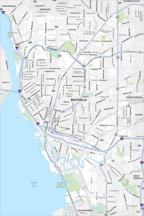
Buffalo, New York sits on Lake Erie at the head of the Niagara River. Our map shows the waterfront, highways/streets, and green parkways.
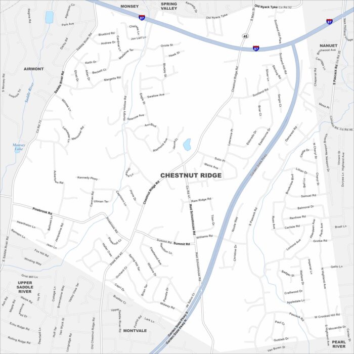
Our map of Chestnut Ridge shows the local roads, highways, and green spaces. It sits in Rockland County along the New Jersey border.
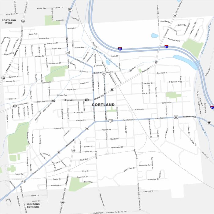
Cortland is sandwiched between Syracuse and Binghamton in New York state. It’s nicknamed the “Crown City” because it sits on a plateau.
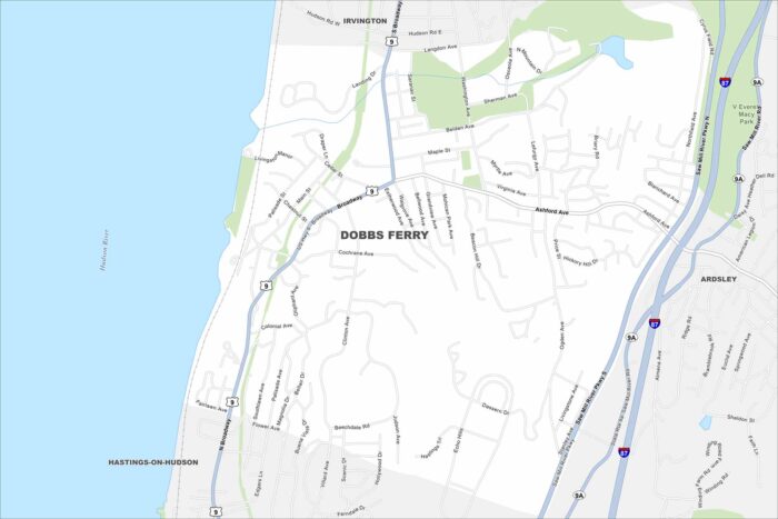
Our map of Dobbs Ferry shows a Hudson River town just north of New York City. Its river views set it apart from neighboring villages.
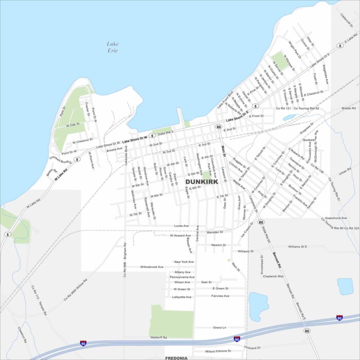
Dunkirk lies on the shores of Lake Erie in western New York. Our map shows Lake Shore Drive and Lake Front Blvd that stretches on waterfront.
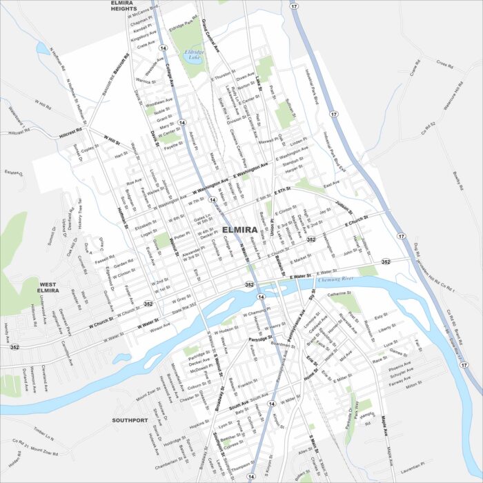
Elmira is located along the Chemung River in southern New York. The city connects to Route 14 and 17. It’s often known as the “Queen City”.
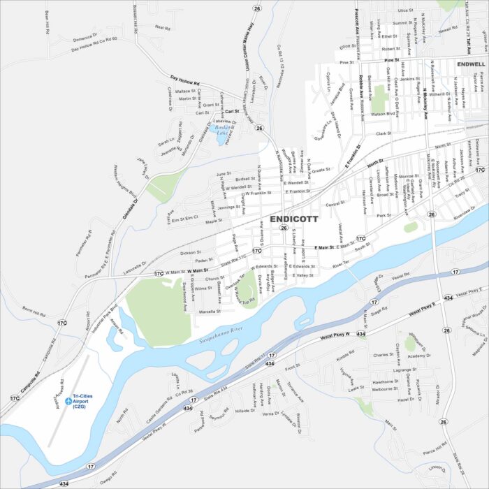
Endicott, New York lies west of Binghamton along the Susquehanna River. Streets spread out on both sides of the water.
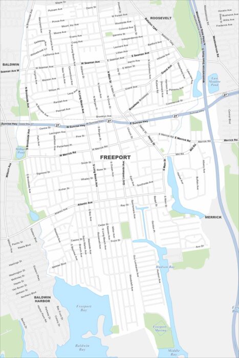
Our map of Freeport shows it right on Long Island’s south shore. The Meadowbrook Parkway provides quick access north.
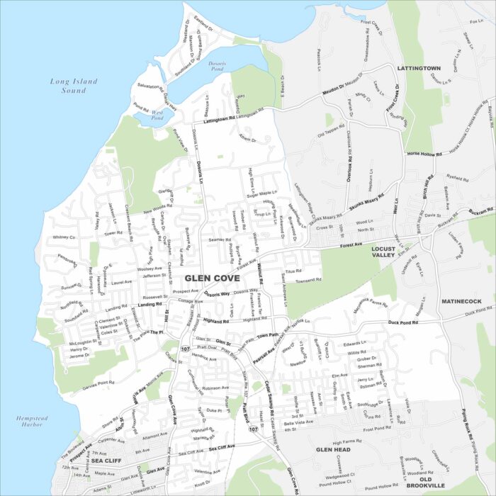
Our map of Glen Cove, New York, highlights a waterfront city on Long Island’s North Shore. Harbors and inlets define much of the landscape.
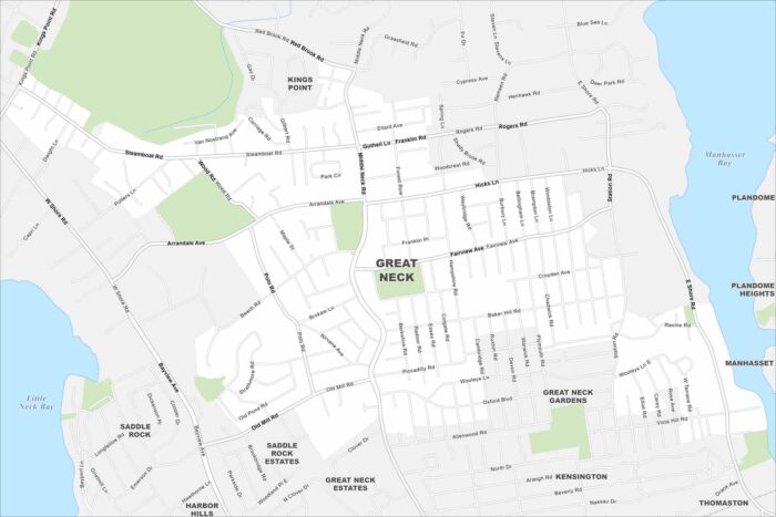
Great Neck is on Long Island’s North Shore, east of Queens. This map shows peninsulas and bays cutting into the coast.
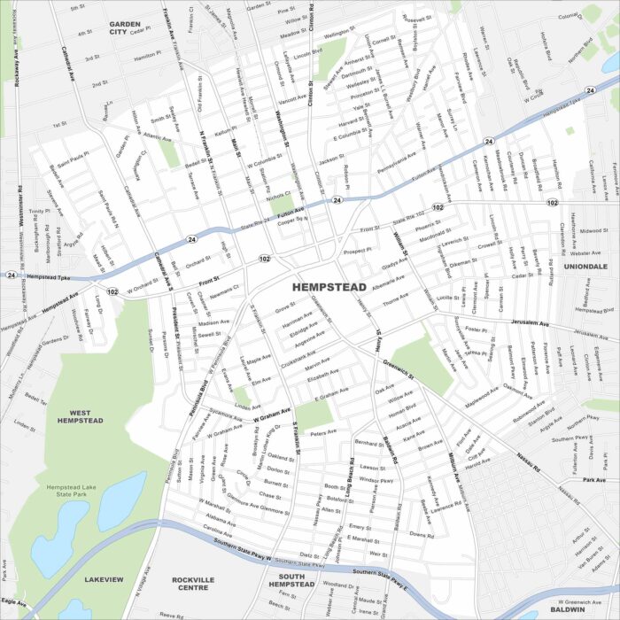
Our map of Hempstead places it on Long Island, just east of New York City. Major parkways run across the area.
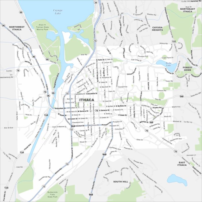
Check out our map of Ithaca, New York on the southern tip of Cayuga Lake. Gorges and waterfalls cut through the city.
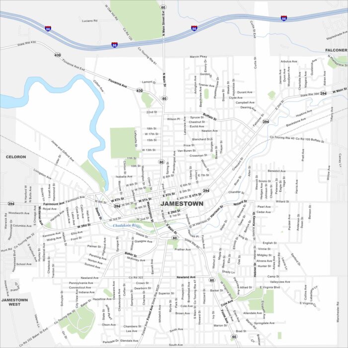
Jamestown sits at the south end of Chautauqua Lake. Our map shows a compact downtown near the Chadakoin River.
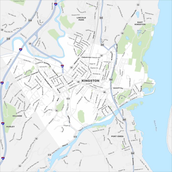
Kingston sits on the Hudson River, just below the Catskills. Our map shows old neighborhoods clustered near the water.
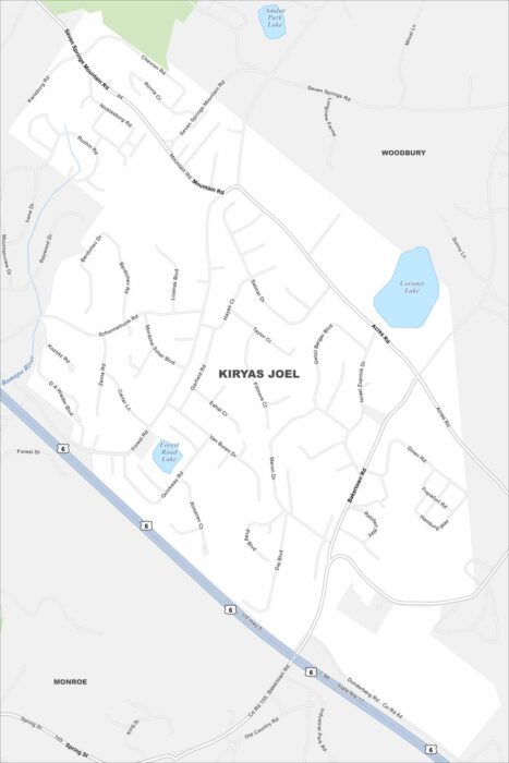
Kiryas Joel is a dense community in Orange County. The map shows compact neighborhoods built close together.