New Jersey Outline Map
New Jersey’s outline runs between the Delaware River and the Atlantic. The shape tilts slightly with a narrow northern top.
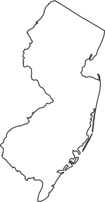
New Jersey’s outline runs between the Delaware River and the Atlantic. The shape tilts slightly with a narrow northern top.
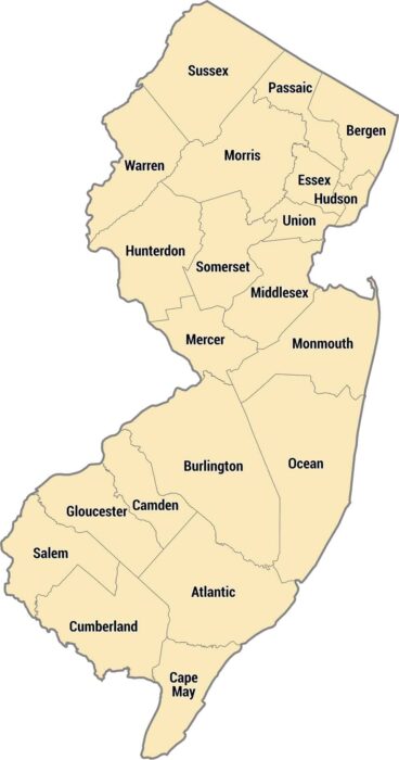
New Jersey’s counties pack tightly along the coast, central corridor, and Appalachian foothills. Bergen County sits across from Manhattan.
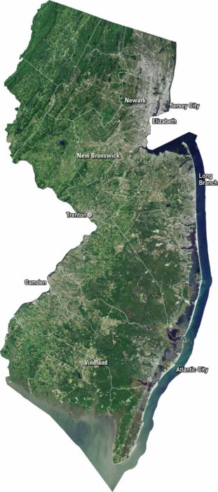
Our satellite map shows New Jersey’s dense cities and winding shorelines. We’ve clearly marked Trenton, Newark, and Jersey City.
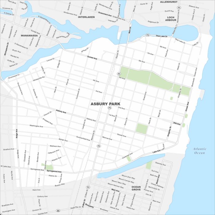
See the streets, highways, and waterfront edges on this map. Our map of Asbury Park highlights its roads leading to the shore.
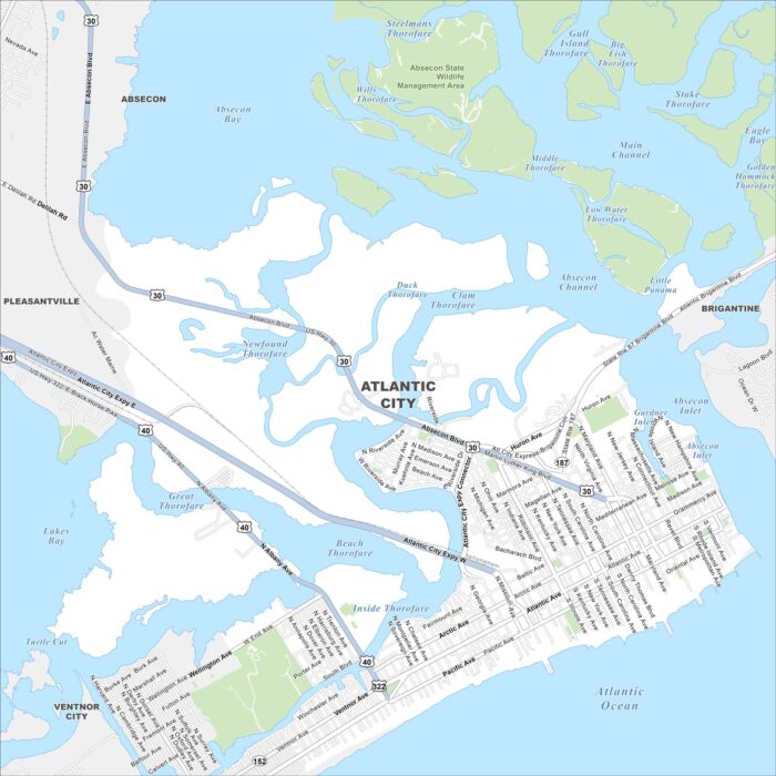
Our map of Atlantic City shows the highways, streets, and boardwalk routes. Roads cut toward the shore for seaside visitors.
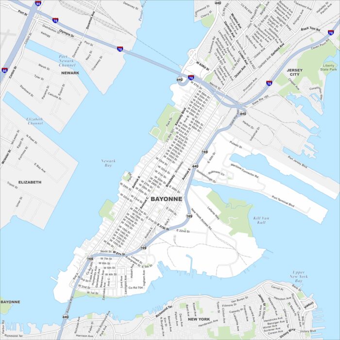
Bayonne is on a peninsula between Newark Bay and New York Harbor. Our map shows its waterfront, city grid, and connecting bridges.
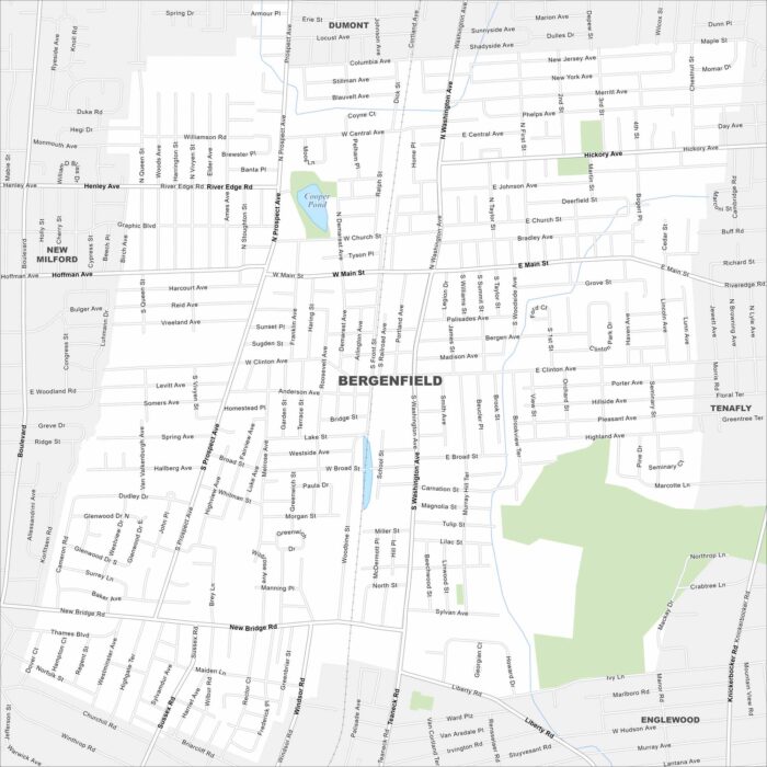
Want to explore Bergenfield? Bergenfield is in northern New Jersey. Use our map to explore this borough just outside New York City.
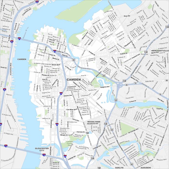
Camden is on the Delaware River across from Philadelphia. Our map shows the waterfront, roads, and major bridges.
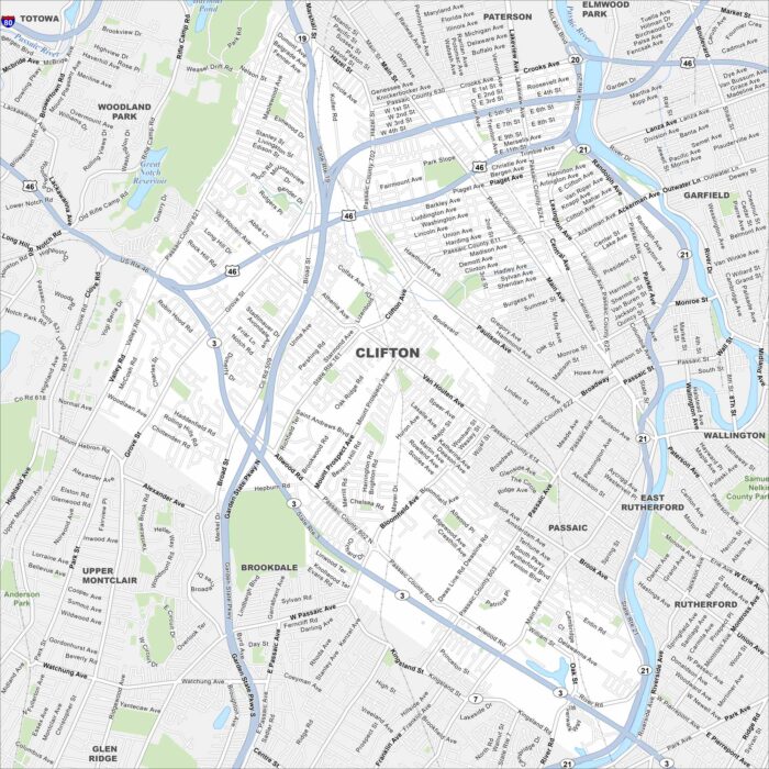
Clifton is shown with its streets, parks, and rivers. It’s just west of New York City and contains both residential areas and industry.
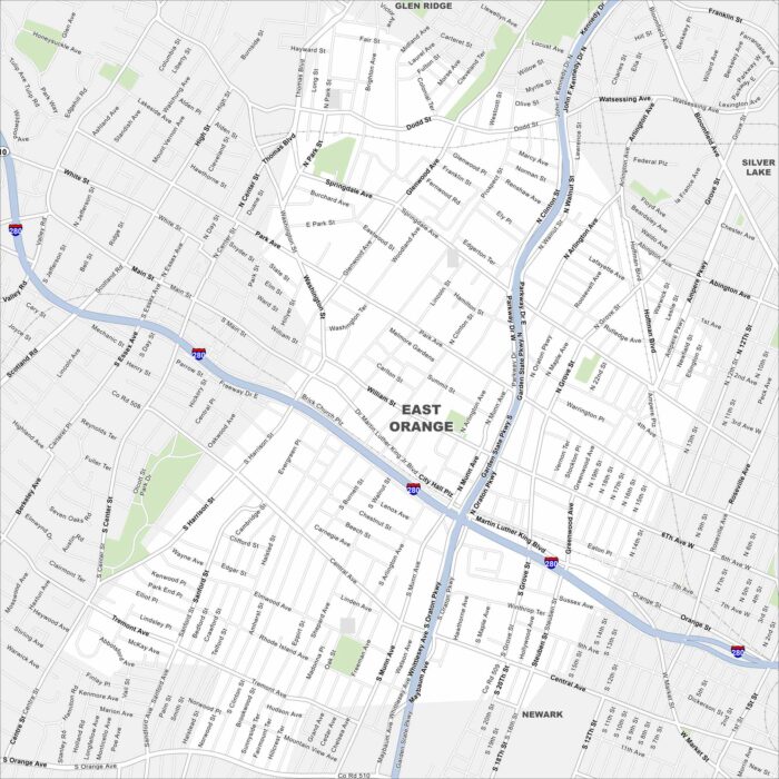
Explore East Orange in northern New Jersey, just west of Newark. The grid of streets links quickly into the Garden State Parkway.
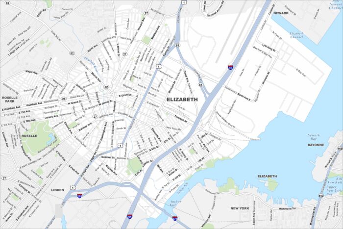
Elizabeth sits on Newark Bay with busy port terminals along the shoreline. Dense city blocks stretch westward.
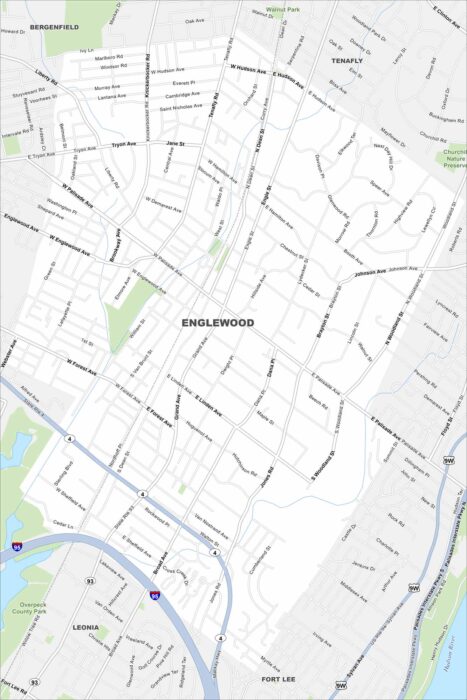
Our map of Englewood shows it just west of the Hudson River. It’s nestled against the Palisades cliffs with steep terrain at the east side.
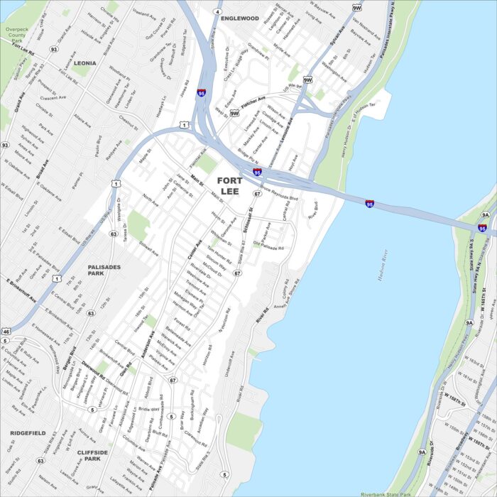
Fort Lee rises just across the Hudson River from Manhattan. The George Washington Bridge makes it a true landmark spot.
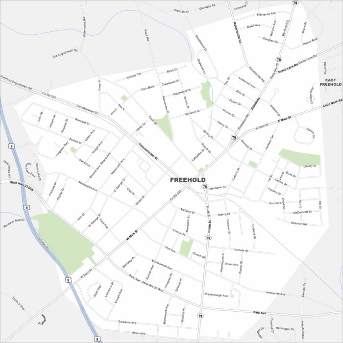
Freehold is in central New Jersey’s rolling terrain. Routes 9 and 33 cross on the west side. Our map also includes parks, roads and railways.
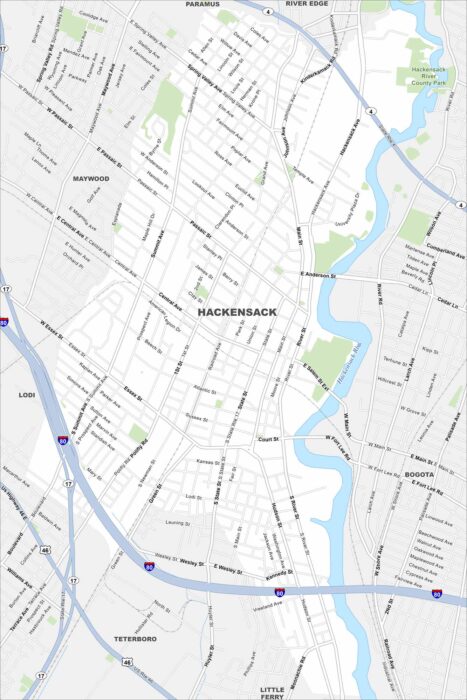
Check out our map of Hackensack in northern New Jersey. The Hackensack River runs right through the city. It’s in close proximity to NYC.