Map of Maple Grove, Minnesota
See Maple Grove on our road map. Lakes and parks break up its suburban grid. Highways connect it quickly into the Twin Cities. Map Information
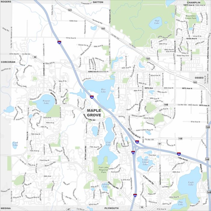
See Maple Grove on our road map. Lakes and parks break up its suburban grid. Highways connect it quickly into the Twin Cities. Map Information
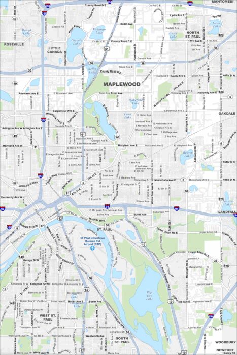
Explore Maplewood with our map. Highways form key routes around its neighborhoods, lakes and green spaces.
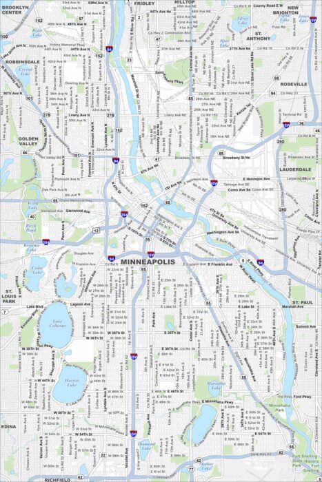
Step into Minneapolis, Minnesota with our map. The Mississippi River divides the city, with lakes and parkways throughout.
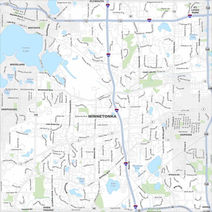
Our map of Minnetonka highlights its mix of lakes, parks, and neighborhoods. Highways connect it easily into Minneapolis.
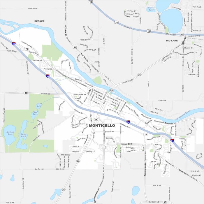
Explore Monticello on our road map. The Mississippi River flows right through and the town spreads along the riverbanks.
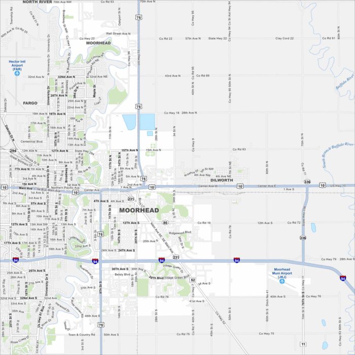
Moorhead sits right on the Red River across from Fargo. Our map shows a its downtown stretching into farmland on the outskirts.
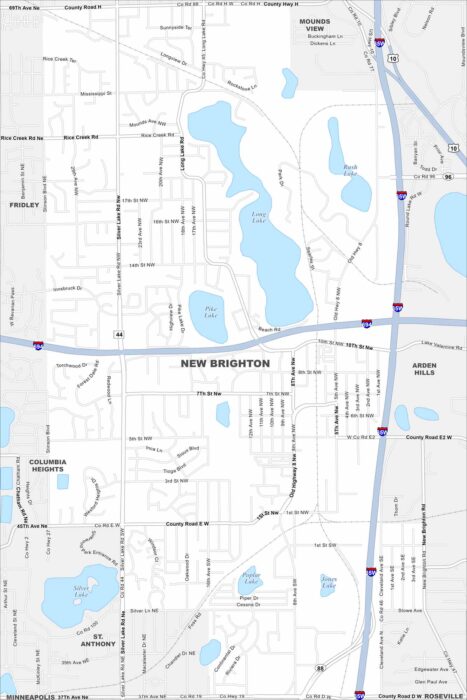
Our map of New Brighton shows a northern suburb of Minneapolis-St. Paul. The layout includes lakes, parks, and a mix of residential areas.
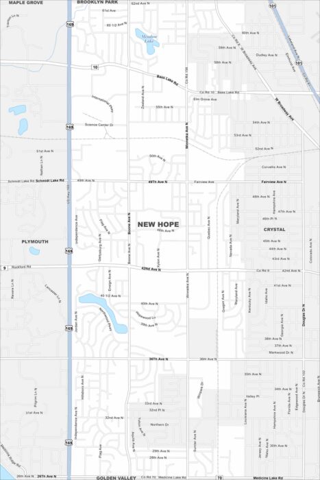
Our map of New Hope shows a suburban community northwest of Minneapolis. Residential neighborhoods and parks fill much of the layout.
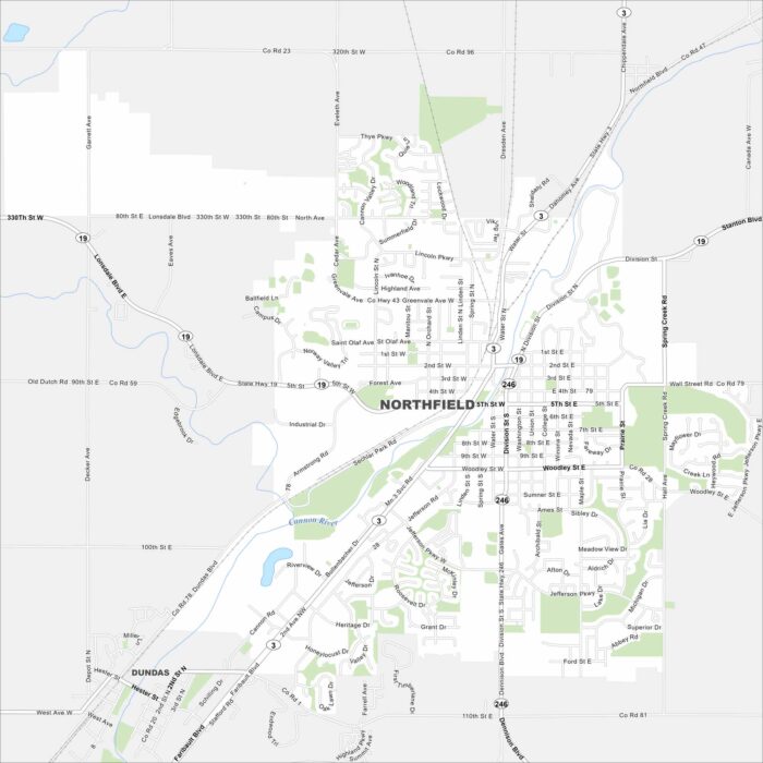
Northfield is set along the Cannon River. Our map shows a walkable downtown, green spaces, and surrounding farmland.
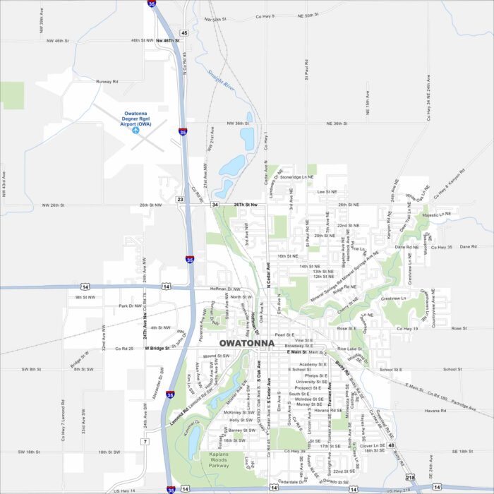
Check out Owatonna, situated along the Straight River. This map shows its downtown, parks, and surrounding farmland.
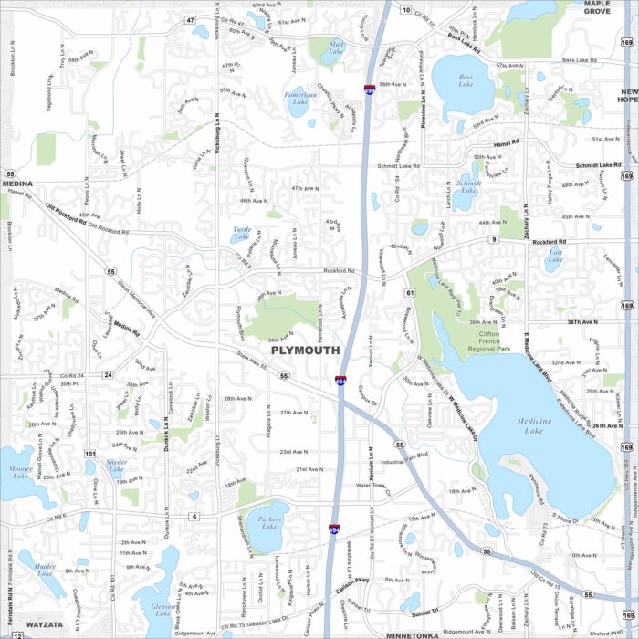
Plymouth sits among rolling lakes just west of Minneapolis. Our map highlights Medicine Lake, which stands out as the city’s centerpiece.
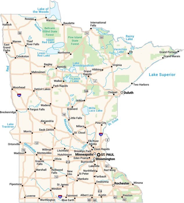
Our map of Minnesota shows the land of 10,000 lakes. From Minneapolis to Duluth, every road connects water, forest, and people.
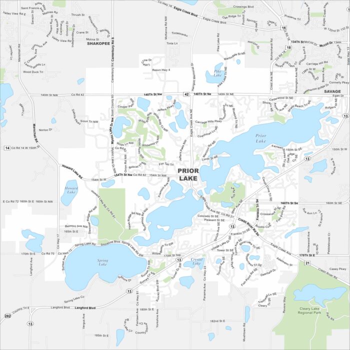
Prior Lake is a lakeside city southwest of Minneapolis. Our map highlights the main roads circling the water, plus neighborhoods and parks.
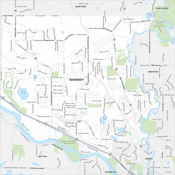
Set along the Mississippi River, our map of Ramsey shows its suburbs and open land. Residents enjoy easy access to the Twin Cities.
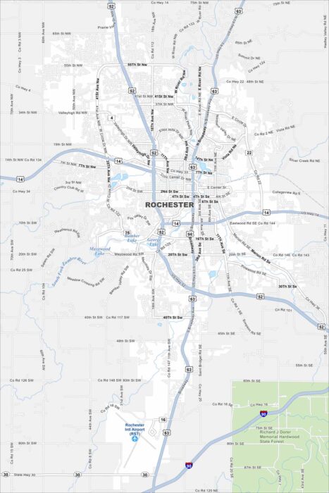
Our map of Rochester, Minnesota displays the parks and the busy roads around downtown. It gives you a sense of how the city is arranged.