Map of Blaine, Minnesota
Our map of Blaine shows the highways, streets, and nearby lakes. Roads spread out here into the Twin Cities metro.
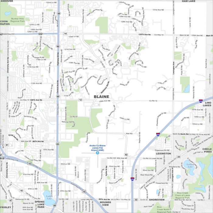
Our map of Blaine shows the highways, streets, and nearby lakes. Roads spread out here into the Twin Cities metro.
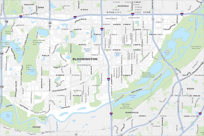
Get a snapshot of Bloomington, Minnesota. This is the home of the Mall of America. Lakes and parks spread through the community.
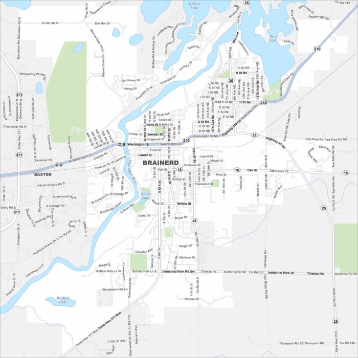
See Brainerd with our map in the heart of lake country. The Mississippi River cuts through the area. It’s a hub for fishing and summer trips.
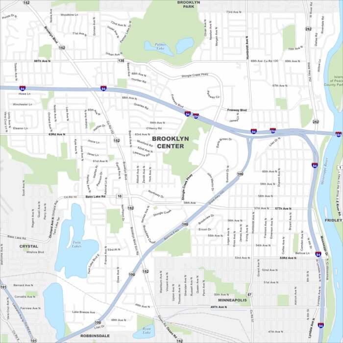
Check out Brooklyn Center on our map, sitting just northwest of Minneapolis. The Mississippi River forms its eastern edge.
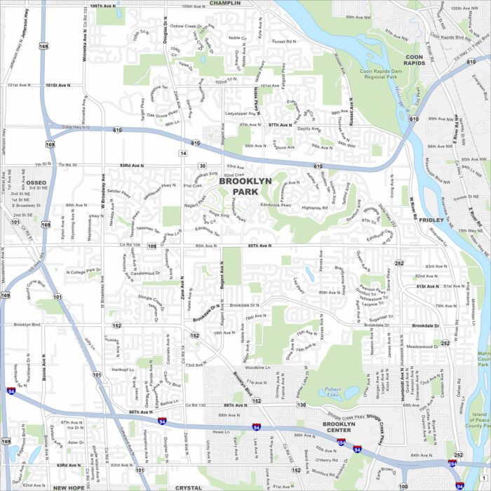
Brooklyn Park is along the Mississippi River, north of Minneapolis. Our map highlights curving roads, parks, and riverfront trails.
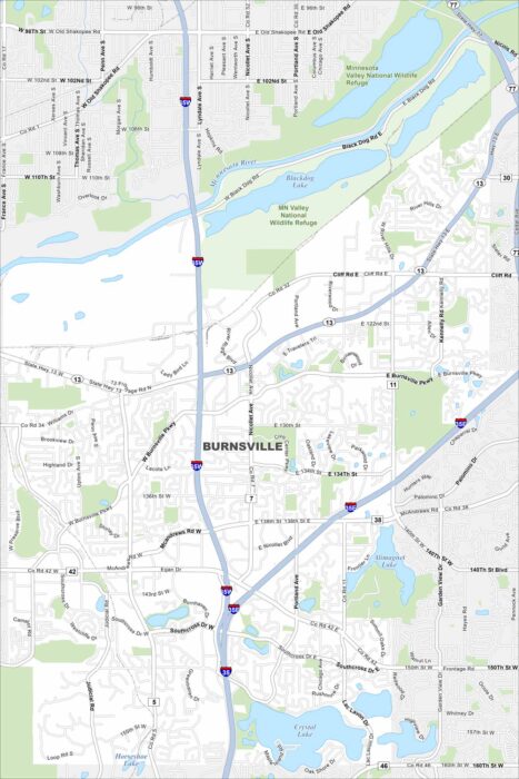
Check out our map of Burnsville, just south of Minneapolis. It highlights lakes, parks, and the Minnesota River forming the city’s edge.
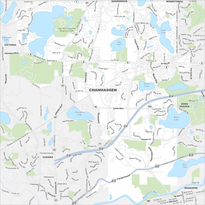
Our map of Chanhassen is filled with lakes and green spaces. The city is popular for its trails and outdoor recreation.
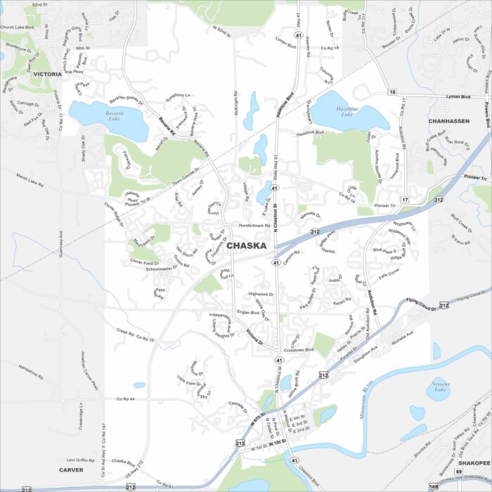
Here’s Chaska with its local roads and the Minnesota River along its edge. Southwest of Minneapolis, it has roots as a small river town.
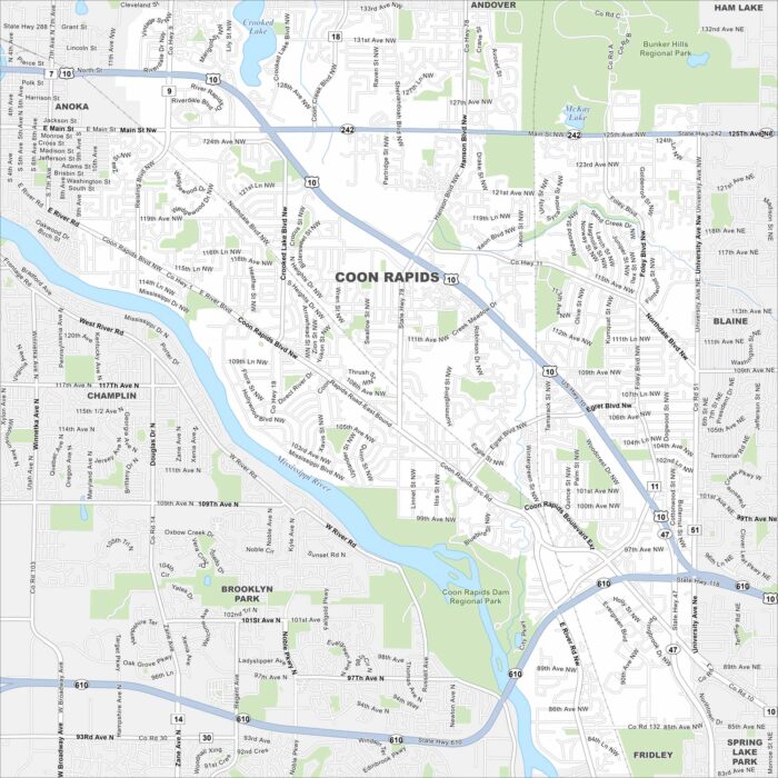
Coon Rapids hugs the Mississippi River and is north of Minneapolis. The area mixes neighborhoods with riverfront trails.
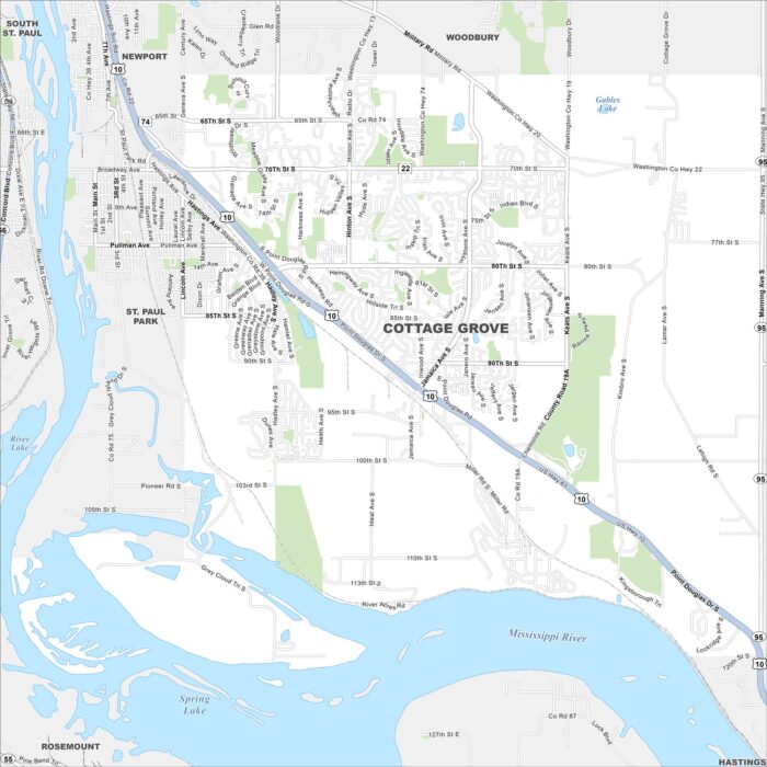
Cottage Grove shows up here with roads, highways, and rivers. You can find it along the Mississippi. It’s also situated south of St. Paul.
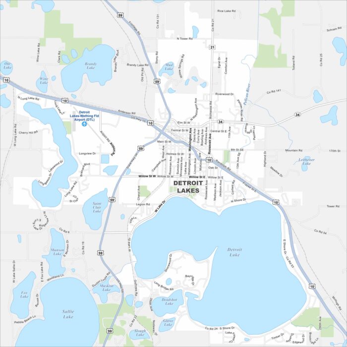
Our map of Detroit Lakes brings out a cluster of lakes scattered around the town. Roads extend between the shorelines and wooded areas.
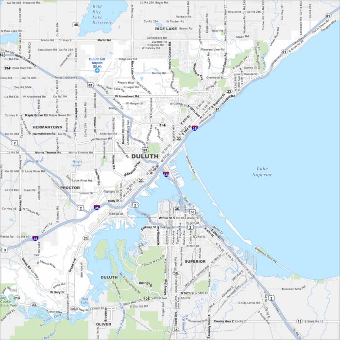
Duluth sits on the western tip of Lake Superior. Our map of the city shows the harbor, lift bridge, and hillside streets.
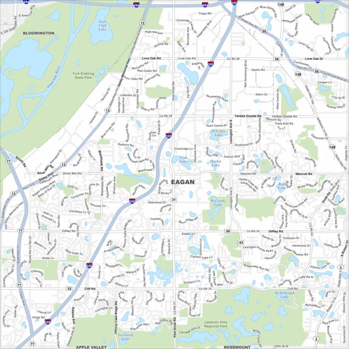
Eagan stretches along the Minnesota River, just south of St. Paul. This map shows its lakes, parks and major freeways.
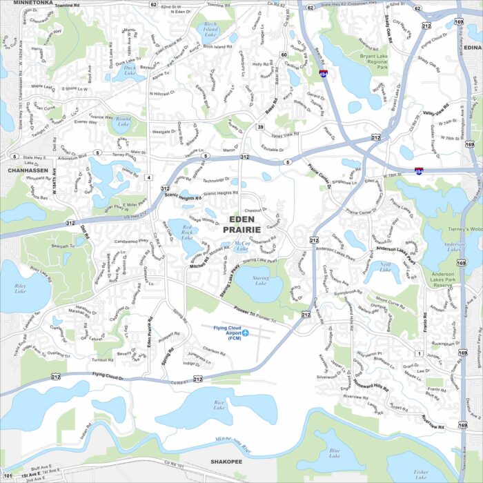
Our map of Eden Prairie, Minnesota shows lakes scattered throughout the city, including Staring and Red Rock Lake.
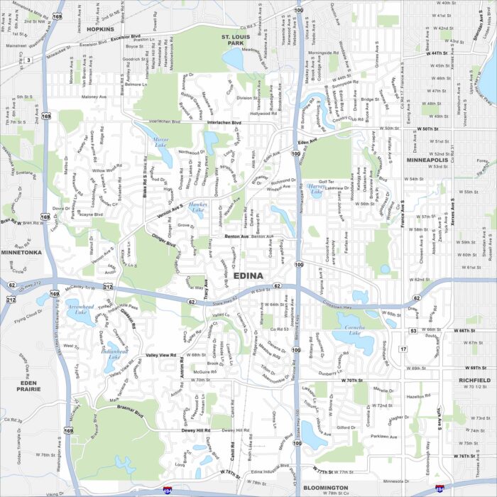
Edina is located southwest of Minneapolis. Our map highlights several lakes, including Arrowhead and Lake Cornelia.