Minnesota Biomes Map
Our map of Minnesota focuses on forests, savannas, and shrublands. The state sits right where major biomes meet and overlap.
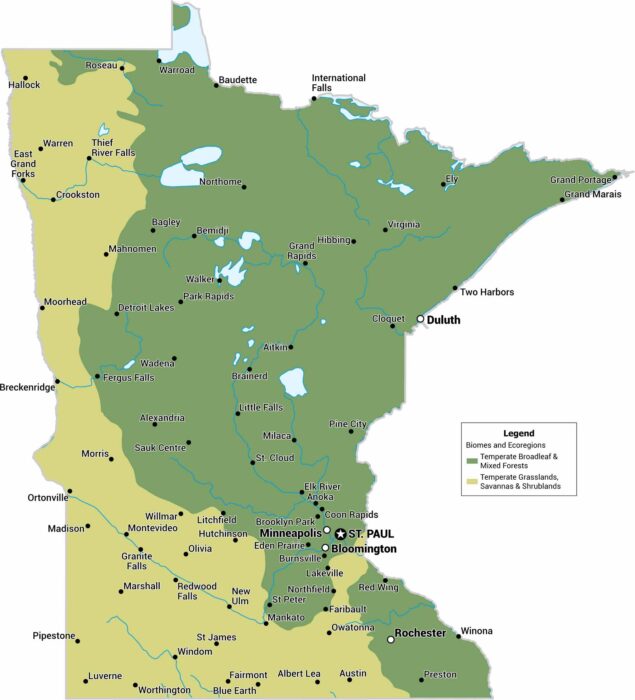
Our map of Minnesota focuses on forests, savannas, and shrublands. The state sits right where major biomes meet and overlap.
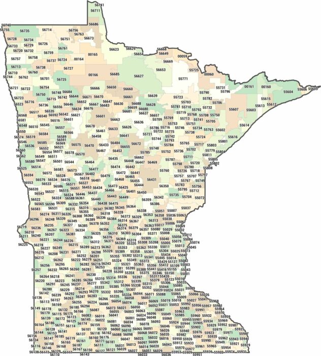
Minnesota zip codes cover lakes, forests, and farmland. But it’s really a heck of a lot of lakes. We’ve mapped every zone from Iowa to Canada.
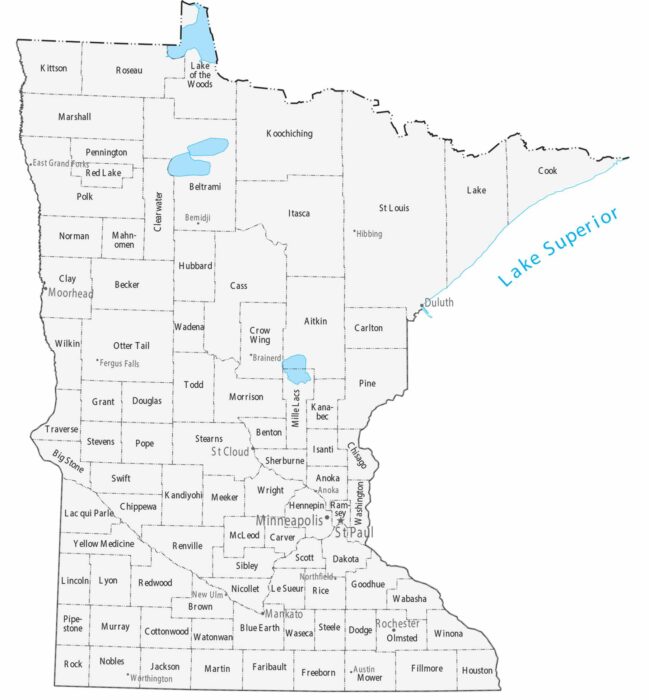
Counties stretch large across northern Minnesota, while southern counties are smaller and more numerous. Our map highlights the Twin Cities.
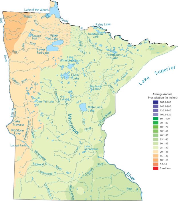
Our precipitation map of Minnesota shows rainfall increasing as you head southeast. The northern latitude gets snow and less precipitation.

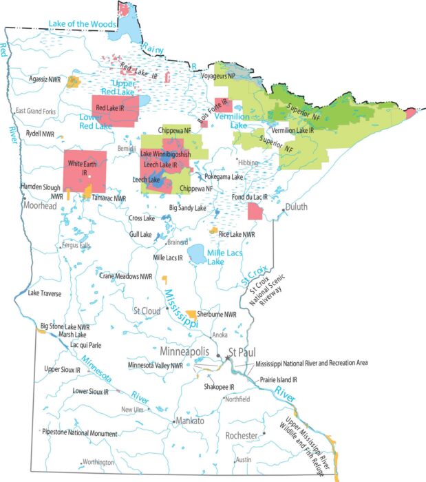
See how Minnesota earns its lake reputation as the “Land of 10,000 Lakes”. Our map shows the Mississippi and Minnesota Rivers.
Minnesota stretches from prairie in the south to thick forests in the north. Voyageurs National Park protects the lake next to Canada.
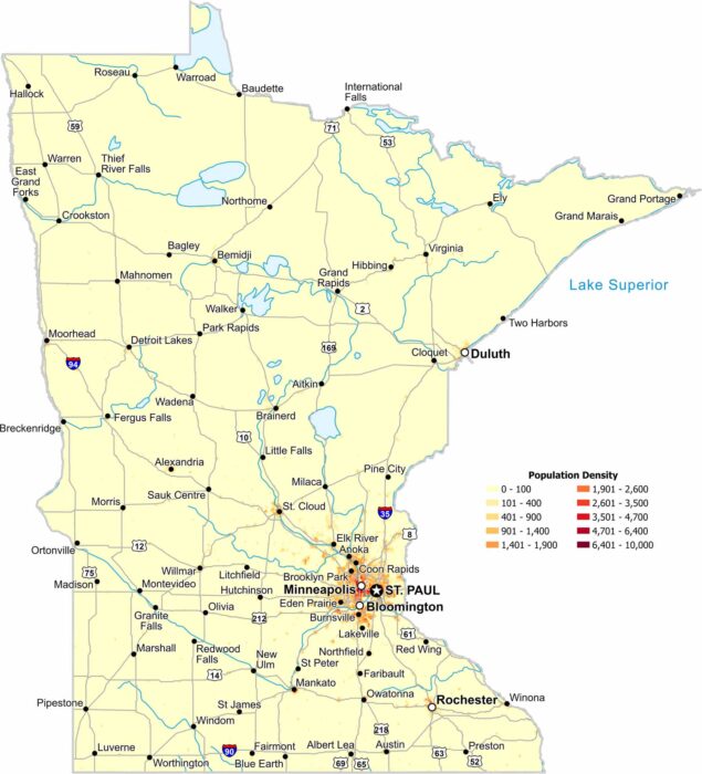
The Twin Cities dominate our population density map of Minnesota. But density fades outward such as in the sparse northern regions.
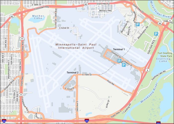
Get a snapshot of Minneapolis–Saint Paul International Airport. Our map features its runways, terminals, and surrounding highways/roads.
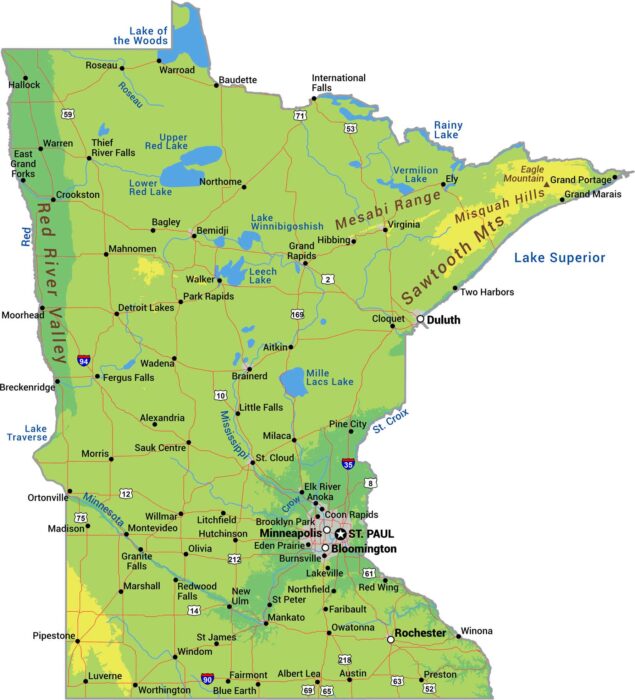
From the Sawtooth Mountains to the Red River Valley, this is our physical map of Minnesota. Over 10,000 lakes cluster in the north.
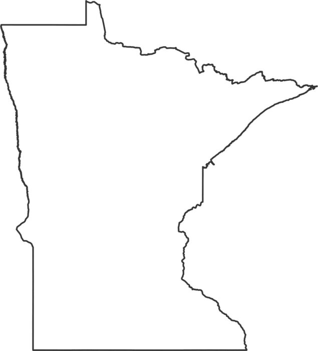
Here’s out outline map of Minnesota. As you can see, the eastern border follows the St. Croix River, which runs up to Lake Superior.
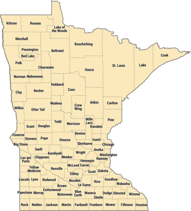
There are 87 counties in Minnesota, from the prairie farmland in the south to the forests up north. Hennepin County contains Minneapolis.
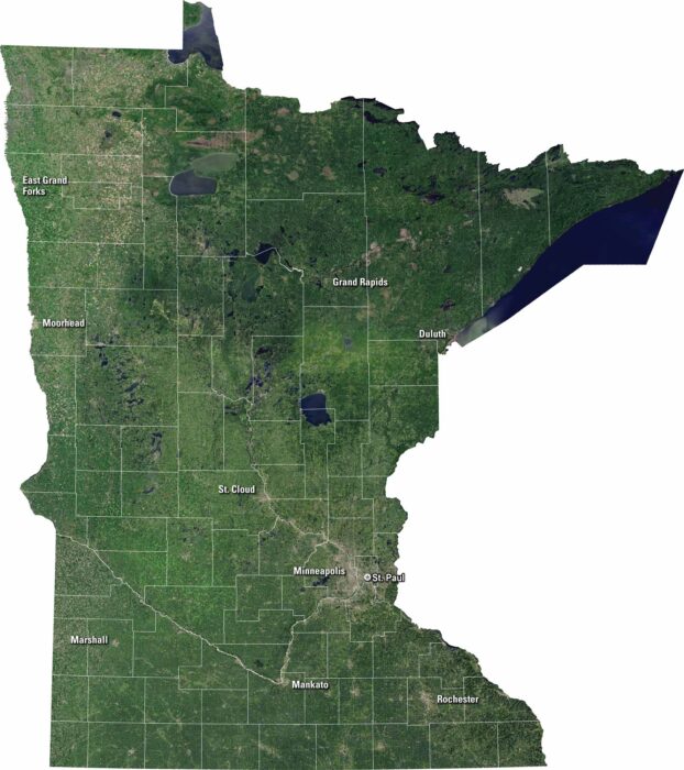
Minnesota is a land of lakes and forests. You’ll spot Minneapolis and St. Paul on our satellite map. Lakes like Mille Lacs and Red show up.
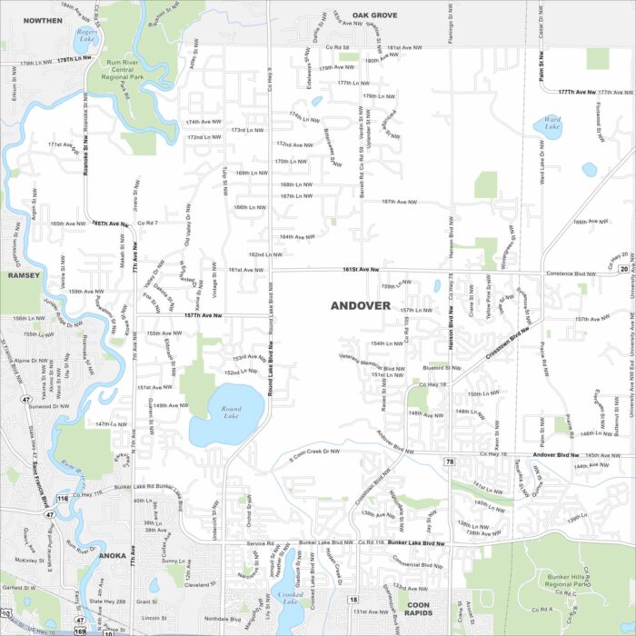
Andover is mapped with its lakes, waterways and highways. Roads connect into the Twin Cities but still maintains wide green spaces.
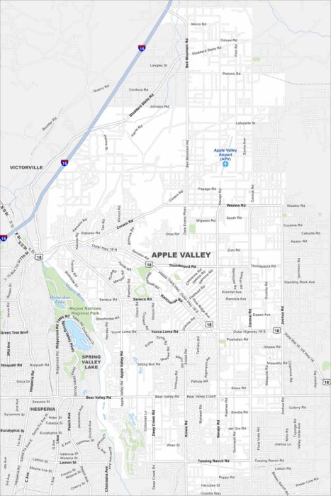
Our map of Apple Valley highlights the highways, streets, and nearby lakes. Roads link toward Minneapolis in the Twin Cities area.
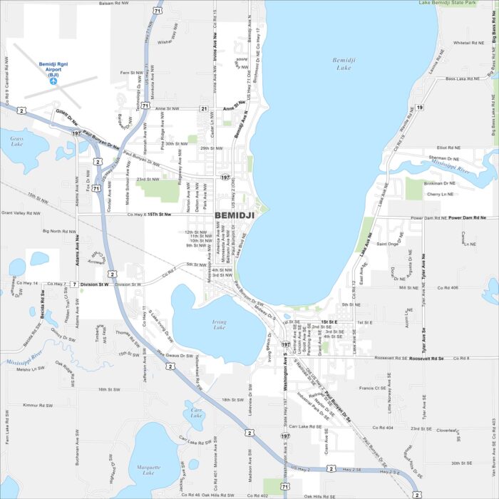
Bemidji is surrounded by lakes in northern Minnesota. Our map shows its roads, water bodies, and nearby forests.