Indiana Zip Code Map
Our map of Indiana highlights how evenly zip codes cover the state. Indiana runs through 460 to 479, covering Indianapolis to Midwest towns.
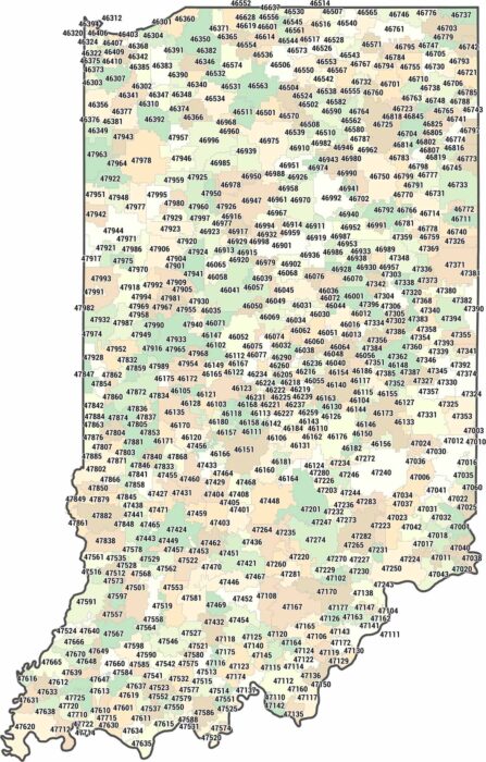
Our map of Indiana highlights how evenly zip codes cover the state. Indiana runs through 460 to 479, covering Indianapolis to Midwest towns.
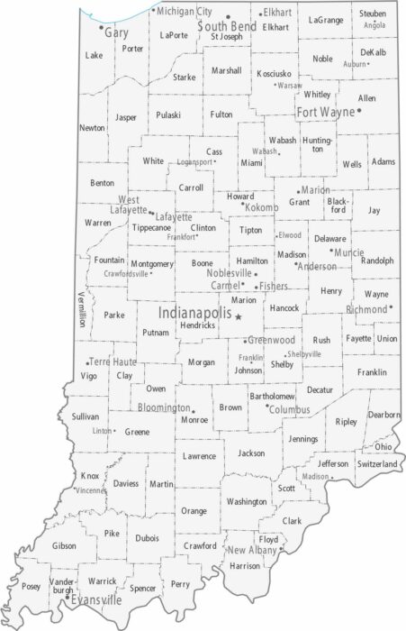
Our map of Indiana has Indianapolis sitting almost perfectly in the center. Fort Wayne anchors the northeast and Evansville the southwest.
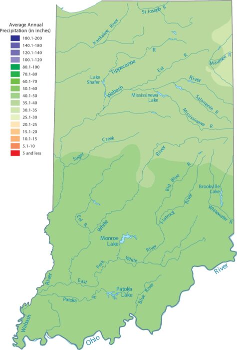
Our precipitation map of Indiana shows rainfall spread pretty evenly. The terrain is flat here so it doesn’t create any barriers.
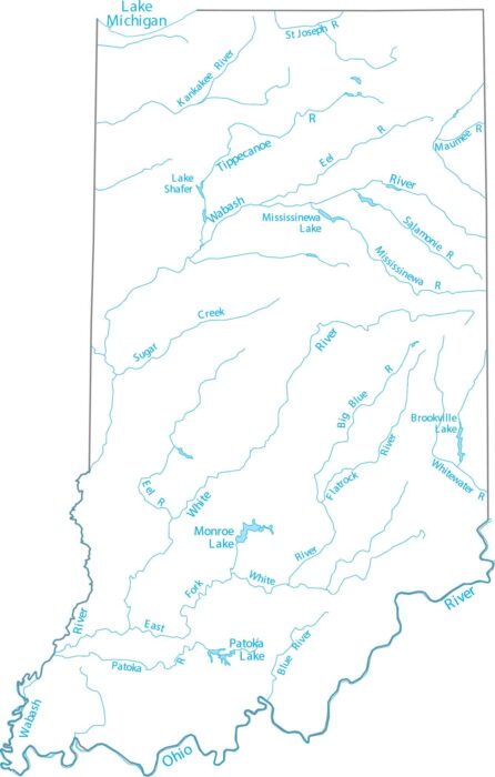
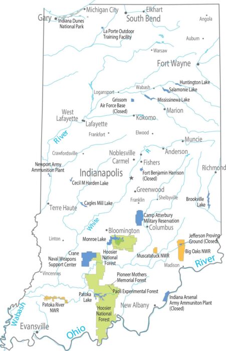
See how Indiana’s rivers connect the state together. Our map shows the Wabash River flowing southwest through the entire state.
Flat farmland takes over most of Indiana. The south looks different from the north with forests bunching up in the hillier terrain.
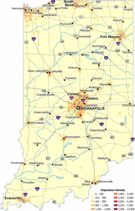
Our Indiana population density map shows urban centers with Indianapolis, Evansville and Fort Wayne as the main focal points.
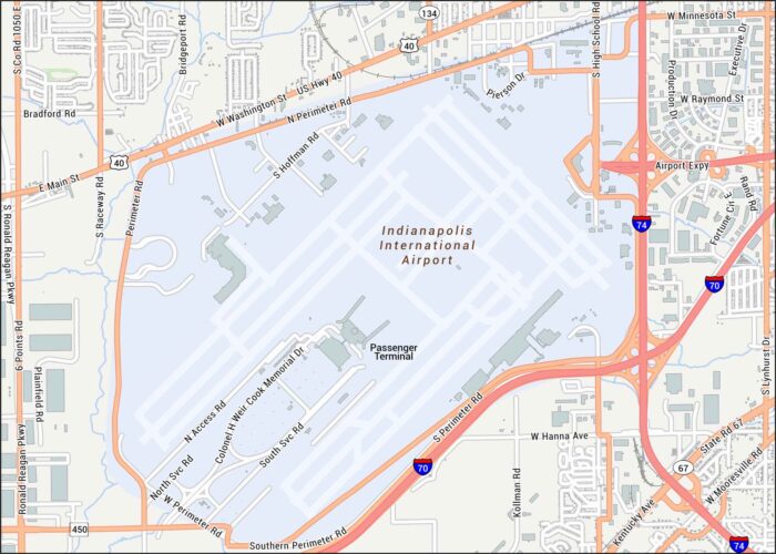
Touch down in Indianapolis. Located just west of downtown, our map shows terminals, runways, highways and much more.
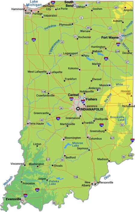
Try finding a mountain in Indiana. This state is has some rolling hills but it’s mostly flat. Our physical map of Indiana shows flat farmland.
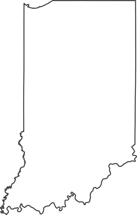
Our Indiana outline map shows the Ohio River creating the entire southern border with Kentucky. Lake Michigan cuts into the northwest corner.
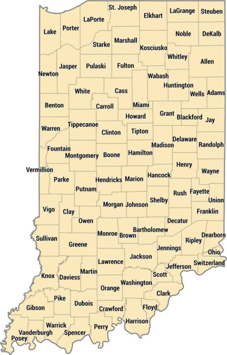
Our Indiana county map shows 92 counties laid out in a near-perfect grid. The map shows the shift from dense urban regions to rural spaces.
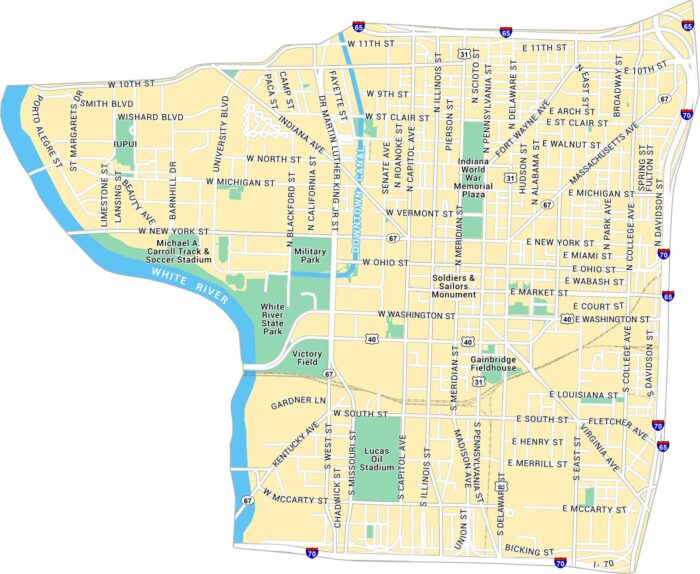
Our map of Downtown Indianapolis highlights Lucas Oil Stadium and attractions. City streets, sporting venues and parks are all clear to see.
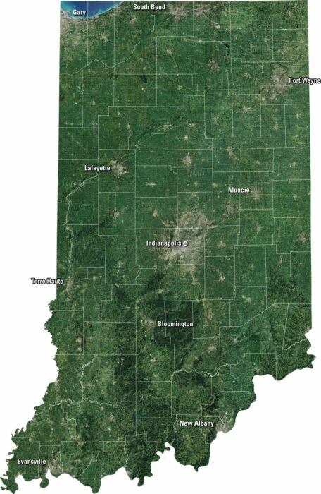
Indiana stretches from quiet farmland to big cities. Our satellite map shows it all. It has fields, forests, and roads connecting it all.
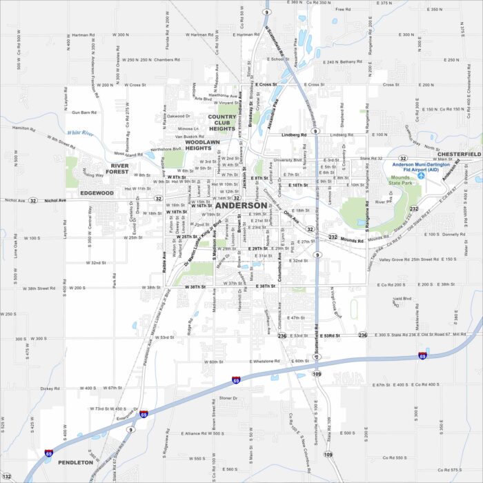
Anderson carries an industrial past but leans into small-city charm today. It’s a crossroads town with roots in the auto industry.
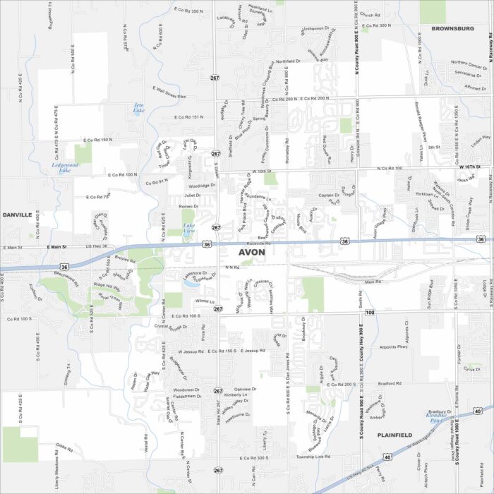
Avon is mapped with its streets, highways, and parkland. This town is known for its strong school system and family-friendly fun.
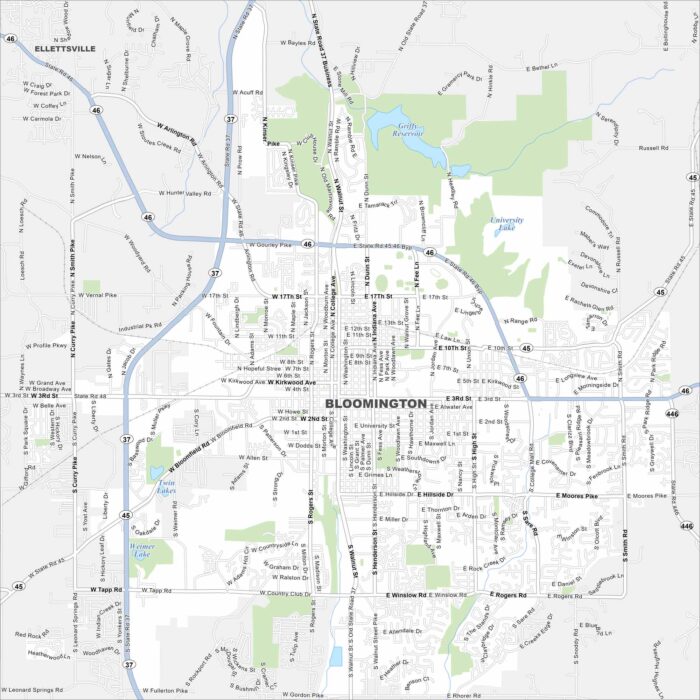
Here’s our road map of Bloomington, Indiana. It’s home to Indiana University and rolling southern Indiana hills.