Map of Park Ridge, Illinois
Check out Park Ridge just northwest of Chicago. This map shows leafy neighborhoods and a classic downtown core.
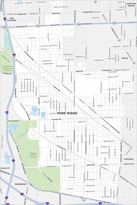
Check out Park Ridge just northwest of Chicago. This map shows leafy neighborhoods and a classic downtown core.
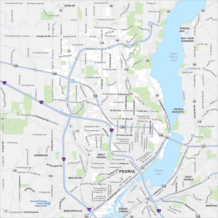
Peoria hugs the Illinois River in the center of the state. Our map highlights the riverfront, downtown streets, and neighborhoods.
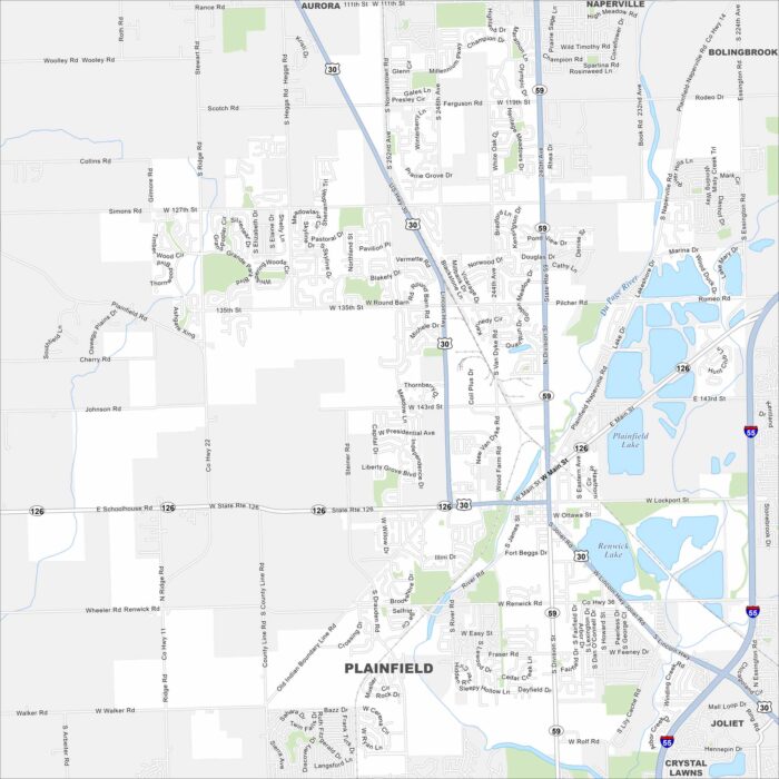
Check out our Plainfield map, which sits southwest of Chicago. This map shows suburban sprawl mixed with farmland edges.
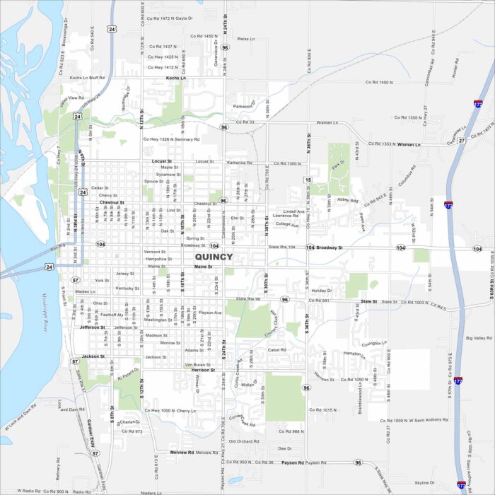
Our map shows Quincy, perched on the Mississippi River. You’ll see highways, lakes and parks mapped clearly.
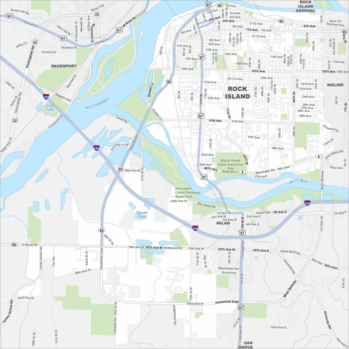
Our map of Rock Island displays the bridges, the riverfront, and the grid of city streets. You’ll know how it links across the Mississippi.
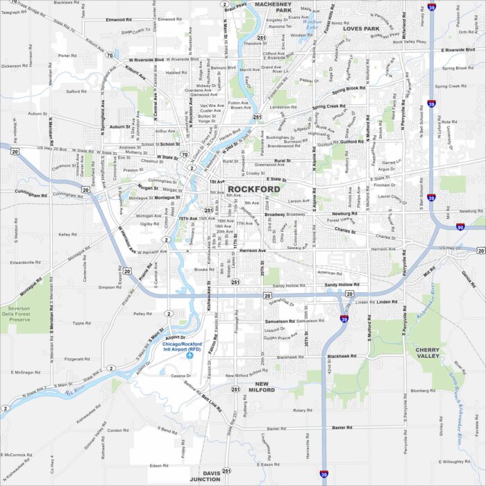
Get oriented with our Rockford, Illinois map. The streets and parks stand out. You’ll also notice the Rock River that cuts through the city.
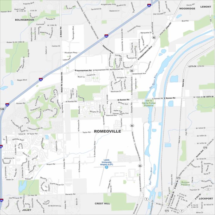
Our map of Romeoville shows streets, parks, and business districts. It also highlights routes into Chicago so you can move through the area.
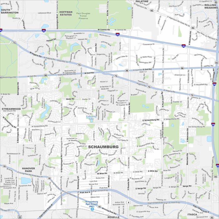
Check out our map of Schaumburg, Illinois. From sprawling business parks and neighborhoods, the layout makes it easy to find your way.
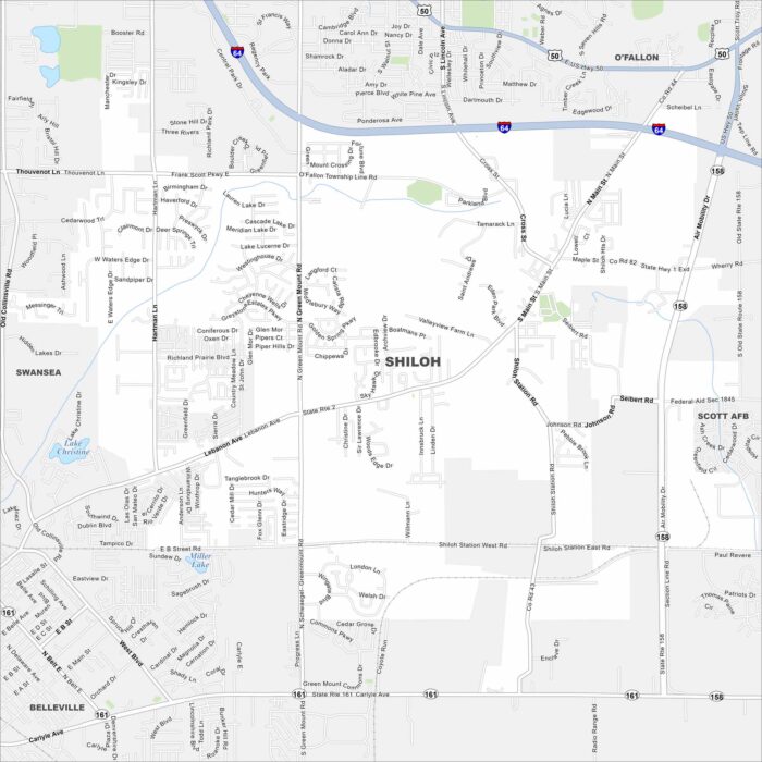
This street map of Shiloh helps you explore this town in Illinois. It sits near Scott Air Force Base and has parks, schools, and shops.
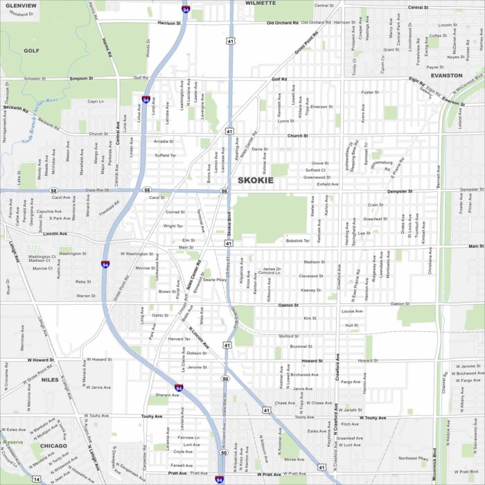
This street map of Skokie helps you get around near Chicago’s North Shore. The town is filled with parks, schools, and cultural centers.
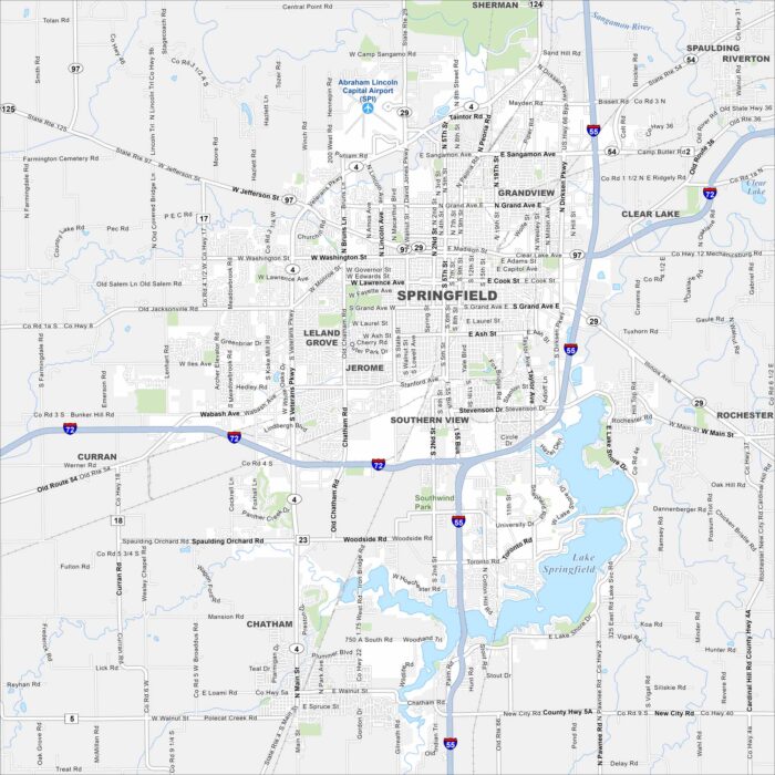
Get around Springfield with our map. As Illinois’ capital, the city is filled with Lincoln landmarks, government buildings and historic sites.
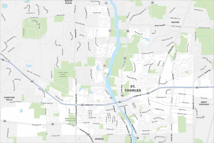
Here’s a map of St. Charles along the Fox River. The town is known for its scenic downtown, theaters, and family-friendly festivals.
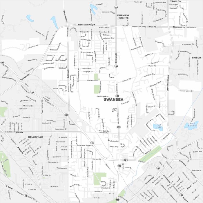
Our road map of Swansea shows this St. Louis suburb. Quiet neighborhoods, shopping, and parks fill the town, making it a calm place to live.
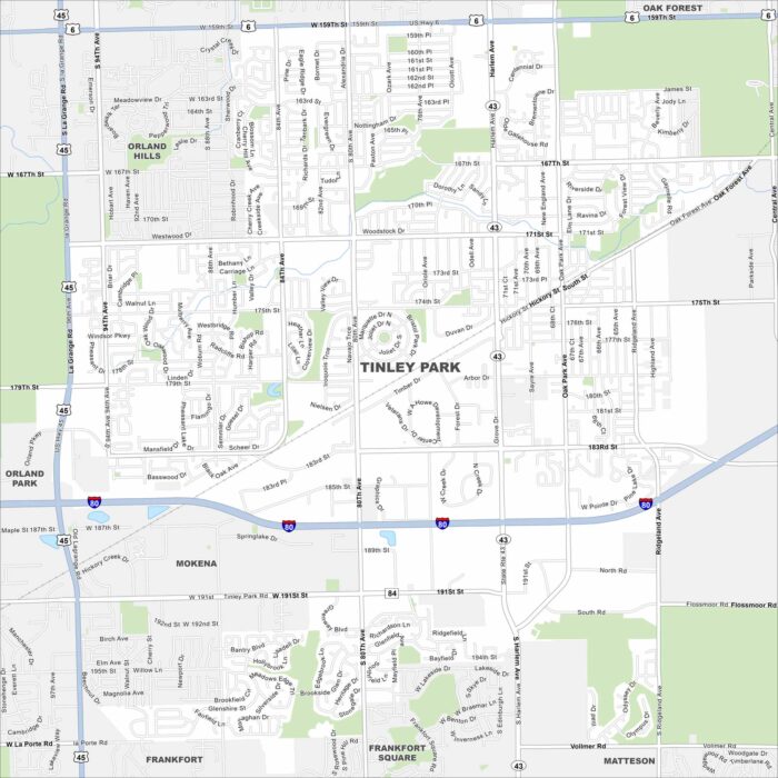
Our road map of Tinley Park highlights this Chicago suburb. Known for its outdoor music amphitheater, it also has neighborhoods and parks.
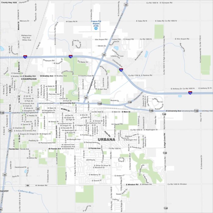
Our map of Urbana shows you around this college town. Home to the University of Illinois, it blends campus life with quiet neighborhoods.