Map of Dade City, Florida
Check out Dade City with its mapped roads, highways, and rolling hills. Situated northeast of Tampa, it’s known for its historic downtown.
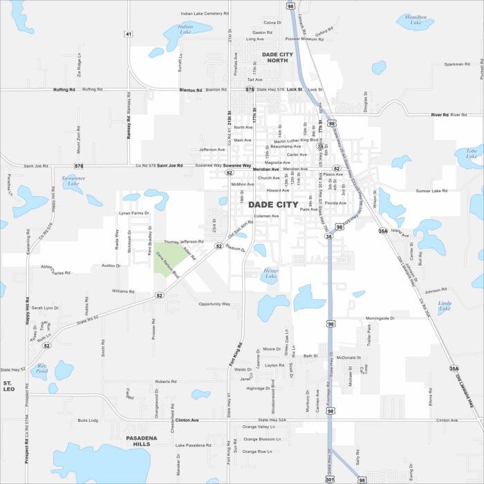
Check out Dade City with its mapped roads, highways, and rolling hills. Situated northeast of Tampa, it’s known for its historic downtown.
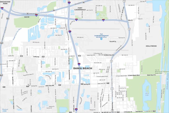
Dania Beach hugs the Intracoastal Waterway and the Atlantic coast. Its streets lead from beachside resorts inland toward residential areas.
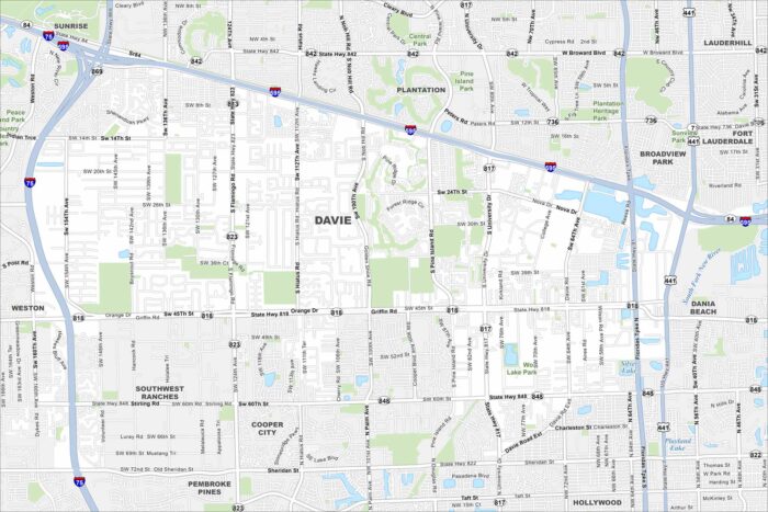
Our map of Davie highlights local roads, highways, and parks. It sits inland from Fort Lauderdale with the Everglades spread out to the west.
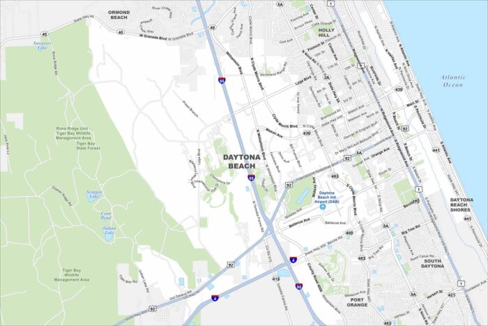
Daytona Beach stretches along the Atlantic, with roads running parallel to its famous beaches. It’s known for its speedway and shorelines.
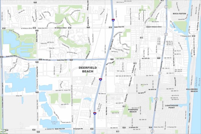
Take a look at this map of Deerfield Beach with its streets, waterways, and coastal parks. It’s located north of Fort Lauderdale.
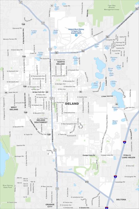
DeLand is mapped with its streets, highways, and surrounding lakes. It’s located between Orlando and Daytona Beach with a historic downtown.
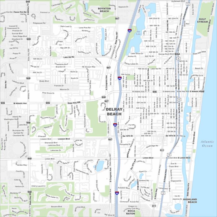
Explore our map of Delray Beach on Florida’s Atlantic coast. This map highlights sandy beaches, the Intracoastal Waterway, and neighborhoods.
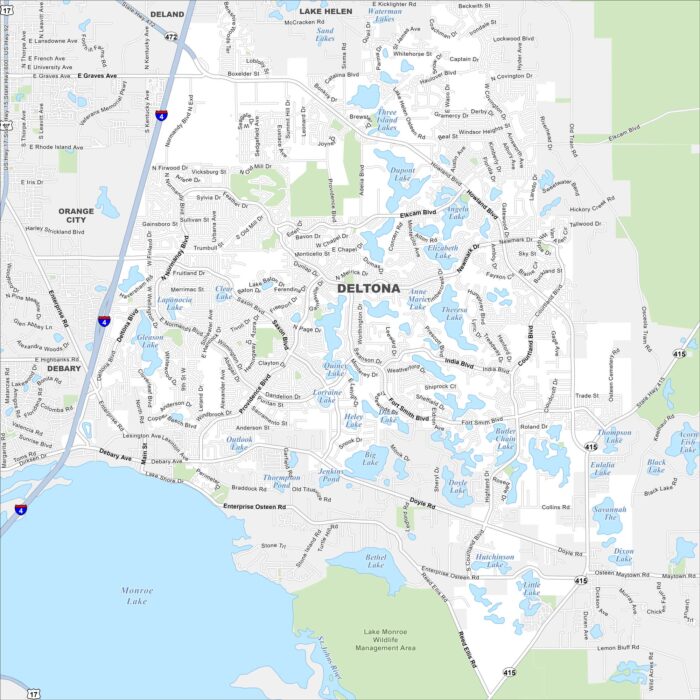
Deltona is set between Orlando and Daytona Beach. On the map, you’ll notice it’s covered with small lakes and spread-out suburban streets.
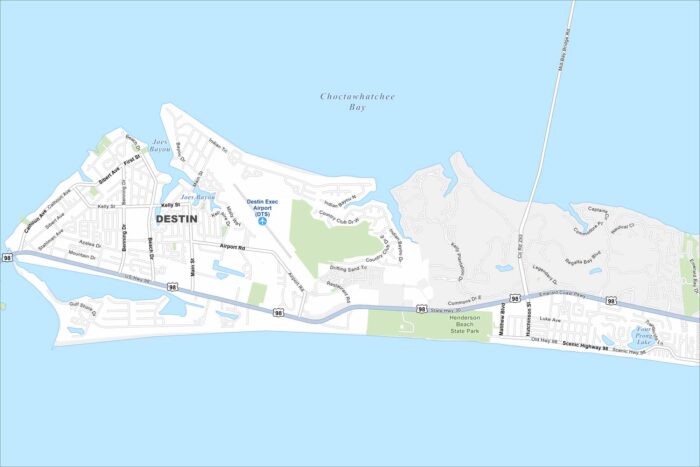
Check out our map of Destin on Florida’s Emerald Coast. It has plenty of white-sand beaches along the Choctawhatchee Bay.
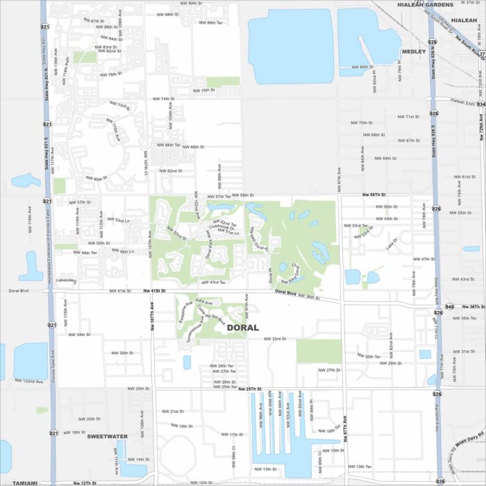
Take a look at our map of Doral in Miami-Dade County. Wide boulevards, lakes, and green golf courses fill the layout.
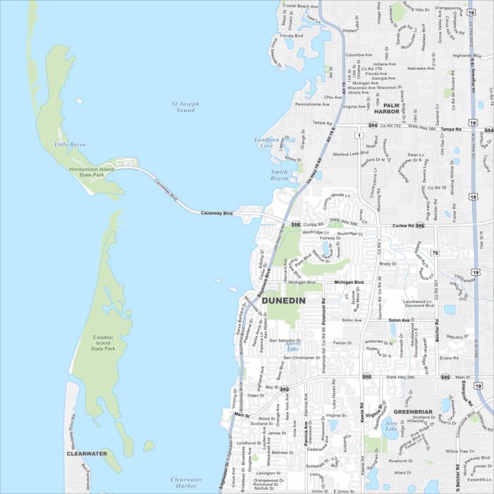
Explore our map of Dunedin along Florida’s Gulf Coast. You’ll spot sandy beaches, offshore islands, and green coastal parks.
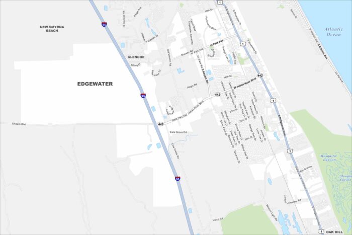
Edgewater sits along the Indian River, just south of New Smyrna Beach. On the map, you’ll see long stretches of waterfront and nearby canals.
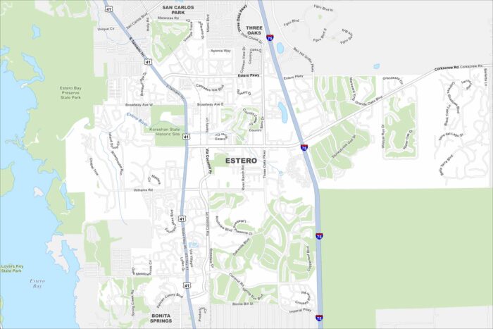
Check out our map of Estero along Florida’s Gulf Coast. The Estero River flows through toward Estero Bay on the west side.
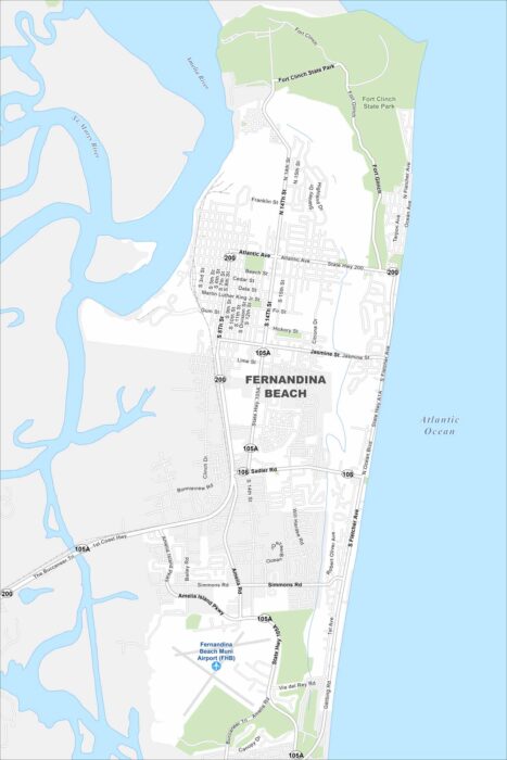
Check out our map of Fernandina Beach on Amelia Island. It hugs the Atlantic shoreline with wide beaches to the east.
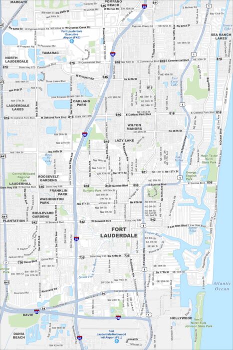
Fort Lauderdale sits on the Atlantic coast with lots of canals. Our map shows the New River and streets winding right through the city.