Central Coast Map
Check out our map of California’s Central Coast region, showing counties and cities. We’ve highlighted in gold along the Pacific coastline.
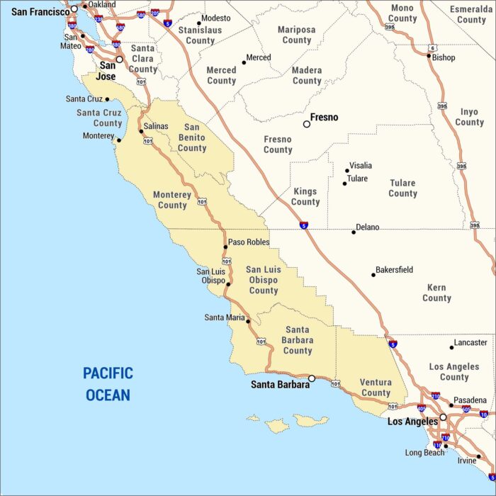
Check out our map of California’s Central Coast region, showing counties and cities. We’ve highlighted in gold along the Pacific coastline.
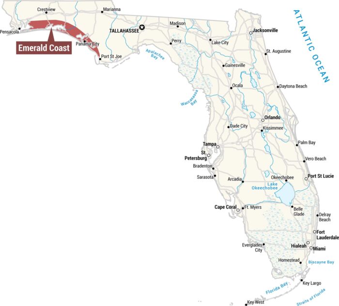
Our map displays the Emerald Coast along the northwestern Panhandle coastline. This region stretches along the Gulf Coast.
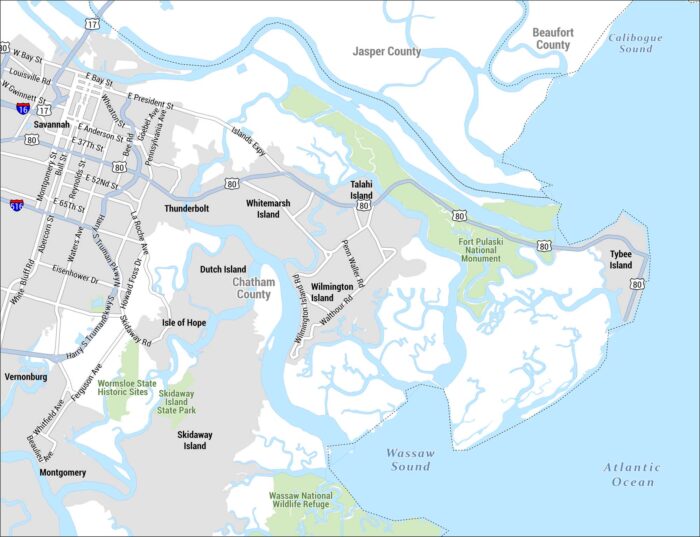
See our detailed map of the Golden Isles region centered on Savannah, Georgia and its barrier islands, coastal waterways, and marshlands.
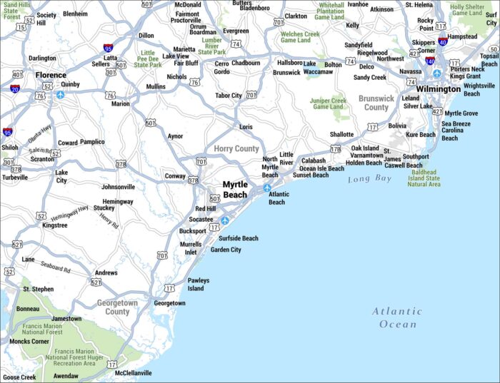
This is a detailed street-level map of the Grand Strand region on the South Carolina and North Carolina coastline, centered on Myrtle Beach.
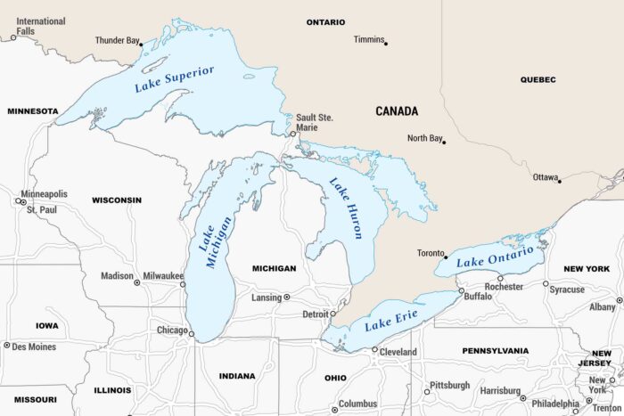
Our map is centered on the Great Lakes, showcasing all five lakes spanning the US-Canada border with states, provinces and major cities.
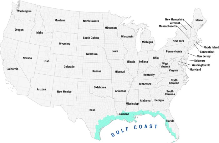
See our Gulf Coast map highlighted in teal along the southern coastline. This region sweeps from Texas and down through Florida.
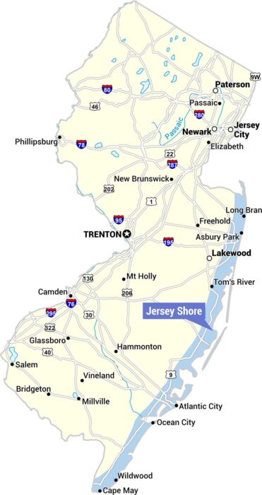
Our map highlights the Jersey Shore along the eastern coastline, marked with a blue label. The map covers the full state with major cities.
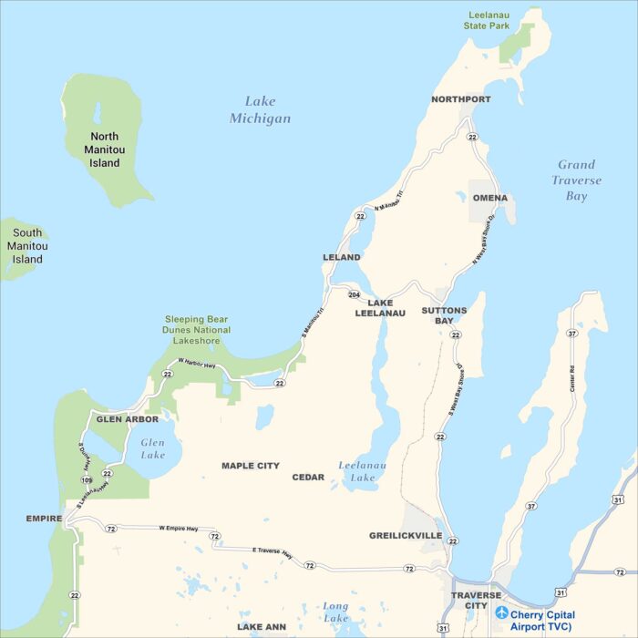
This is a detailed map of the Leelanau Peninsula in northwestern Michigan, showing towns, lakes, parks, islands, and roads.
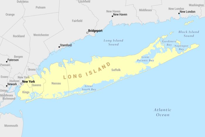
Here’s our reference map of Long Island, New York, shown in yellow. It extends eastward from New York City into the Atlantic Ocean.
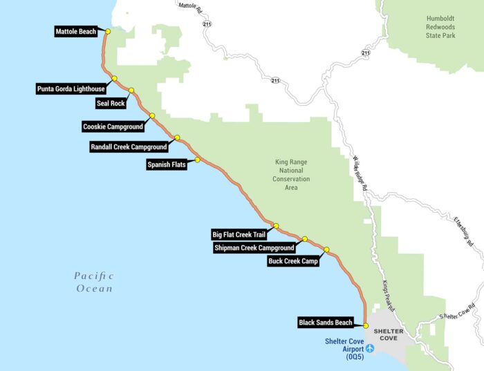
Our Lost Coast map shows the famous coastal backpacking route running along the Pacific Ocean, from Mattole Beach to Black Sands Beach.
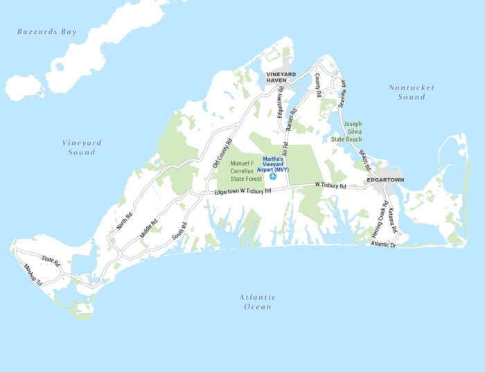
Here’s our detailed map of Martha’s Vineyard, the island off the coast of Massachusetts. It shows towns, roads, natural areas, and waterways.
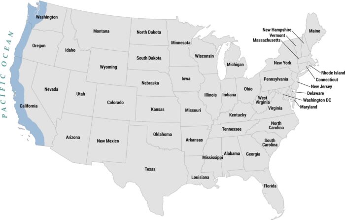
Our map highlights the Pacific Coast states shaded in blue along the western edge with the Pacific Ocean labeled to the left.
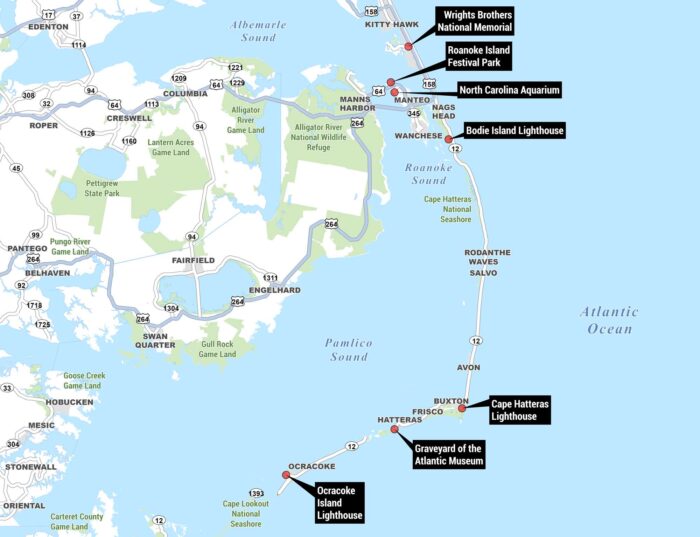
Our Outer Banks map highlights key landmarks, waterways, highways, and natural areas, with points of interest marked in black callout boxes.
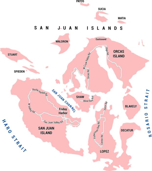
This map shows San Juan Island in Washington State with its roads, channels, and places. It’s a small place with big views of the ocean.
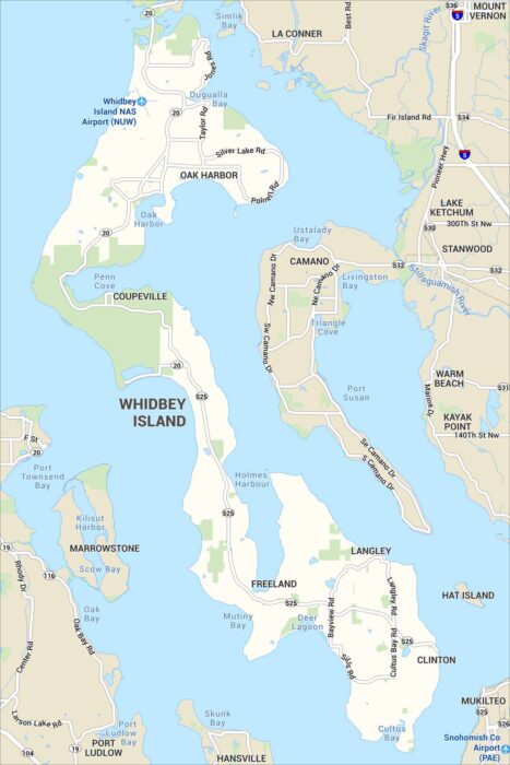
Our map of Whidbey Island shows its highways, parks and small towns. Shoreline roads run the length of the surrounding Puget Sound.