Map of Benicia, California
Benicia, California sits on the Carquinez Strait in the Bay Area. Our map highlights waterfront streets and major highways.
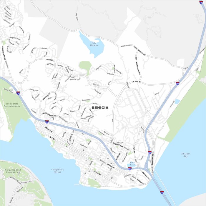
Benicia, California sits on the Carquinez Strait in the Bay Area. Our map highlights waterfront streets and major highways.
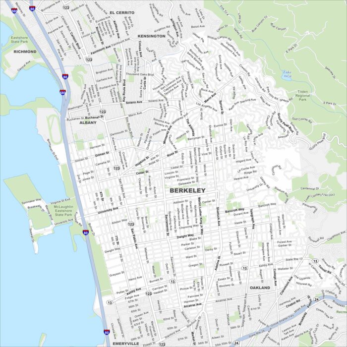
Here’s a simple map of Berkeley. Our map of Berkeley shows its streets stretching from the bay to the hills.
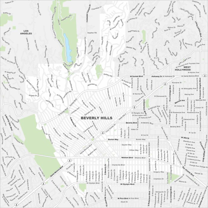
Explore Beverly Hills with our map west of Los Angeles. Palm-lined streets and landscaped neighborhoods fill the layout.
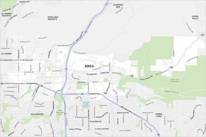
Explore Brea on our map in northern Orange County. The city is built around Chino Hills State Park with parks and trails throughout.
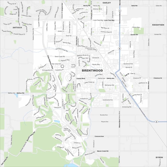
Brentwood, California is in the East Bay, surrounded by farmland. Our map shows its highways, waterways and green spaces.
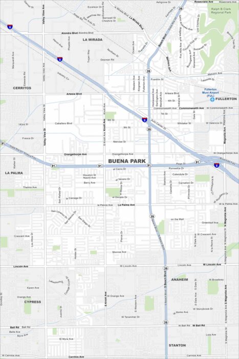
See the highways, streets, and park areas laid out here. Our map of Buena Park highlights its roads and open spaces.
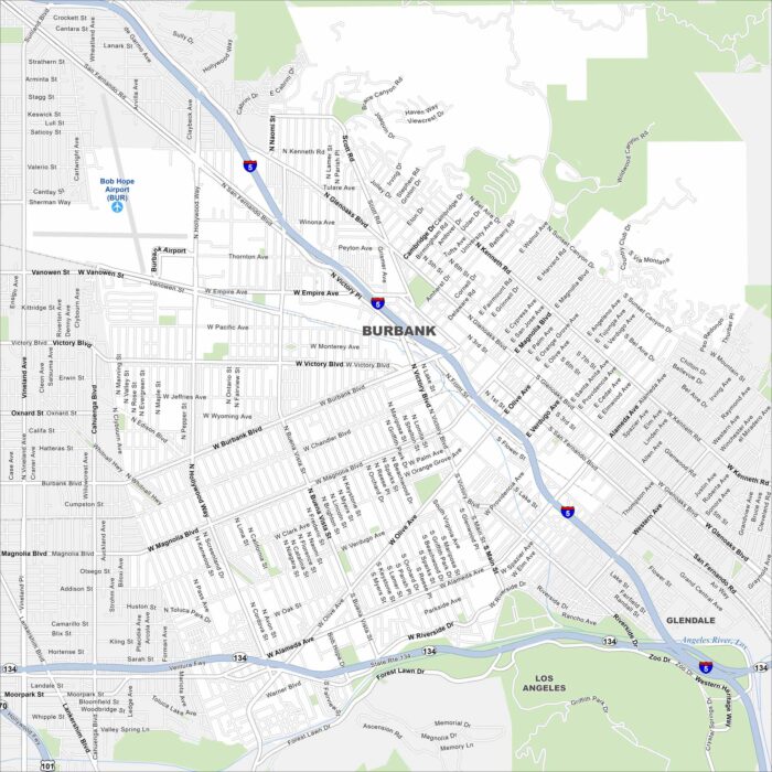
Burbank is in the San Fernando Valley, bordered by the Verdugo Mountains. Our map shows major routes and connections to nearby Los Angeles.
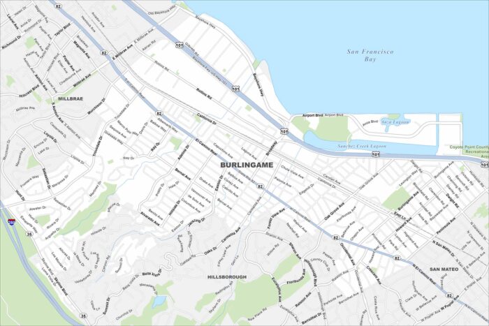
Our map of Burlingame shows its waterfront along San Francisco Bay. You’ll find highways, rivers, lakes and green spaces.
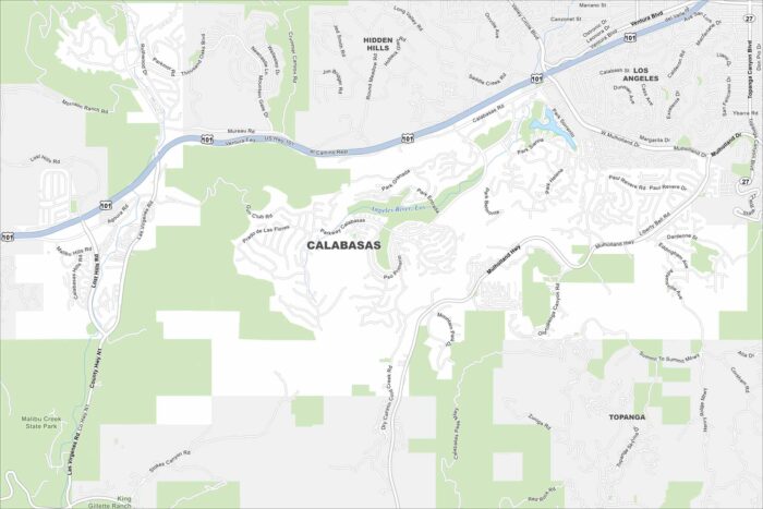
Explore Calabasas with our map, where neighborhoods wind through the Santa Monica Mountains. Roads curve instead of form grids.
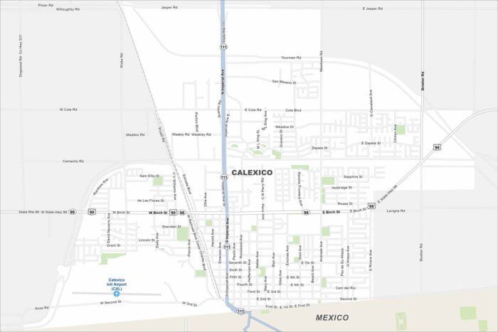
See Calexico on our map, right at the US and Mexico border. The city spreads out across the desert with a straightforward street network.
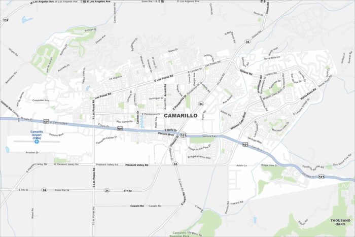
Check out Camarillo with our road map. The city sits between the Santa Monica Mountains and the Pacific Ocean.
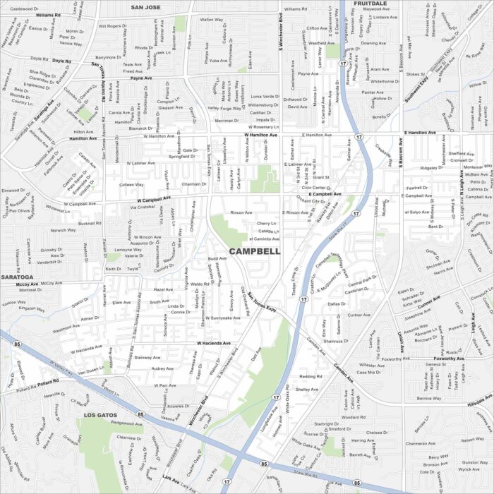
Explore Campbell with our map, a small city in Silicon Valley. It’s surrounded by San Jose but still keeps its own downtown core.
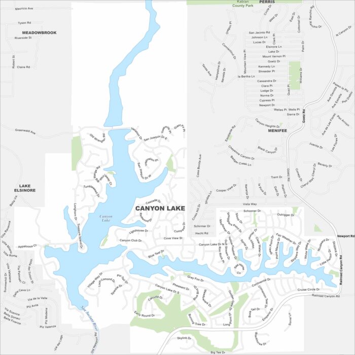
Our map of Canyon Lake highlights the gated community built around its reservoir. Roads wind around the shoreline.
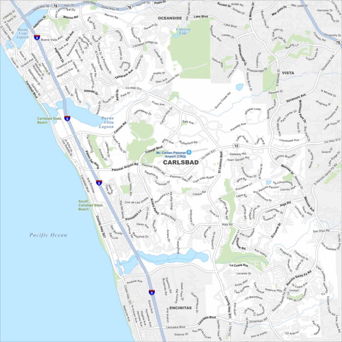
Carlsbad is a coastal city north of San Diego. Our map shows beaches, lagoons, and neighborhoods near the Pacific Ocean.
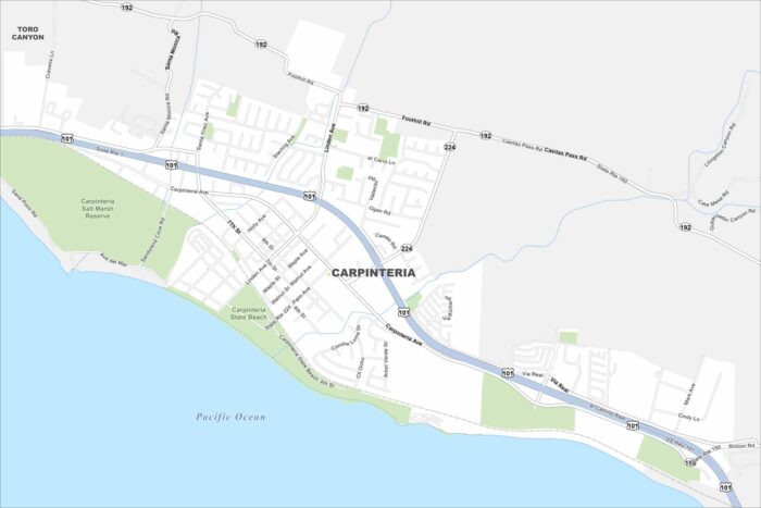
Explore Carpinteria on our map, set along the California coast. This city is small but surrounded by ocean views and foothills.