Map of Pico Rivera, California
Our map of Pico Rivera lays out a suburban grid between Los Angeles and Whittier. Freeways cut across the city, linking neighborhoods.
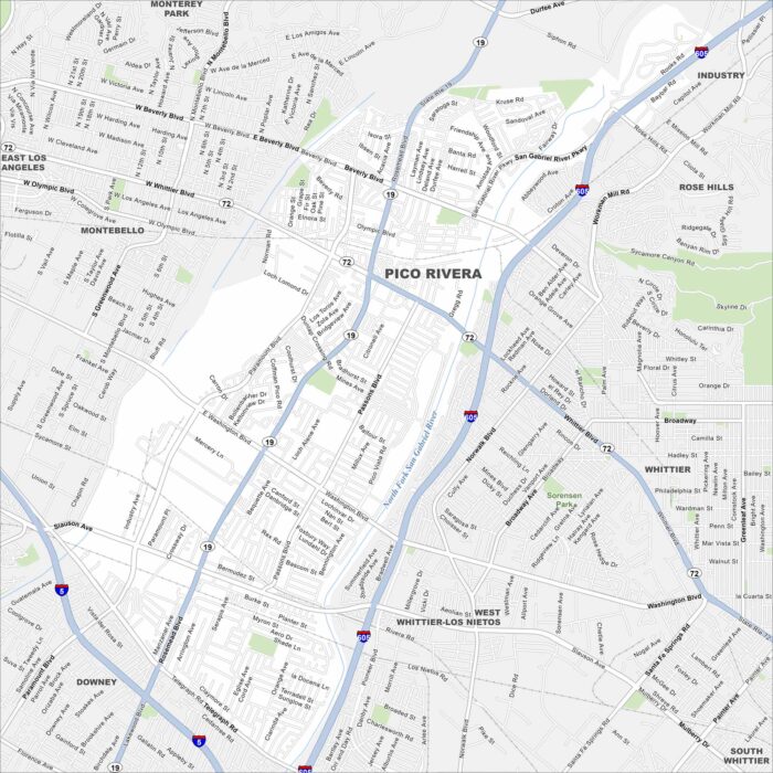
Our map of Pico Rivera lays out a suburban grid between Los Angeles and Whittier. Freeways cut across the city, linking neighborhoods.
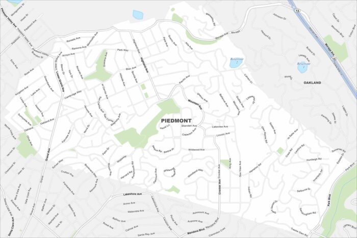
Piedmont is an enclave surrounded entirely by Oakland. Check out our map to see its residential streets in the East Bay hills.
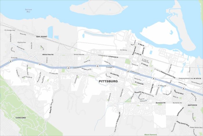
Pittsburg sits on the southern edge of Suisun Bay. Check out our map to see its waterfront, neighborhoods, and highway links.
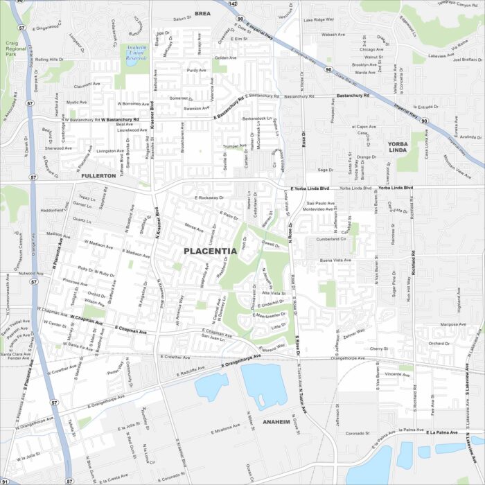
Our map of Placentia shows the suburban grid northeast of Anaheim. Residential neighborhoods dominate, with parks scattered throughout.
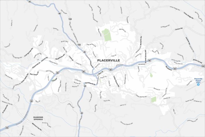
Placerville rests in the Sierra Nevada foothills, once central to the Gold Rush. Our map shows the winding streets climbing the hills.
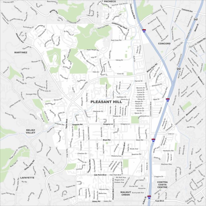
Our map of Pleasant Hill shows its suburban grid tucked between Concord and Walnut Creek. Parks and open spaces are scattered throughout.
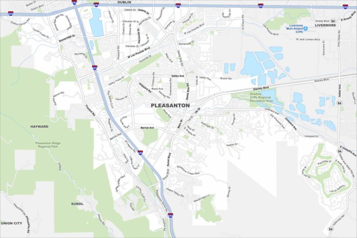
Our map highlights Pleasanton’s easy freeway access and historic downtown. The Alameda County Fairgrounds are a major local landmark.
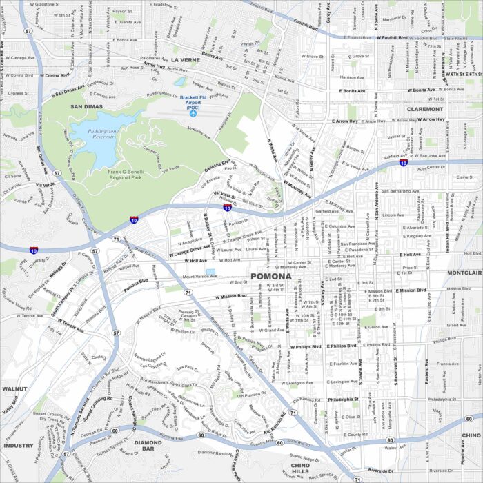
Our map of Pomona highlights a large city in the Inland Empire. Major freeways cut across it, linking neighborhoods and business districts.
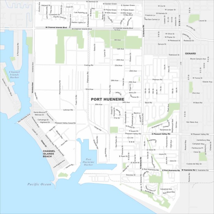
Check out Port Hueneme’s grid of streets leading straight to the Pacific coast. This map highlights its harbor and beach access.
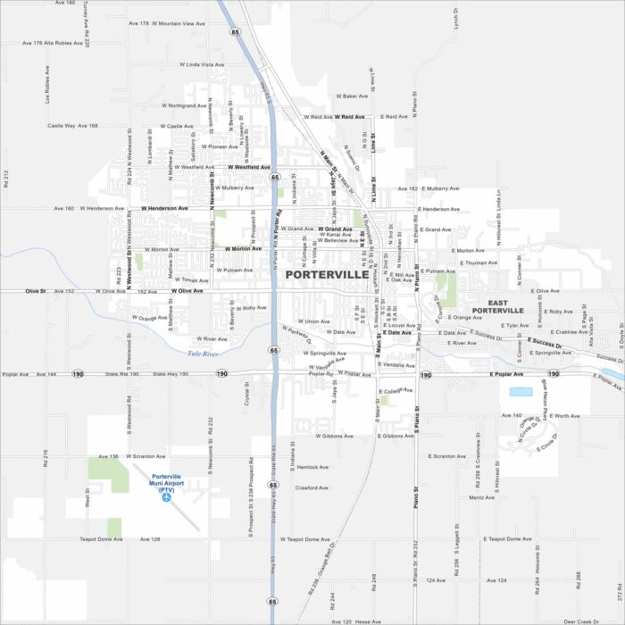
Porterville lies in the San Joaquin Valley with mountains rising to the east. Mostly farming surrounds the city.
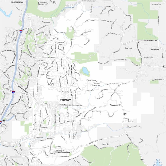
Poway lies northeast of San Diego, surrounded by hills and canyons. Reservoirs and open space are scattered throughout the city.
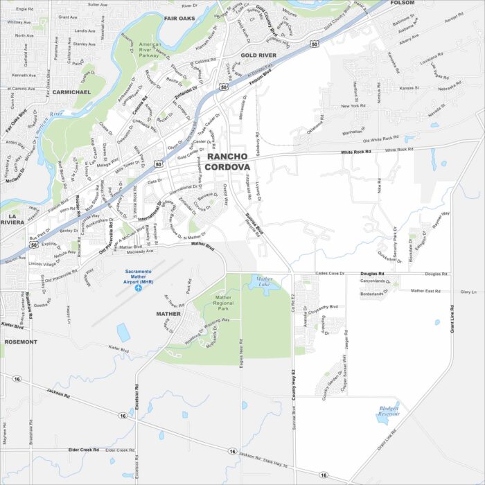
Our map of Rancho Cordova shows the business parks, neighborhoods, and main corridors. The city lies just east of Sacramento.
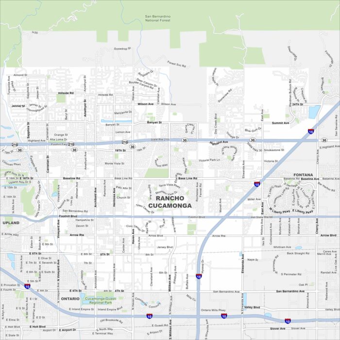
You can find Rancho Cucamonga, California at the base of the San Gabriel Mountains. Our map makes it simple to navigate its freeways.
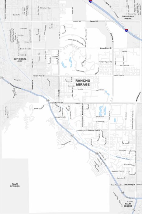
Known for golf courses and luxury resorts, Rancho Mirage sits in the Coachella Valley. Our road map helps you find your way around.
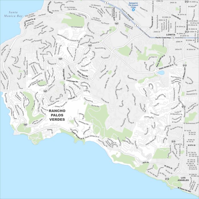
Dramatic coastal cliffs define Rancho Palos Verdes. This map lays out winding hillside roads and access to oceanfront views.