Map of Pomona, California
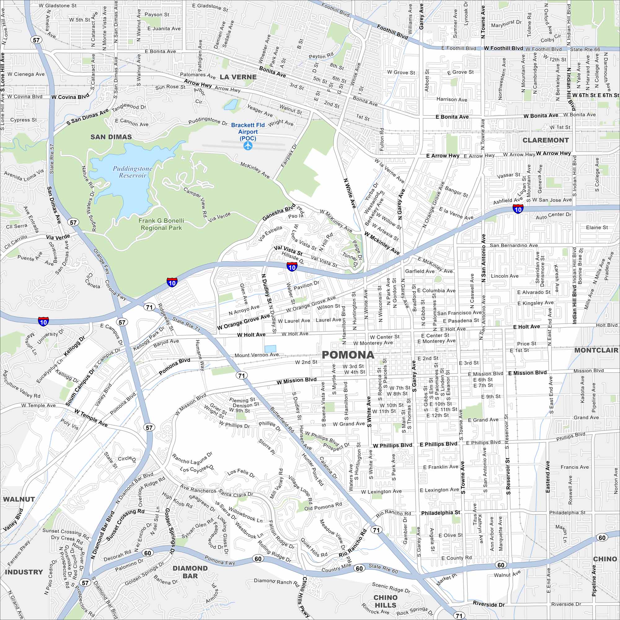
Our map of Pomona highlights a large city in the Inland Empire. Major freeways cut across it, linking neighborhoods and business districts. The Los Angeles County Fairgrounds are one of its biggest attractions.
California State Maps
Explore California with our state maps


Map Information
On the Map
Interstates/Highways: I-10, State Rte 57, State Rte 60, State Rte 66, State Rte 71 Major Roads: Holt Ave, Mission Blvd, Garey Ave, Foothill Blvd, White Ave, Phillips Blvd, Towne Ave, San Bernardino Ave, Arrow Hwy, Bonita Ave, McKinley Ave, Ganesha Blvd, Temple Ave, Diamond Bar Blvd, Rio Rancho Rd, Reservoir St, Orange Grove Ave, Dudley St, Palomares Ave, San Antonio Ave Airports: Brackett Fld Airport (POC) Lakes and Reservoirs: Puddingstone Reservoir Parks and Preserves: Frank G Bonelli Regional Park Nearby Communities: La Verne, San Dimas, Claremont, Montclair, Walnut, Diamond Bar, Chino Hills, ChinoCalifornia City Maps
Here are detailed maps of California


