Map of Pleasanton, California
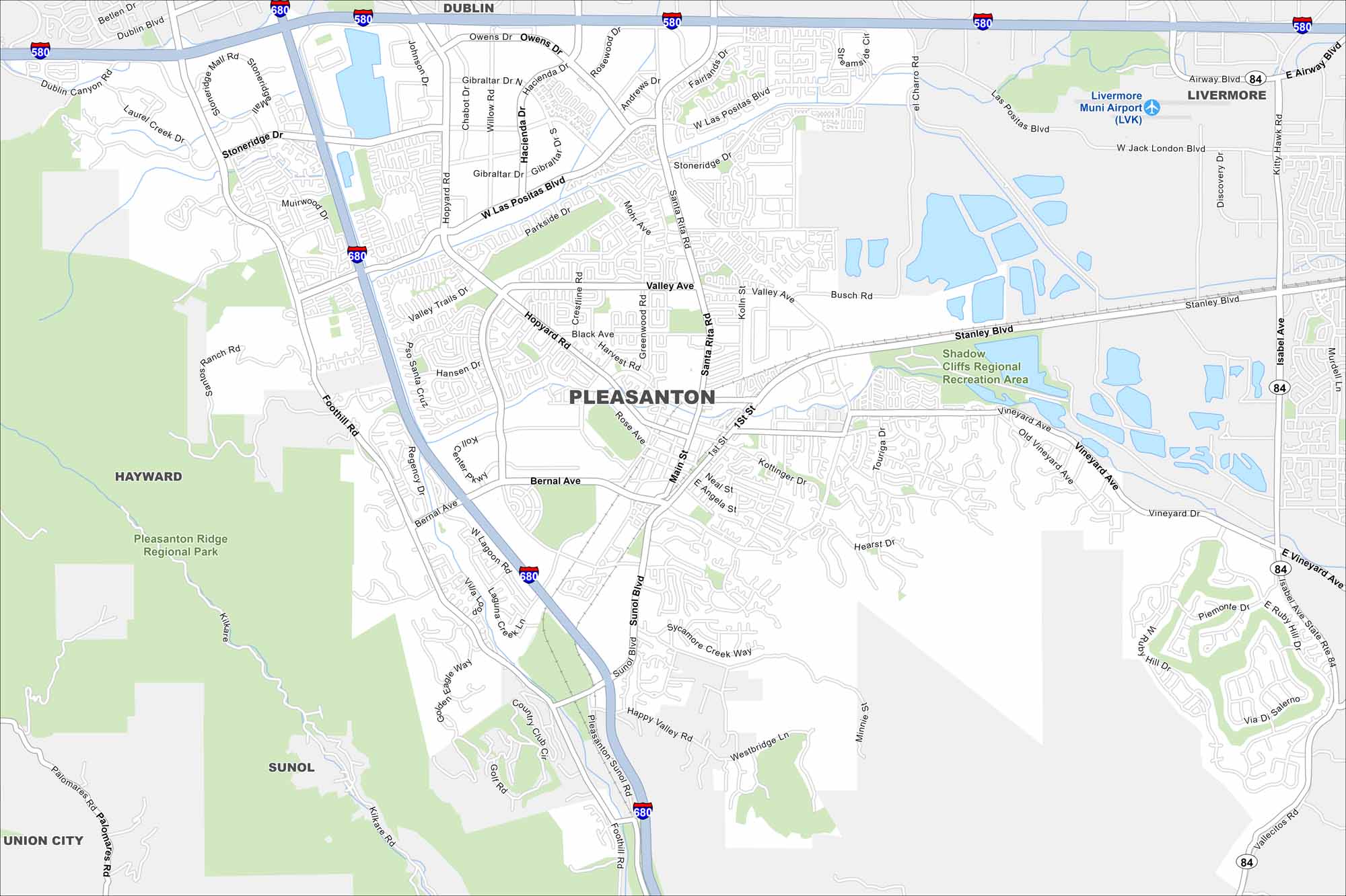
Our map highlights Pleasanton’s easy freeway access and historic downtown. The Alameda County Fairgrounds are a major local landmark found here.
California State Maps
Explore California with our state maps


Map Information
On the Map
Interstates/Highways: I-580, I-680, State Rte 84 Major Roads: Bernal Ave, Santa Rita Rd, Stanley Blvd, Valley Ave, Main St, Sunol Blvd, Hopyard Rd, Foothill Rd, Stoneridge Dr, Las Positas Blvd, Vineyard Ave, Westbridge Ln, Johnson Dr, Owens Dr, Rose Ave, Kottinger Dr, Hearst Dr, First St, Happy Valley Rd, Ruby Hill Dr Airports: Livermore Muni Airport (LVK) Parks and Preserves: Pleasanton Ridge Regional Park, Shadow Cliffs Regional Recreation Area Nearby Communities: Dublin, Livermore, Hayward, Sunol, Union CityCalifornia City Maps
Here are detailed maps of California


