Map of Fremont, California
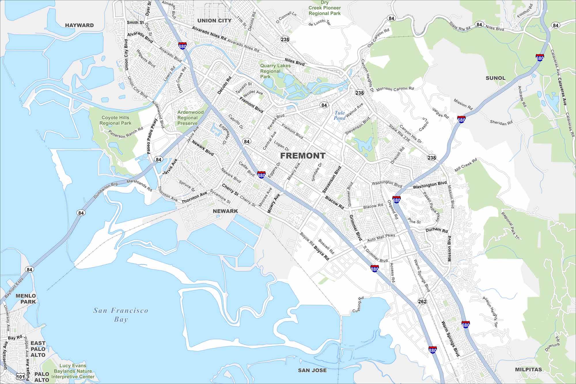
Fremont sits at the edge of the San Francisco Bay. Our map shows both I-880 and I-680, which both run through the city. What makes it stand out is its spot right next to Silicon Valley.
California State Maps
Explore California with our state maps


Map Information
On the Map
Interstates/Highways: I-880, I-680, State Rte 84, State Rte 238, State Rte 262 Major Roads: Fremont Blvd, Mission Blvd, Washington Blvd, Thornton Ave, Mowry Ave, Stevenson Blvd, Auto Mall Pkwy, Grimmer Blvd, Warm Springs Blvd, Alvarado Niles Rd, Newark Blvd, Ardenwood Blvd, Decoto Rd, Paseo Padre Pkwy, Cushing Pkwy, Boyce Rd, Blacow Rd, Central Ave, Peralta Blvd, Niles Blvd Lakes and Reservoirs: San Francisco Bay, Tule Pond Parks and Preserves: Coyote Hills Regional Park, Ardenwood Regional Preserve, Quarry Lakes Regional Park, Dry Creek Pioneer Regional Park, Regional Park Tr Nearby Communities: Hayward, Union City, Sunol, Milpitas, San Jose, Newark, East Palo Alto, Palo Alto, Menlo ParkCalifornia City Maps
Here are detailed maps of California


