Arkansas Physical Map
Our Arkansas physical map displays its shift from mountains to delta. The Ozark Plateau and Ouachita Mountains hold the north and west.
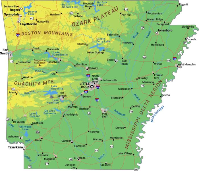
Our Arkansas physical map displays its shift from mountains to delta. The Ozark Plateau and Ouachita Mountains hold the north and west.
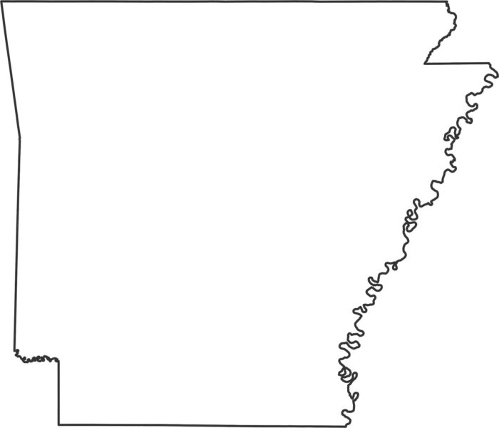
Our outline map of Arkansas shows the Mississippi River creating the entire eastern border with its winding curves.
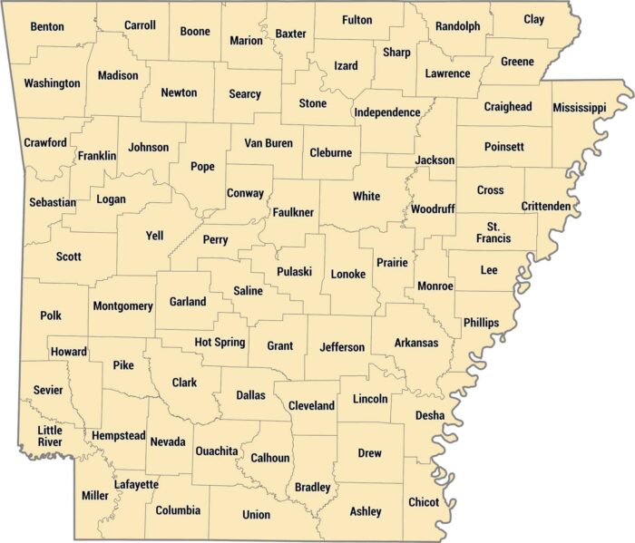
Our Arkansas county map shows all 75 counties across the state. Arkansas counties stretch from the rugged Ozarks to the flat, fertile Delta.
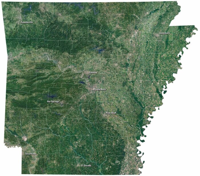
On our satellite map of Arkansas, green covers most of the state. The Ozark Mountains spread out in the north. Little Rock is near the middle.
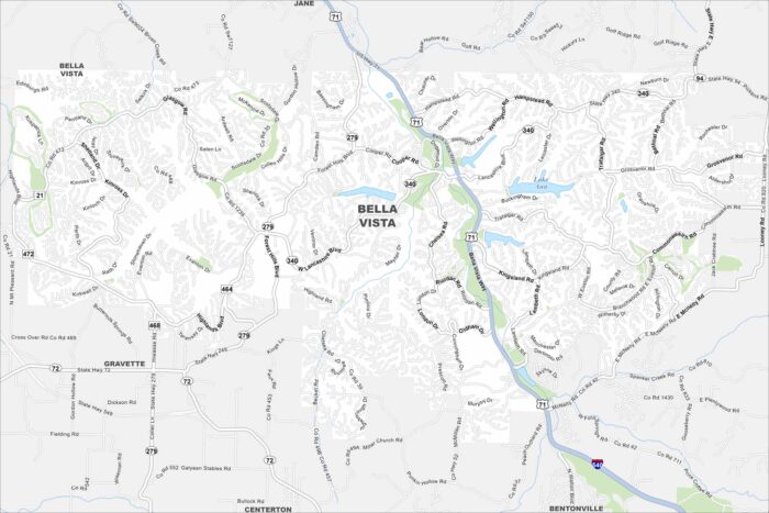
Our map of Bella Vista highlights winding roads, lakes, and wooded hills. The city sits in the Ozark region of northwest Arkansas.
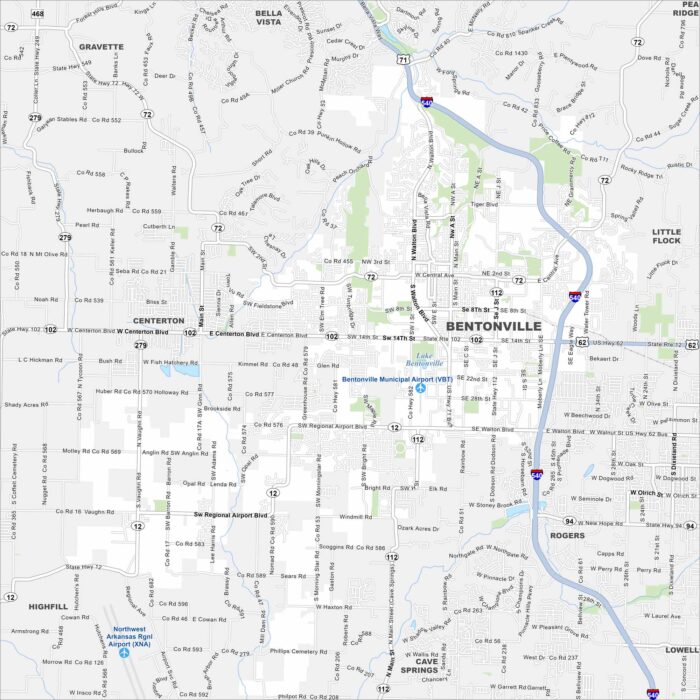
Explore Bentonville on our map in northwest Arkansas. The map includes roads, green spaces, and major highways.
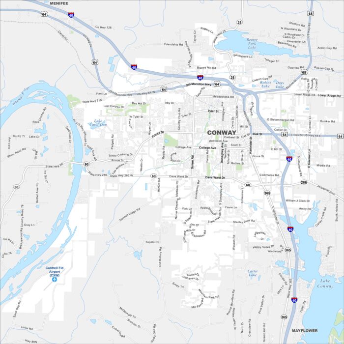
Our map of Conway highlights US-64 and its downtown streets. Just north of Little Rock, it’s called the “City of Colleges”.
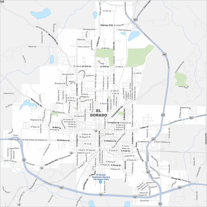
El Dorado is in southern Arkansas near the Ouachita River. Our map reveals its downtown surrounded by wooded countryside.
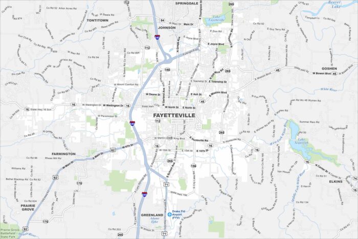
Fayetteville is in the Ozark Mountains of northwest Arkansas. Roads wind through hills and ridges across the city.
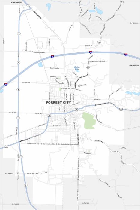
Check out our map of Forrest City in eastern Arkansas. The city lies along Crowley’s Ridge, which rises above the Delta flatlands.
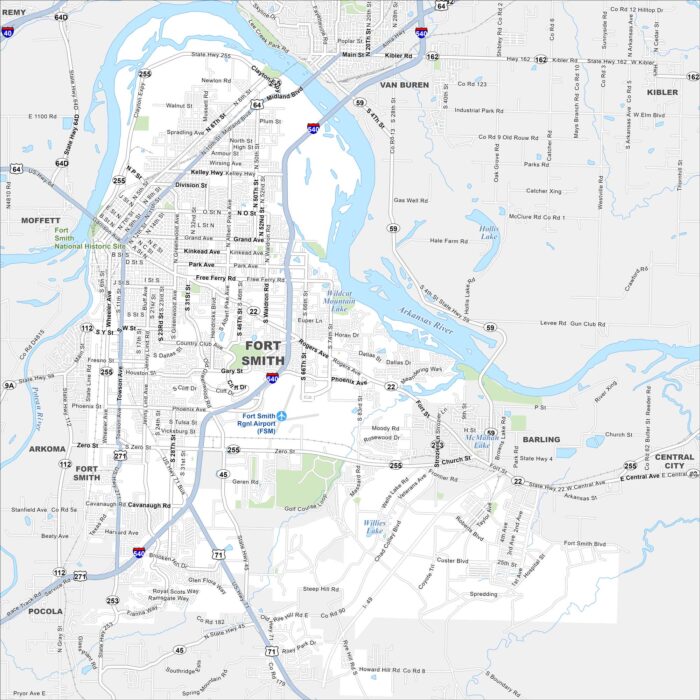
Fort Smith is on the Arkansas River, right by the Oklahoma border. Our map shows U.S. 64 and I-540, which connect the area.
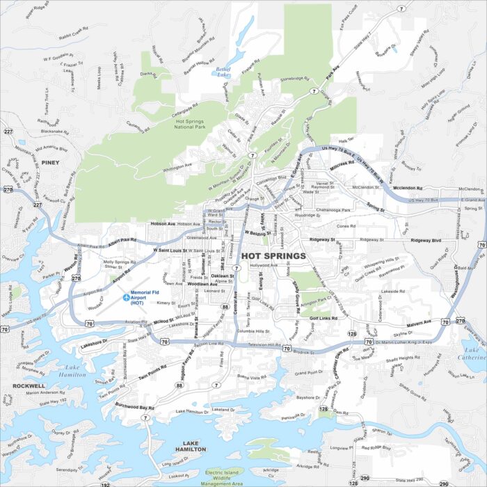
Hot Springs is situated next the Ouachita Mountains. Bathhouse Row sits near the center. Lakes and national parkland surround the city.
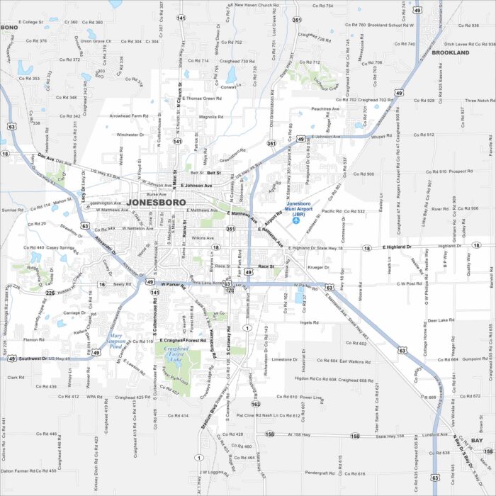
Our map of Jonesboro shows it spreading across Crowley’s Ridge. Highways extend out toward Memphis and Little Rock.
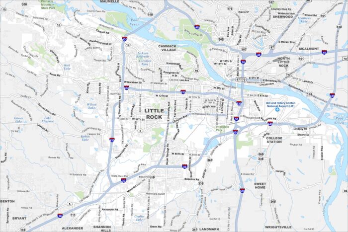
Our map of Little Rock shows the Arkansas River running through downtown. Interstates 30 and 40 cross near the city.
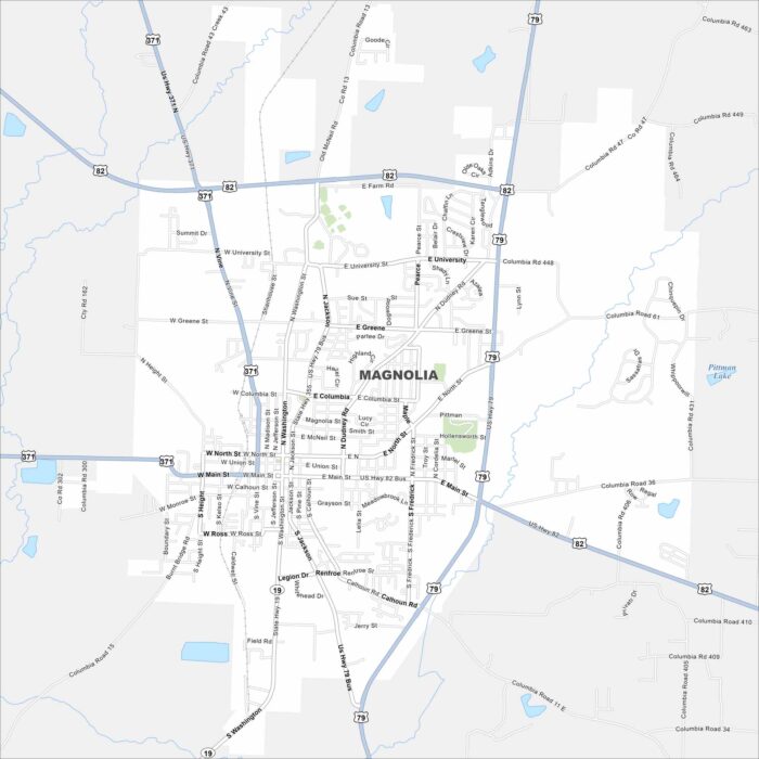
Explore Magnolia, located in southern Arkansas. Our map shows its highways that connect the town to forests and farmland.