Maryland Counties and Cities Map
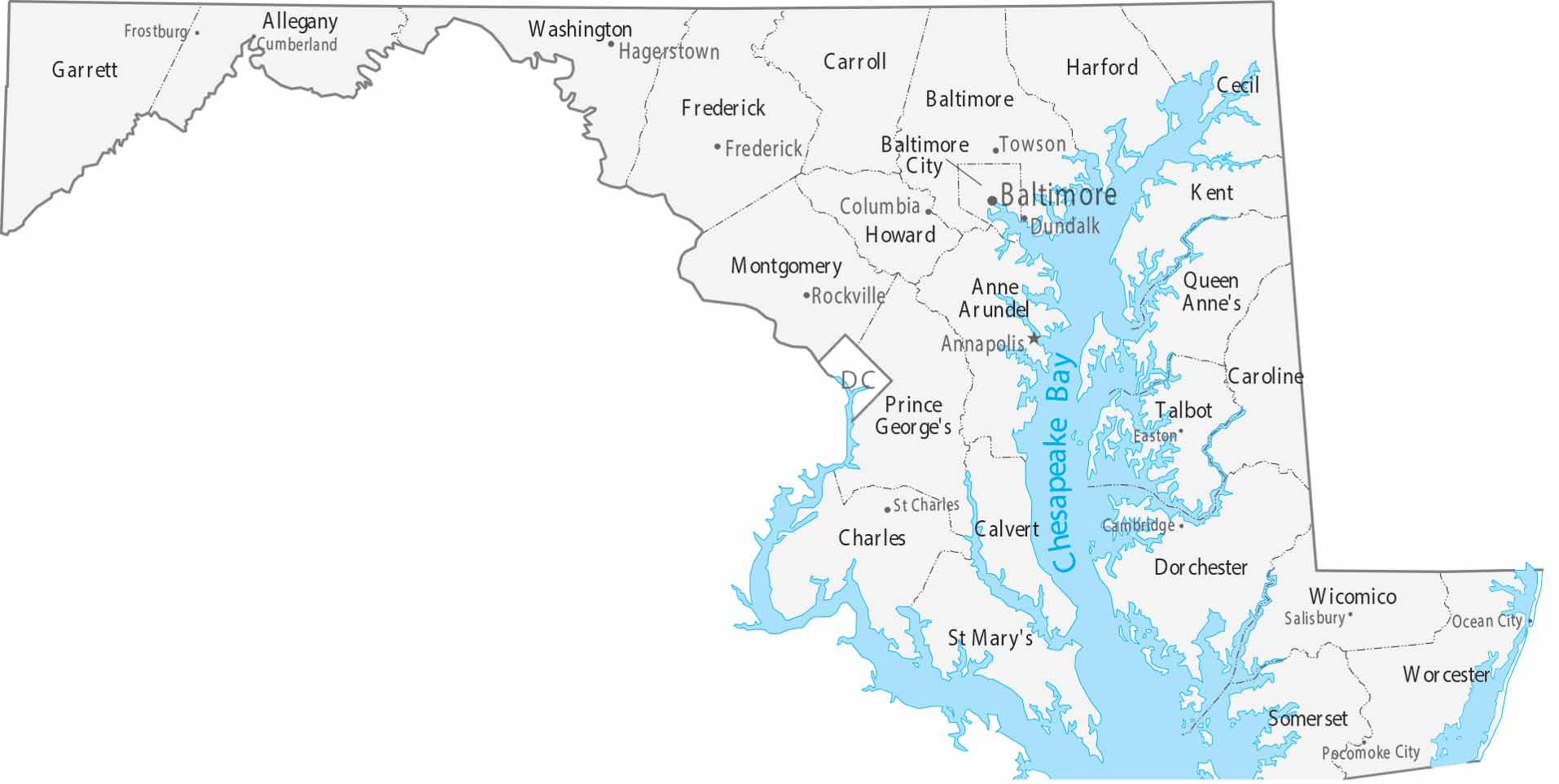
Maryland features 23 counties and the independent city of Baltimore. Our map shows Annapolis as the capital on the Chesapeake Bay. Western counties stretch wider through Appalachian terrain.
Map Information
On the Map
|
Name |
Population 2024 |
Total Area (sq mi) |
FIPS Code |
|
Allegany County |
67,097 |
427.9 |
24-001 |
|
Anne Arundel County |
602,350 |
587.8 |
24-003 |
|
Baltimore County |
852,425 |
681.7 |
24-005 |
|
Calvert County |
94,913 |
345.1 |
24-009 |
|
Caroline County |
34,248 |
325.9 |
24-011 |
|
Carroll County |
177,108 |
452.7 |
24-013 |
|
Cecil County |
106,305 |
417.8 |
24-015 |
|
Charles County |
174,478 |
642.9 |
24-017 |
|
Dorchester County |
33,138 |
983 |
24-019 |
|
Frederick County |
299,317 |
667.4 |
24-021 |
|
Garrett County |
28,393 |
657.8 |
24-023 |
|
Harford County |
265,514 |
526.7 |
24-025 |
|
Howard County |
339,668 |
253.4 |
24-027 |
|
Kent County |
19,557 |
413.4 |
24-029 |
|
Montgomery County |
1,082,273 |
506.9 |
24-031 |
|
Prince George’s County |
966,629 |
498.8 |
24-033 |
|
Queen Anne’s County |
53,688 |
510.7 |
24-035 |
|
St. Mary’s County |
116,469 |
764.2 |
24-037 |
|
Somerset County |
25,241 |
610.3 |
24-039 |
|
Talbot County |
38,244 |
476.8 |
24-041 |
|
Washington County |
157,228 |
467.3 |
24-043 |
|
Wicomico County |
106,329 |
400.2 |
24-045 |
|
Worcester County |
54,337 |
694.9 |
24-047 |
|
Baltimore City |
568,271 |
92 |
24-510 |
Counties and Cities Maps
Select any state map below to view its counties and cities map.


