SeaTac Airport Map
Our Seattle-Tacoma International Airport map shows the main terminal, Highway 518 and I-5 in Washington’s busy Puget Sound corridor.
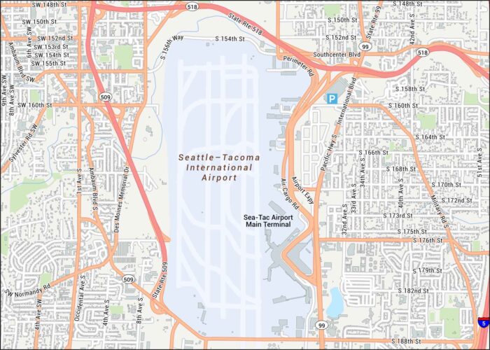
Our Seattle-Tacoma International Airport map shows the main terminal, Highway 518 and I-5 in Washington’s busy Puget Sound corridor.
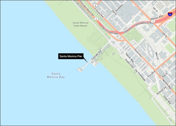
Step into Santa Monica with our street map showing the iconic pier. You’ll find Ocean Avenue and Pacific Coast Highway along the coastline.
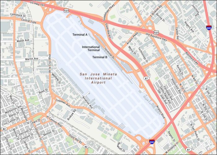
San Jose Airport serves the heart of California’s tech capital and lies just minutes from downtown. Here’s our map of this airport.
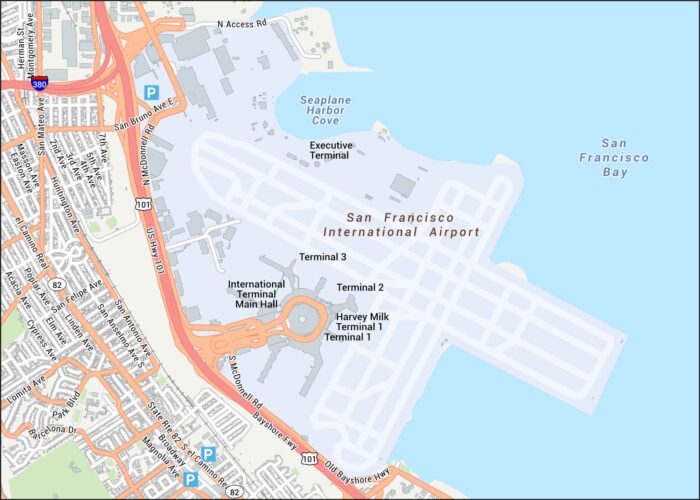
Our map of San Francisco International Airport highlights all four terminals and major access roads like Highway 101 and I-380.
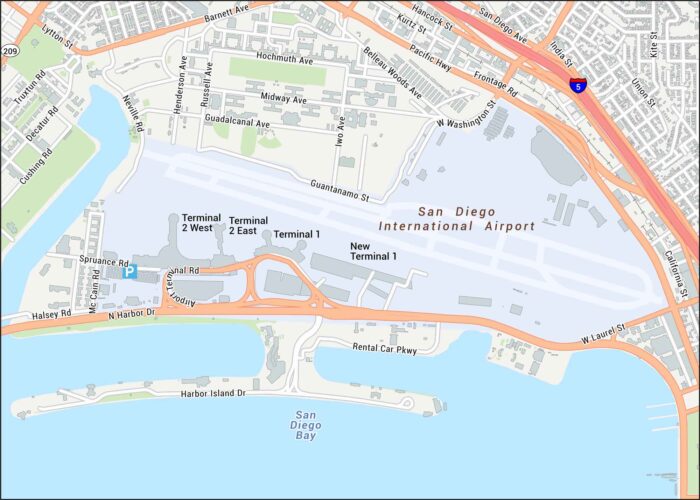
Get to know San Diego International Airport with our detailed map. It shows Terminal 1 & 2, and the connecting roadways along Harbor Drive.
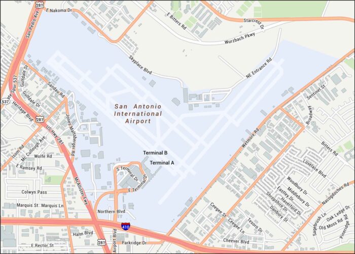
See the streets close to San Antonio Airport. Our map shows terminals, runways, and the nearby interchanges.
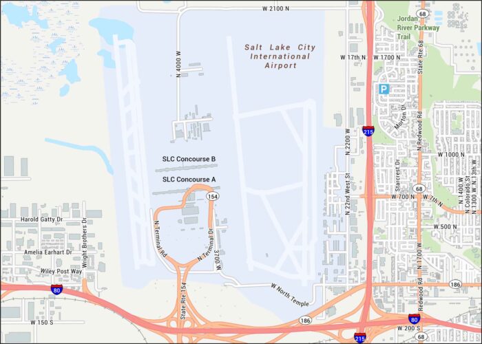
Our map of Salt Lake City Airport shows runways, terminals, and concourses. The airport sits near the Great Salt Lake.
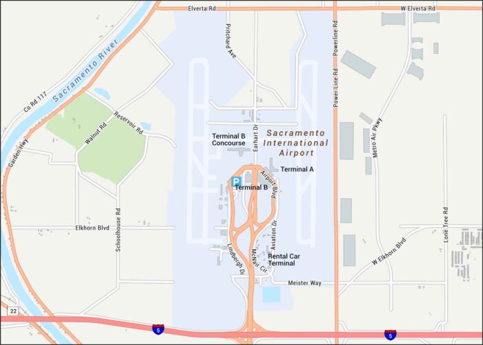
Find your bearings in Sacramento Airport with its terminal and highways. Our map shows its location near the Sacramento River.
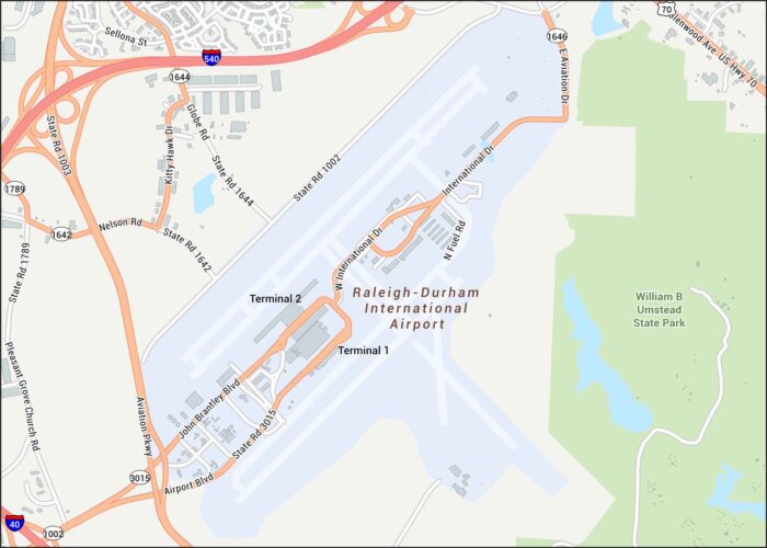
Check out RDU Airport with its two major runways, terminal loops, and the highway connectors that tie Raleigh and Durham together.
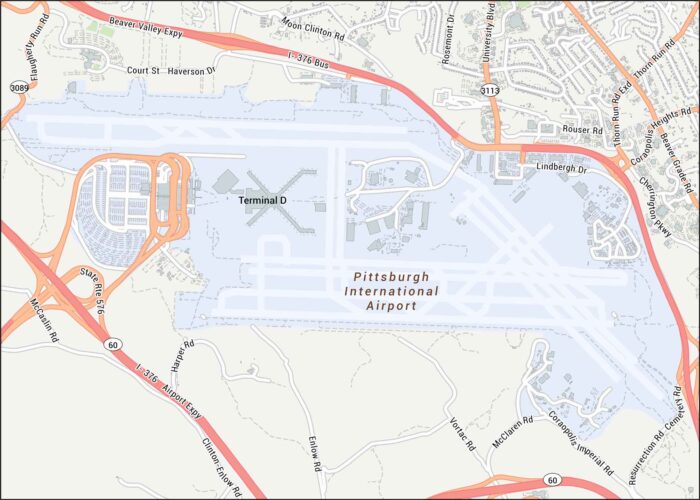
Pittsburgh Airport is shown with its runways and terminals. Our map highlights each primary highways like Airport Parkway.
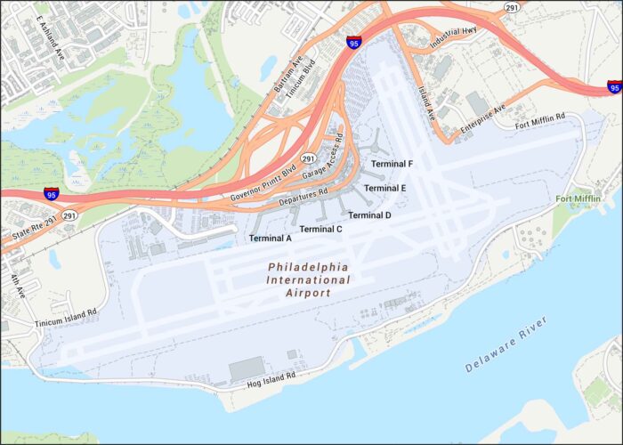
Here’s our map of Philadelphia International Airport showing terminals, runways, and the highways wrapping around the complex.
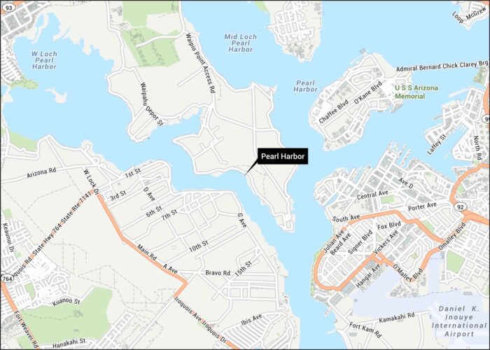
Here’s our map of Pearl Harbor showing harbor basins and surrounding roads. We’ve mapped the key routes that run along the shoreline.
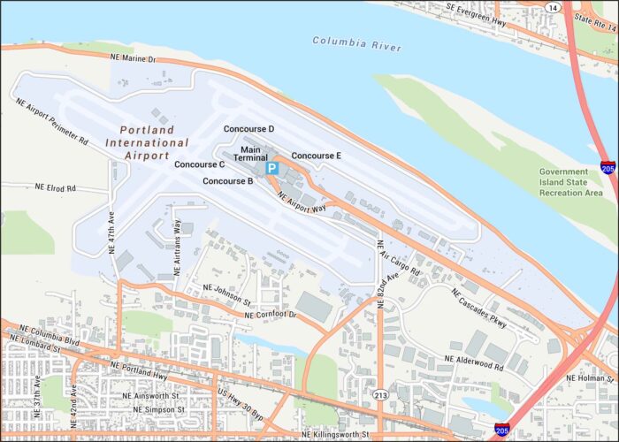
Take a look at PDX with its terminals, runways, and roads leading toward the Columbia River. We’ve mapped out all nearby highways and roads.
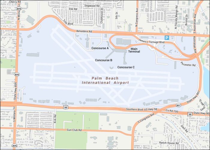
Palm Beach International Airport is laid out here with its runways, terminal loop, and nearby highways. Our road map keeps things simple.
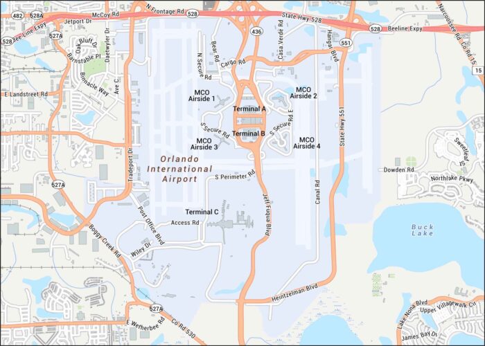
Our map of Orlando International Airport shows terminals, runways, and the main roads curling through the complex.