San Jose Airport Map
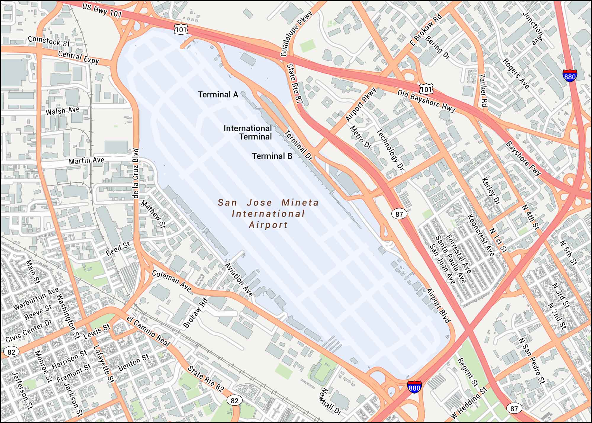
San Jose Airport serves the heart of California’s tech capital and lies just minutes from downtown. Here’s our map of this airport with both terminals, runways and connecting roads.
Map Information
On the Map
Interstates/Highways: I-880, US Hwy 101, State Rte 87, State Rte 82 Major Roads: Airport Blvd, Guadalupe Pkwy, Coleman Ave, El Camino Real, De la Cruz Blvd, Central Expy, Technology Dr, Metro Dr, Airport Pkwy, Bayshore Fwy, Old Bayshore Hwy, Brokaw Rd, Martin Ave, Mathew St, Reed St, Aviation Ave, Newhall Dr, Hedding St, 1st St, 4th St Other Landmarks: Terminal A, Terminal B, International TerminalTourist Maps in California
Discover all the prime locations with our tourist maps.