Sacramento Airport Map
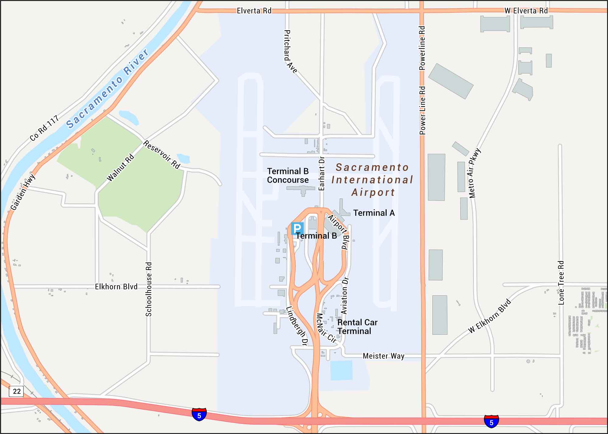
Find your bearings in Sacramento Airport with its terminal buildings and highways nearby. Our map shows its location in the north part of the city. It sits across flat farmland and the Sacramento River basin.
Map Information
On the Map
Interstates/Highways: I-5 Major Roads: Airport Blvd, Elkhorn Blvd, Elverta Rd, Garden Hwy, Power Line Rd, Metro Air Pkwy, Lone Tree Rd, Aviation Dr, Lindbergh Dr, Earhart Dr, McNair Cir, Meister Way, Schoolhouse Rd, Walnut Rd, Reservoir Rd, Pritchard Ave Rivers/Lakes: Sacramento River Other Landmarks: Terminal A, Terminal B, Terminal B Concourse, Rental Car TerminalTourist Maps in California
Discover all the prime locations with our tourist maps.