Biscayne National Park Map
Biscayne sits off the coast of Miami with reefs, keys, and mangroves. Our Biscayne National Park map shows boat launches, marines and more.
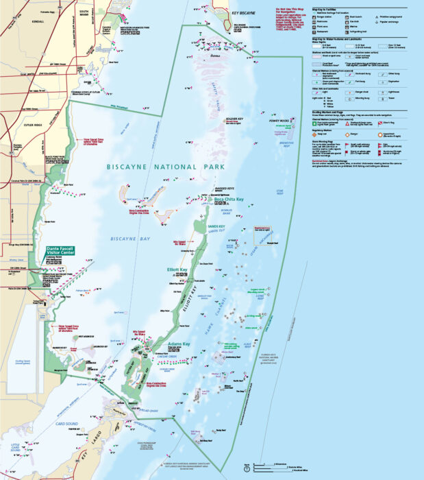
Biscayne sits off the coast of Miami with reefs, keys, and mangroves. Our Biscayne National Park map shows boat launches, marines and more.
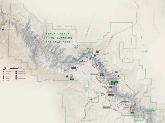
In western Colorado, the Gunnison River carves a narrow, dark canyon. This is the location of Black Canyon of the Gunnison National Park.
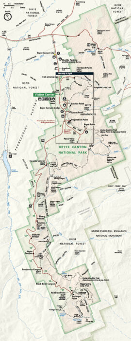
Brace yourself for a skyline of hoodoos. Our map of Bryce Canyon National Park includes viewpoints, roads, and trails.
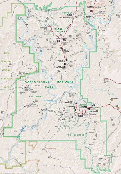
Canyonlands spreads across southeastern Utah. Our Canyonlands National Park map shows roads, overlooks, trails, routes and geographic features.
Capitol Reef National Park cuts across central Utah with canyons, domes, and orchards. Our map outlines roads, trailheads, and scenic drives.
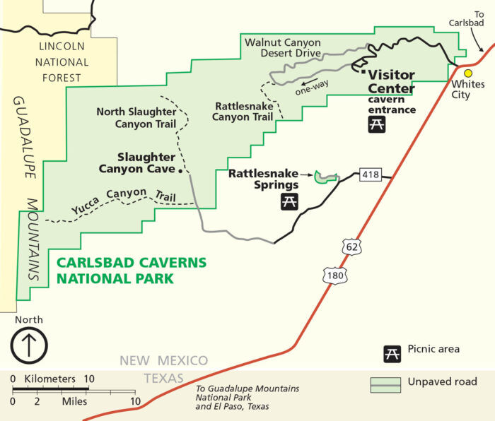
Everything begins underground at this national park. Our map of Carlsbad Caverns National Park highlights canyon trails, roads, major routes.
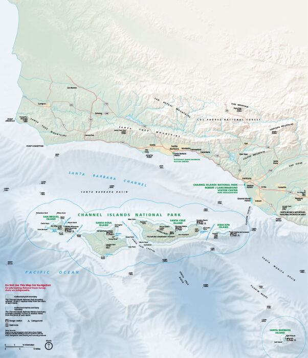
Our map of Channel Islands National Park features everything from ranger stations to campgrounds and restrooms.
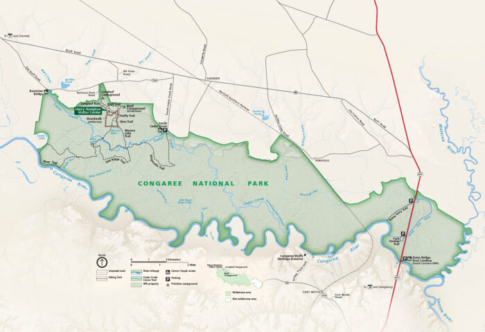
In central South Carolina, Congaree protects massive hardwoods and its floodplains. Our map shows everything from trails to roads and parking.
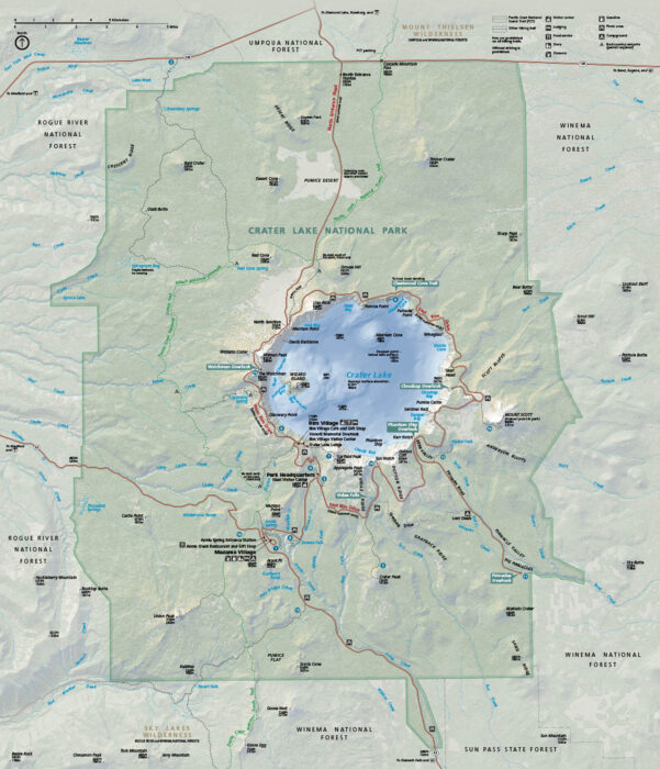
Stare straight into a caldera filled with the bluest water you’ll ever see. Crater Lake sits in southern Oregon, shaped by a volcano collapse.
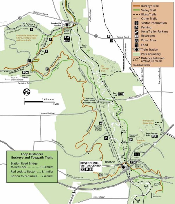
Our map of Cuyahoga Valley National Park sets the scene clearly. It’s split into two maps with Station Road to Boston and Boston to Everett.
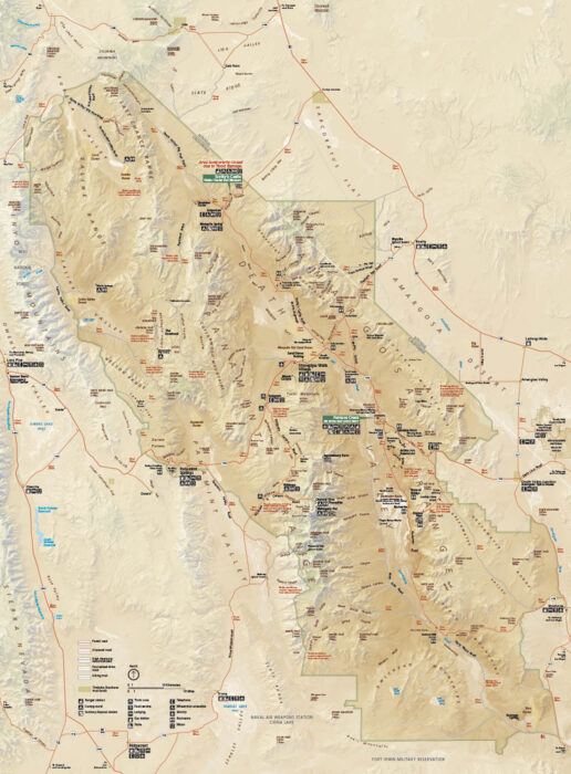
Heat defines this vast desert. In fact, summer temperatures here regularly exceed 120°F. This makes it one of the hottest places on Earth.
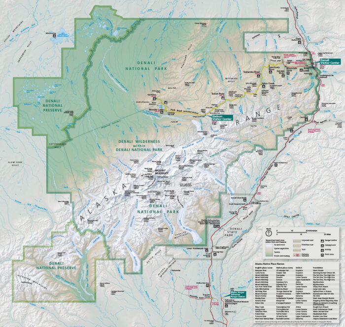
In central Alaska, Denali rises over everything. Our park map shows the roads, trails, campgrounds, overlooks, and mountain glaciers.
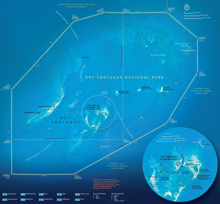
Dry Tortugas feels like a world offshore. Located west of Key West, it’s known for Fort Jefferson, coral reefs, and bright turquoise water.
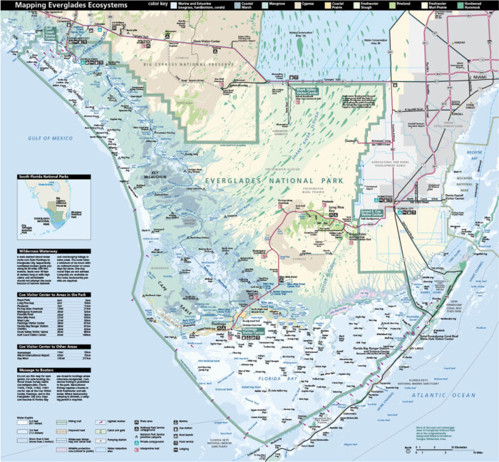
In southern Florida, you can find Everglades National Park with its coastal environment. Our park map shows roads, picnic areas and ecosystems.
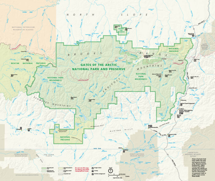
Set entirely above the Arctic Circle in northern Alaska, our national park map marks rivers, lakes, routes, and the continental divide.