Indiana National Parks and Forests Map
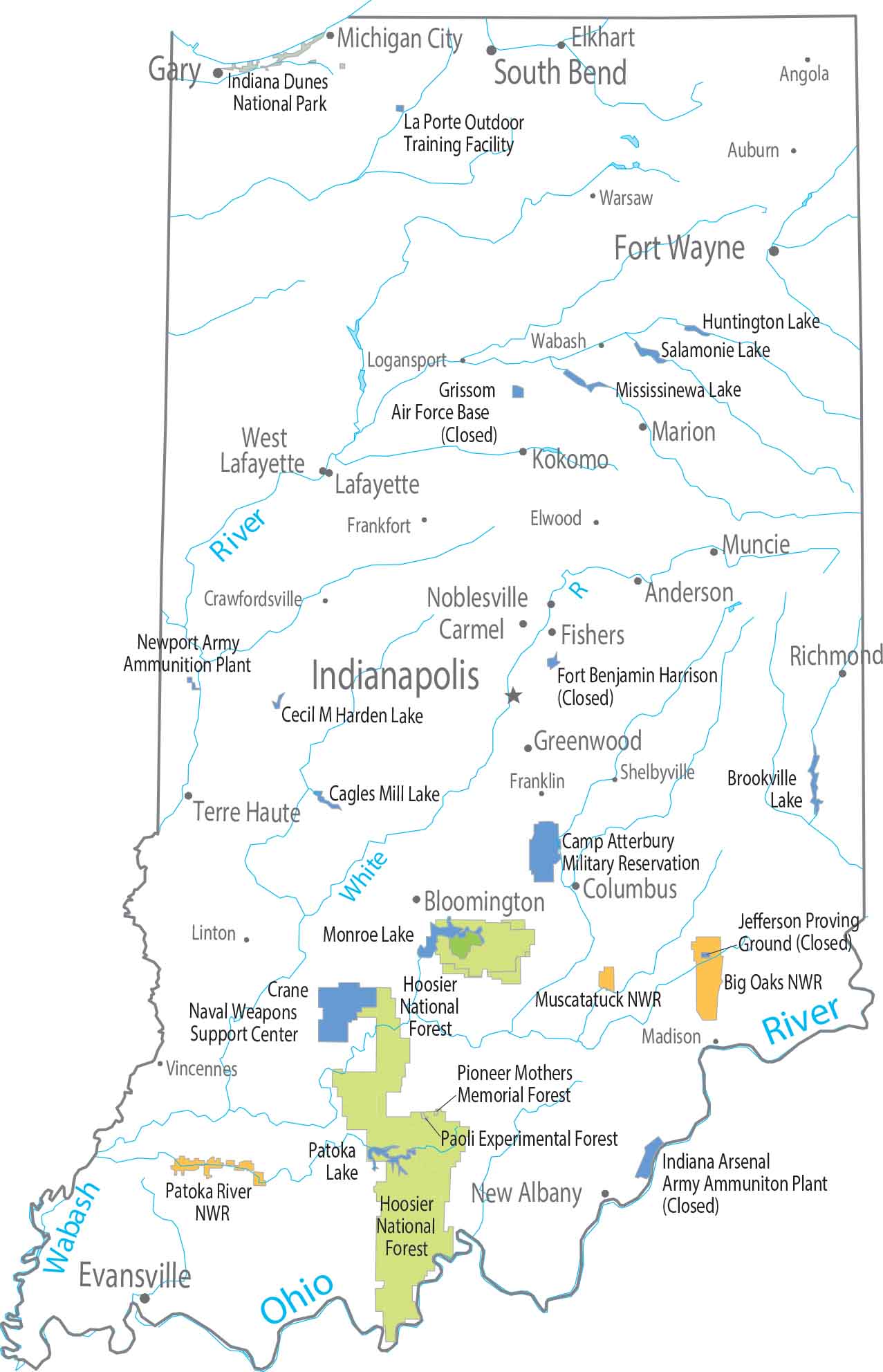
Flat farmland takes over most of Indiana. The south looks completely different from the north with forests bunching up in the hillier terrain. Our map shows Hoosier National Forest standing out clearly as its main national forest.
Map Information
On the Map
Parks, Forests and Federal Lands
National Parks: Indiana Dunes NP National Forests: Hoosier National Forest, Paoli Experimental Forest, Pioneer Mothers Memorial Forest National Wildlife Refuges: Big Oaks NWR, Muscatatuck NWR, Patoka River NWR Army, Naval and Military: Camp Atterbury Military Reservation, Crane Naval Weapons Support Center, La Porte Outdoor Training Facility, Newport Army Ammunition PlantLand Information
State Capital: Indianapolis Major Cities: Evansville, Fort Wayne, South Bend Cities and Towns: Anderson, Angola, Auburn, Bloomington, Carmel, Columbus, Crawfordsville, Elkhart, Elwood, Frankfort, Franklin, Gary, Greenwood, Hammond, Kokomo, Lafayette, Linton, Logansport, Madison, Marion, Michigan City, Muncie, New Albany, Noblesville, Richmond, Shelbyville, Terre Haute, Vincennes, Wabash, Warsaw, West Lafayette Lakes and Reservoirs: Brookville Lake, Cagles Mill Lake, Cecil M Harden Lake, Huntington Lake, Mississinewa Lake, Patoka Lake, Salamonie Lake Rivers and Streams: Ohio River, Wabash River, White RiverIndiana State Maps
Study about Indiana with our map collection


