Satellite Map of Rhode Island
Rhode Island may be small, but it’s packed with character. Providence sits along Narragansett Bay. But Newport is on Aquidneck Island.
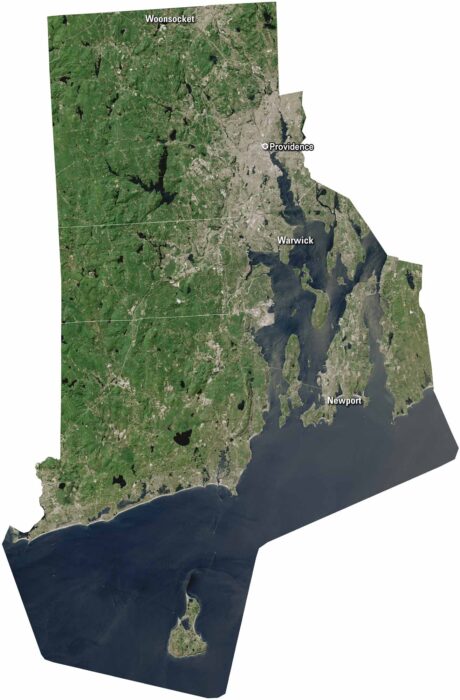
Rhode Island may be small, but it’s packed with character. Providence sits along Narragansett Bay. But Newport is on Aquidneck Island.
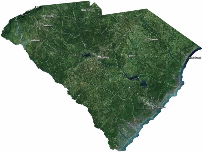
South Carolina blends coast, countryside, and history. See it on our satellite map, that includes Charleston, Myrtle Beach and Columbia.
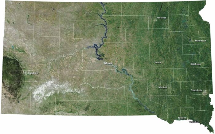
South Dakota stretches wide with rolling plains and rugged Badlands. Sioux Falls and Rapid City anchor the eastern and western sides.
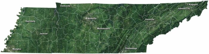
Tennessee rolls from the Smoky Mountains to the Mississippi River. Our satellite map of Tennessee shows cities like Nashville and Memphis.
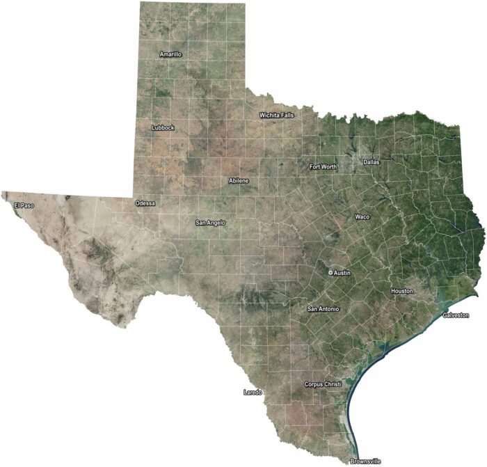
Texas stretches from desert plains to piney woods. Houston and Dallas buzz with energy. Austin keeps its own rhythm with music and culture.
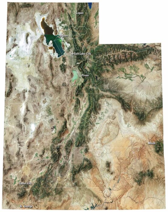
From national parks to quiet valleys, our Utah satellite map shows every corner of this state. It includes Salt Lake City and Wasatch Range.
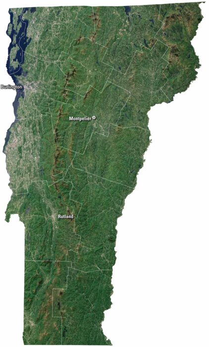
Vermont has green mountains and a landscape that feel timeless. Our satellite map of Vermont shows Burlington, which sits on Lake Champlain.
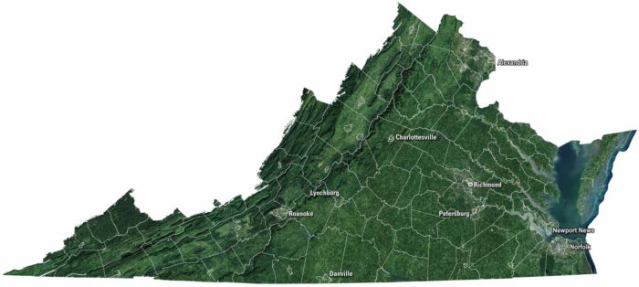
Rolling hills meet long stretches of Atlantic shoreline in Virginia. Our Virginia satellite map displays Richmond, Norfolk, and Roanoke.
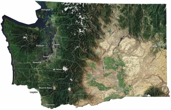
Our Washington satellite map shows it both wild and full of life. Islands and bays shape the Puget Sound, while green forests blanket the land.
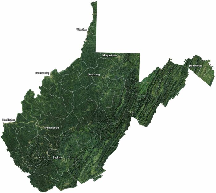
Mountains fill most of the view on our satellite map of West Virginia. Forests spread across the hills, broken by winding valleys.
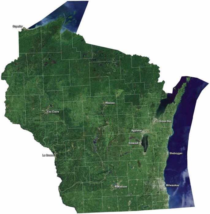
Wisconsin’s satellite map shows green farmland and rolling hills. The Great Lakes shine along the state’s edges including Lake Michigan.
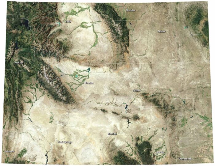
Wyoming’s satellite map is full of open land and rugged scenery. Yellowstone’s lakes stand out along with cities like Cheyenne and Casper.
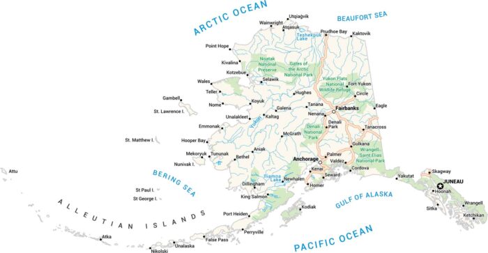
Here’s Alaska. It’s big, wild, and wide open. Our Alaska map lays it all out. Picture the mountains, ice, towns, and endless water.
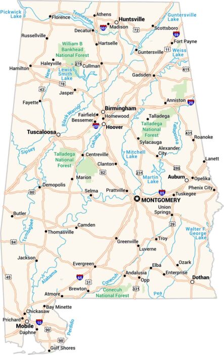
Our map of Alabama contains towns, cities, rivers, and lakes. The Tennessee flows across the top, and the Gulf occupies the bottom.
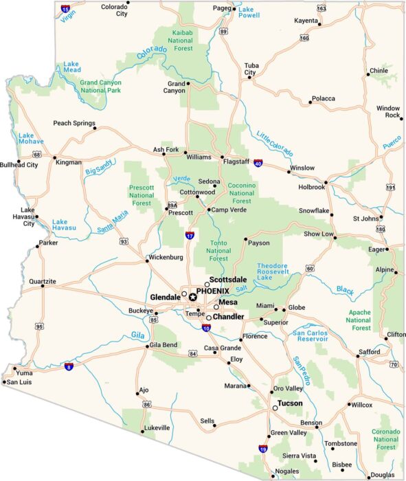
Here’s our map of Arizona. Rivers cut through dry land here, and the Grand Canyon is in the north. You’ll find Phoenix, Tucson and Flagstaff.