Canadian River Map
Don’t look north to Canada for the Canadian River. Our map shows the one that spans New Mexico, Texas and Oklahoma.
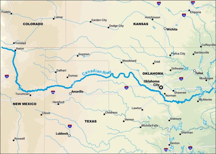
Don’t look north to Canada for the Canadian River. Our map shows the one that spans New Mexico, Texas and Oklahoma.
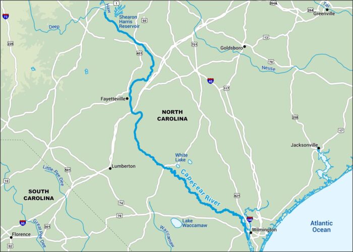
Have no fear. Because our map of the Cape Fear River is here. Start inland and follow the Cape Fear east until the salt hits the air.
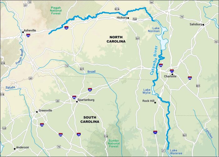
Here’s the Catawba River. It’s steady, working, and alive. It feeds lakes and threads through Carolina towns that grew up on its banks.
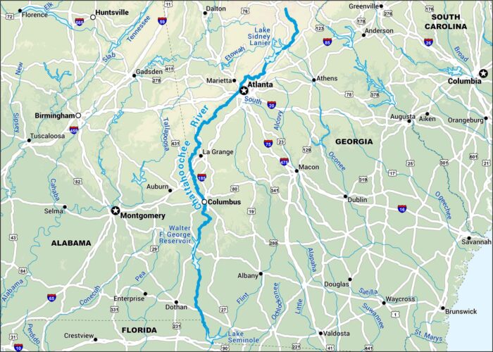
From the Blue Ridge down through Atlanta, the Chattahoochee winds through it all. The map lays down the ground rules. Half wild, half urban.

Go chase the rapids. The Chattooga River roars through wild Georgia-South Carolina country. This map leads you where the wilderness still wins.

Get to know Clearwater River, which truly lives up to its name. Our map lays out the route, where the river joins the Snake River.

The Colorado River winds through canyons and deserts. Our map shows its path in the iconic stretch of the American West.
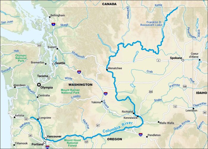
The Columbia River starts in the Canadian Rockies and carves through Washington and Oregon. Eventually, it reaches the Pacific Ocean.

New England’s longest river runs from northern New Hampshire to Long Island Sound. Our map shows this lengthy river with cities and roads.

Our map of the Coosa River outlines its broad bends, from Wetumpka to Gadsden. The Coosa River runs across Alabama’s rolling hills.
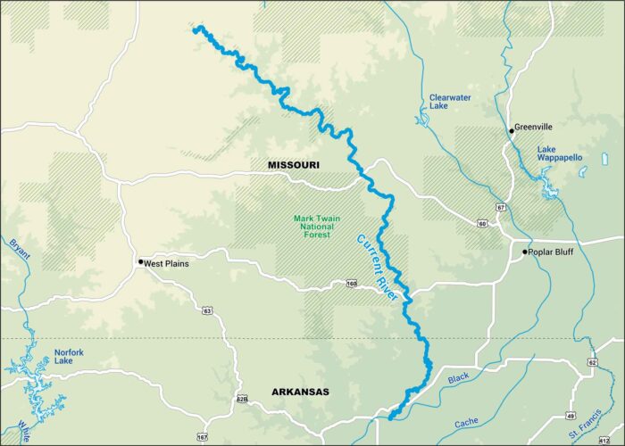
Our Current River map follows it through national forests and quiet river towns. It flows through southern Missouri and the Ozarks.

The Cuyahoga River curves through northeast Ohio through Cleveland before meeting Lake Erie. Get to know this river better using our map.
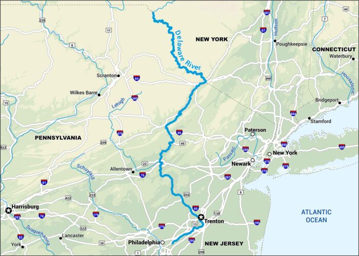
The Delaware River forms the boundary between Pennsylvania and New Jersey before flowing to the Atlantic. Our map highlights its route.
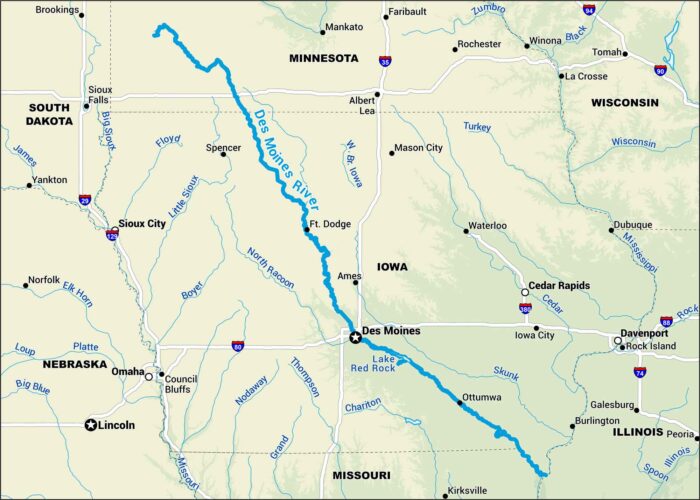
Running from southern Minnesota through Iowa, the Des Moines River winds past farms and the capital city itself. Our map lays out its course.
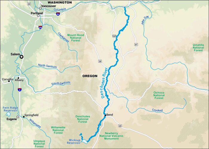
The Deschutes River flows through central Oregon. Our map shows every twist along this legendary stretch of the Pacific Northwest.