Map of Chattanooga, Tennessee
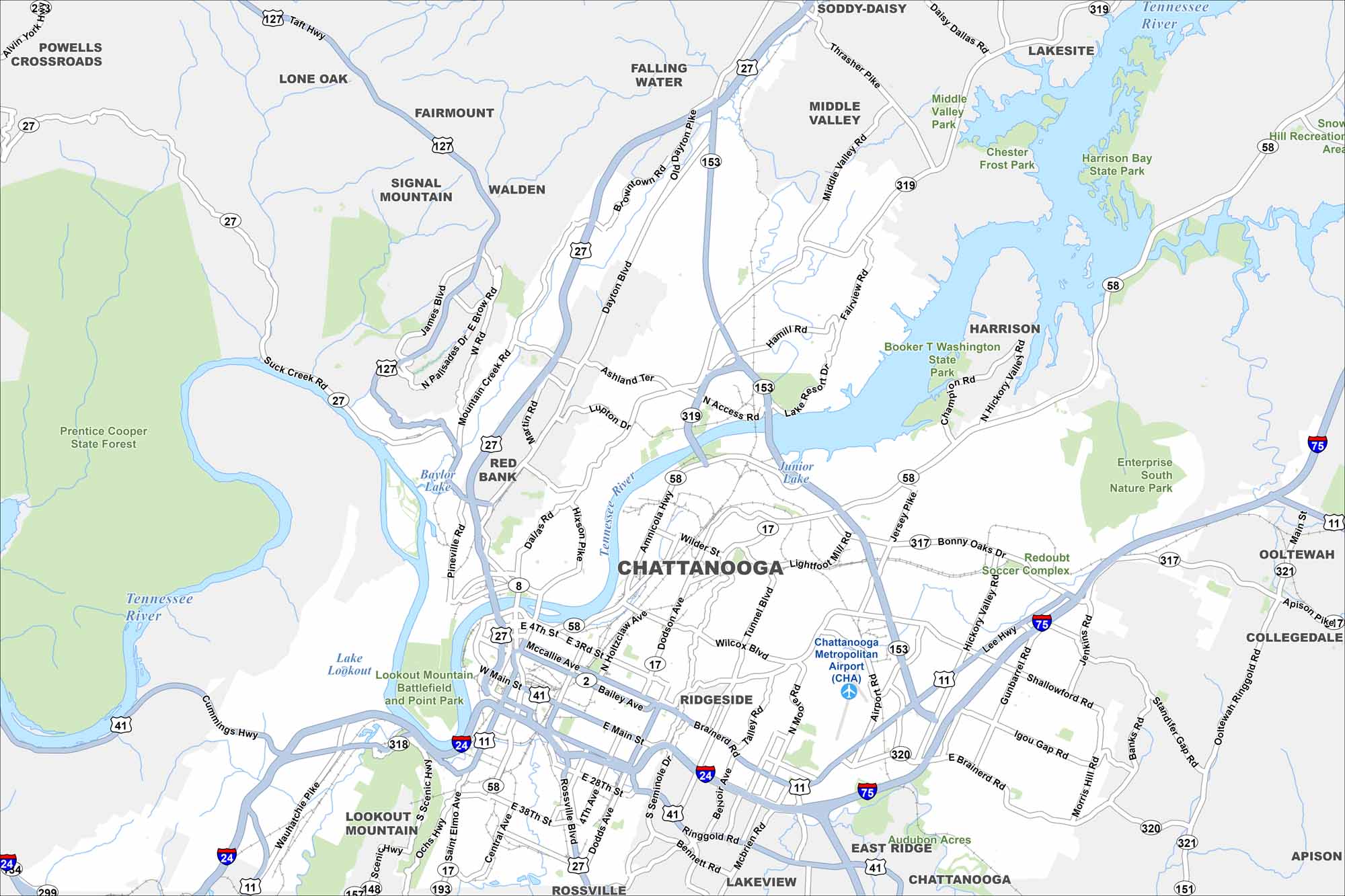
We’ve mapped Chattanooga with its many bridges and riverbanks. The Tennessee River curves right through the city. The city is known as the “Scenic City” because it’s near Lookout Mountain and Missionary Ridge.
Map Information
On the Map
Interstates/Highways: I-24, I-75, US Hwy 27, US Hwy 127, US Hwy 41, US Hwy 11, US Hwy 64, State Rte 153, State Rte 58, State Rte 319, State Rte 17, State Rte 317, State Rte 318, State Rte 320, State Rte 321, State Rte 193 Major Roads: Hixson Pike, Dayton Blvd, Brainerd Rd, Amnicola Hwy, McCallie Ave, Ringgold Rd, Shallowford Rd, Bonny Oaks Dr, Gunbarrel Rd, Lee Hwy, Signal Mountain Rd, Mountain Creek Rd, Wilcox Blvd, Tunnel Blvd, North Moore Rd, Cummings Hwy, Scenic Hwy, Broad St, Main St, Ooltewah Ringgold Rd Airports: Chattanooga Metropolitan Airport (CHA) Lakes and Reservoirs: Junior Lake, Baylor Lake, Lake Lookout Major Rivers: Tennessee River Parks and Preserves: Prentice Cooper State Forest, Booker T Washington State Park, Harrison Bay State Park, Enterprise South Nature Park, Audubon Acres, Lookout Mountain Battlefield and Point Park Nearby Communities: Red Bank, Ridgeside, East Ridge, Signal Mountain, Walden, Harrison, Ooltewah, Collegedale, Apison, Rossville, Walden, Fairmount, Middle Valley, Soddy-Daisy, Lakeside, Lone Oak Neighborhoods: Downtown ChattanoogaTennessee State Maps
Here are our state maps of Tennessee.


City Maps of Tennessee
Explore our Tennessee map collection


