Map of Memphis, Tennessee
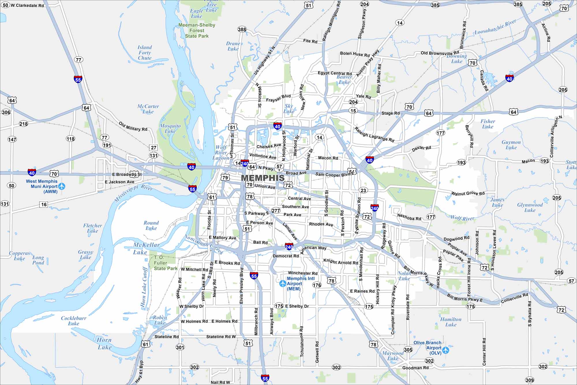
Our map of Memphis shows the Mississippi River shaping the city’s western edge. It’s a major cultural and transportation hub. Beale Street, Midtown, and Graceland all stand out.
Map Information
On the Map
Interstates/Highways: I-40, I-55, I-240, US Hwy 51, US Hwy 61, US Hwy 64, US Hwy 70, US Hwy 72, US Hwy 78, US Hwy 79, State Rte 14, State Rte 15, State Rte 175, State Rte 176, State Rte 177, State Rte 204, State Rte 205, State Rte 277, State Rte 301, State Rte 385 Major Roads: Union Ave, Poplar Ave, Walnut Grove Rd, Central Ave, Southern Ave, Lamar Ave, Shelby Dr, Airways Blvd, Elvis Presley Blvd, Getwell Rd, Perkins Rd, Mendenhall Rd, White Station Rd, Ridgeway Rd, Kirby Pkwy, Germantown Rd, Winchester Rd, Raines Rd, Austin Peay Hwy, Stage Rd Airports: Memphis Intl Airport (MEM), West Memphis Muni Airport (AWM), Olive Branch Airport (OLV) Lakes and Reservoirs: McCarter Lake, Mosquito Lake, Round Lake, Fletcher Lake, McKellar Lake, Horn Lake, Robco Lake, Stateline Lake, Hamilton Lake, Nolia Morris Lake, James Lake, Glynnwood Lake, Guymon Lake, Fisher Lake, Downing Lake, Beaver Lake, Sky Lake, Dranes Lake, Tree Lake, Eagle Lake Major Rivers: Mississippi River, Wolf River, Loosahatchie River, Nonconnah Creek Parks and Preserves: Meeman-Shelby Forest State Park, Fuller State Park Nearby Communities: West Memphis Neighborhoods: Downtown MemphisTennessee State Maps
Here are our state maps of Tennessee.


City Maps of Tennessee
Explore our Tennessee map collection


