Map of Palm Springs, California
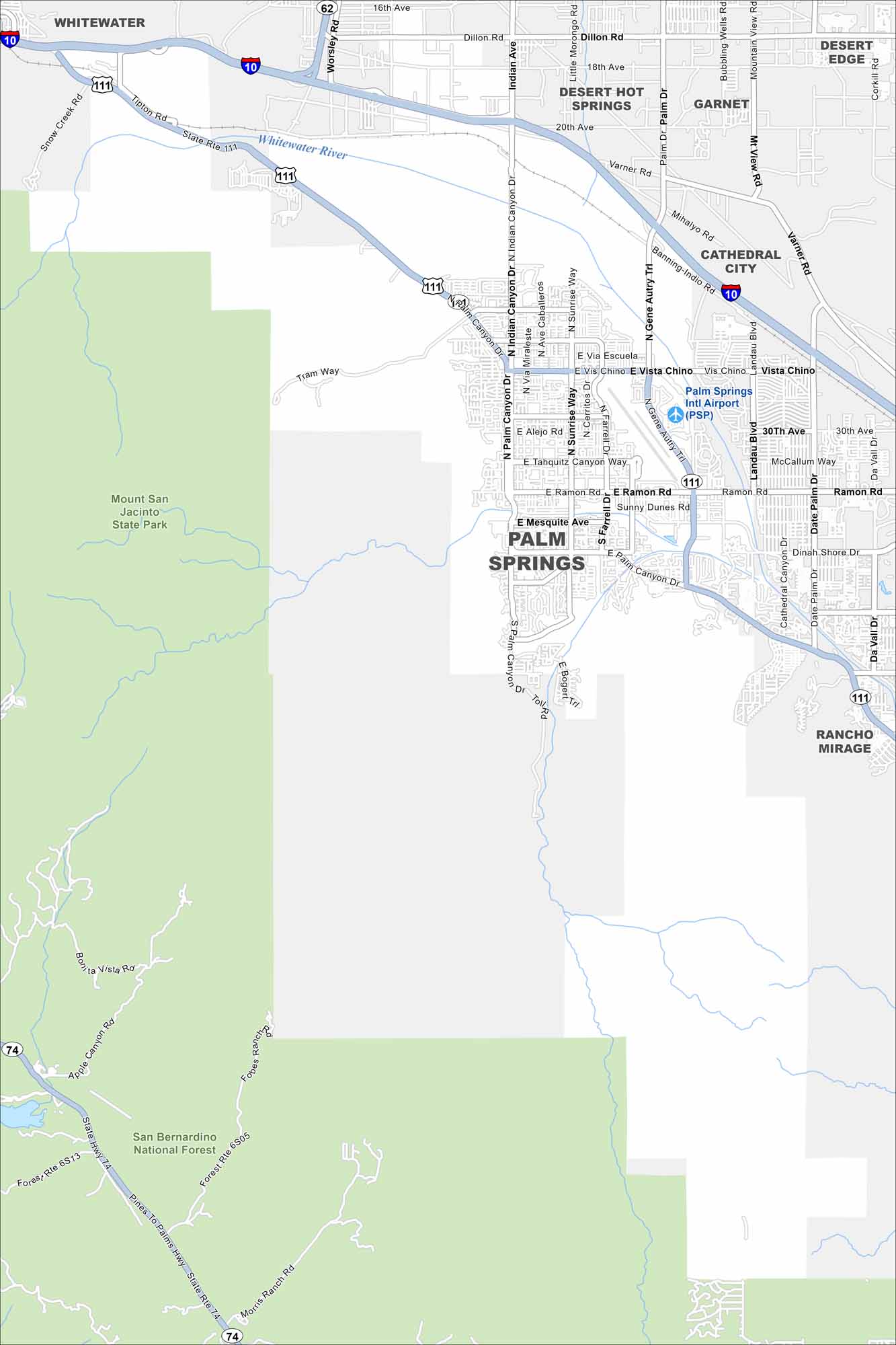
Palm Springs lies at the base of the San Jacinto Mountains. Check out our map to see its downtown streets and wide desert surroundings. It’s famous for mid-century architecture and hot springs.
California State Maps
Explore California with our state maps


Map Information
On the Map
Interstates/Highways: I-10, State Rte 111, State Rte 62, State Rte 74 Major Roads: Palm Canyon Dr, Ramon Rd, Sunrise Way, Vista Chino, Indian Canyon Dr, Gene Autry Trl, Farrell Dr, Dinah Shore Dr, Date Palm Dr, Landau Blvd, Mesquite Ave, Tahquitz Canyon Way, Alejo Rd, Tipton Rd, Varner Rd, Dillon Rd, Tram Way, Bogert Trl, Fobes Ranch Rd, Morris Ranch Rd Airports: Palm Springs Intl Airport (PSP) Major Rivers: Whitewater River Parks and Preserves: San Bernardino National Forest, Mount San Jacinto State Park Nearby Communities: Whitewater, Desert Hot Springs, Garnet, Desert Edge, Cathedral City, Rancho Mirage Neighborhoods: Downtown Palm SpringsCalifornia City Maps
Here are detailed maps of California


