Cape Cod Map
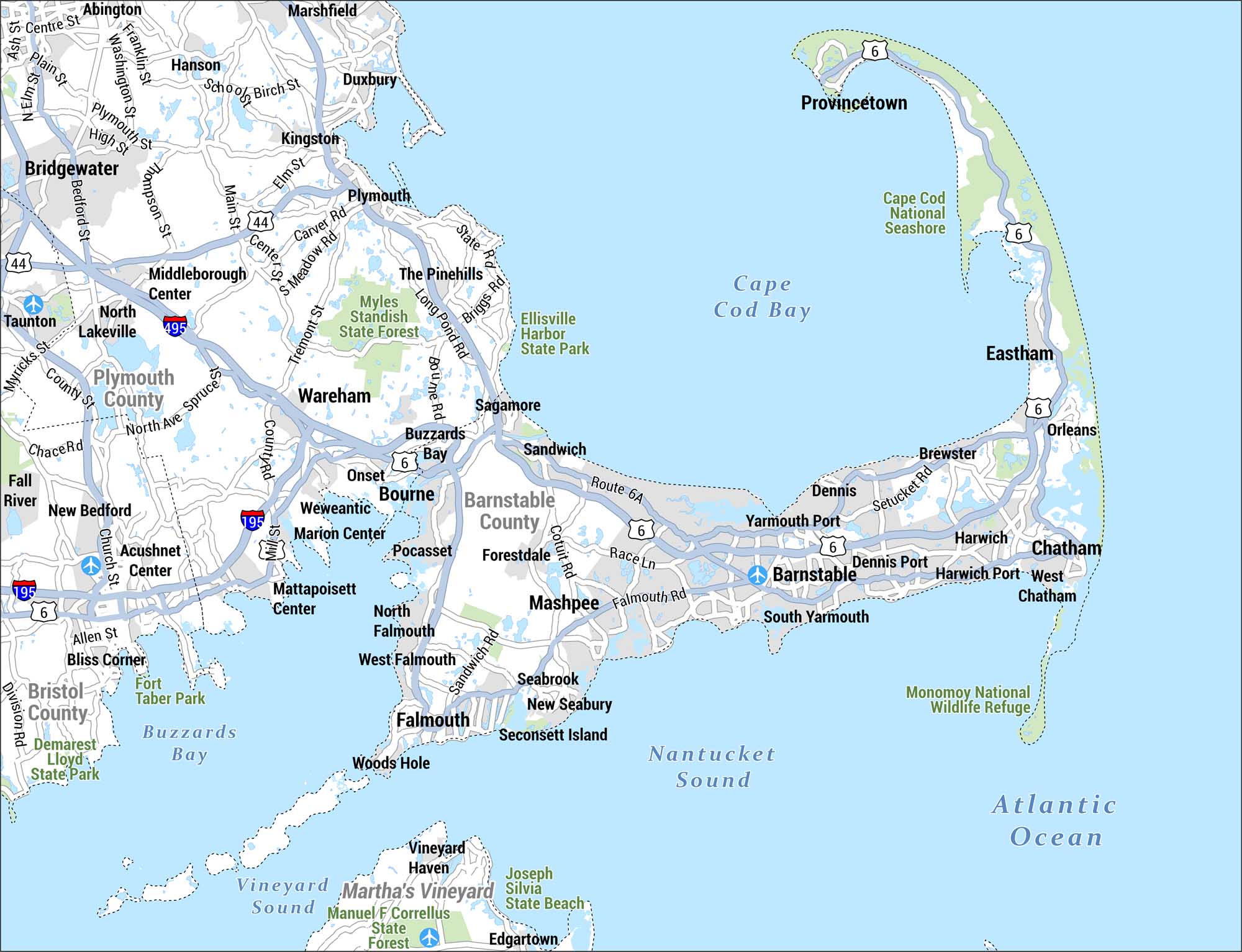
Check out our map of the Cape Cod region of Massachusetts. This area is known for its distinctive hook-shaped peninsula along the Atlantic Ocean.
Map Information
On the Map
Cape Cod Communities: Provincetown, Eastham, Orleans, Brewster, Dennis, Dennis Port, Yarmouth Port, South Yarmouth, Harwich, Harwich Port, West Chatham, Chatham, Barnstable, Sandwich, Sagamore, Bourne, Buzzards Bay, Onset, Falmouth, North Falmouth, West Falmouth, Mashpee, Forestdale, Pocasset, Weweantic, Marion Center Surrounding Communities: Plymouth, Kingston, Duxbury, Marshfield, Bridgewater, Hanson, Middleborough Center, North Lakeville, Wareham, Taunton, New Bedford, Acushnet Center, Mattapoisett Center, Fall River, Bliss Corner Counties: Barnstable County, Plymouth County, Bristol County Parks & Natural Areas: Cape Cod National Seashore, Monomoy National Wildlife Refuge, Myles Standish State Forest, Ellisville Harbor State Park, Fort Taber Park, Demarest Lloyd State Park, Manuel F. Correllus State Forest, Joseph Silvia State Beach Highways: US-6, MA-44, I-495, I-195 Bodies of Water: Cape Cod Bay, Buzzards Bay, Nantucket Sound, Vineyard Sound, Atlantic OceanReferences
Coastal Region Maps
All coastal landscapes, maritime cultures, beaches, and islands.