Jersey Shore Map
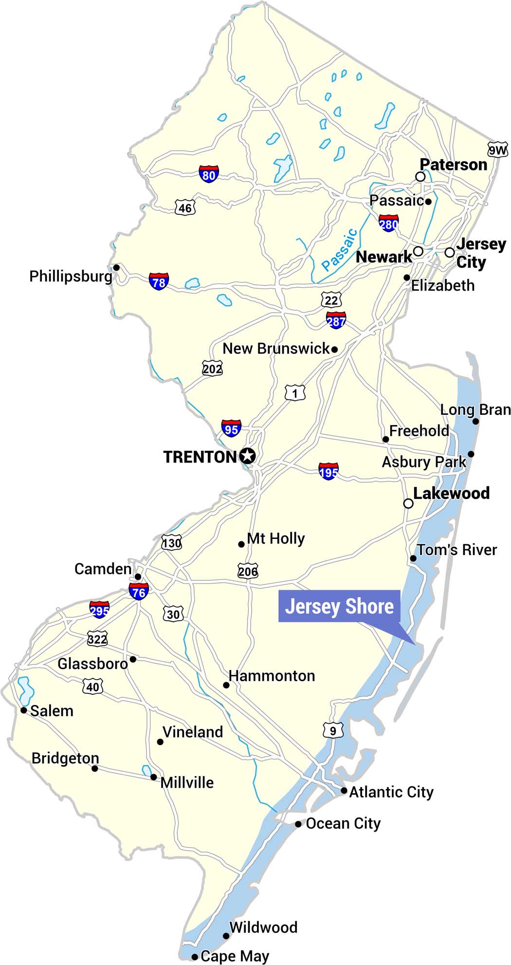
Our map highlights the Jersey Shore along the eastern coastline, marked with a blue label. The map covers the full state with major cities, highways, and the Passaic River.
Map Information
On the Map
Communities Near Jersey Shore: Long Branch, Asbury Park, Tom’s River, Atlantic City, Ocean City, Wildwood, Cape May Other Major Cities: Trenton (capital), Newark, Jersey City, Paterson, Passaic, Elizabeth, New Brunswick, Camden, Lakewood, Freehold, Mt Holly, Hammonton, Glassboro, Salem, Bridgeton, Vineland, Millville, Phillipsburg Highways and Roads: I-80, I-78, I-95, I-195, I-76, I-295, I-280, US-1, US-9, US-22, US-30, US-40, US-46, US-130, US-202, US-206, US-322, NJ-9W Bodies of Water: Passaic RiverReferences
Coastal Region Maps
All coastal landscapes, maritime cultures, beaches, and islands.