Mojave Desert Map
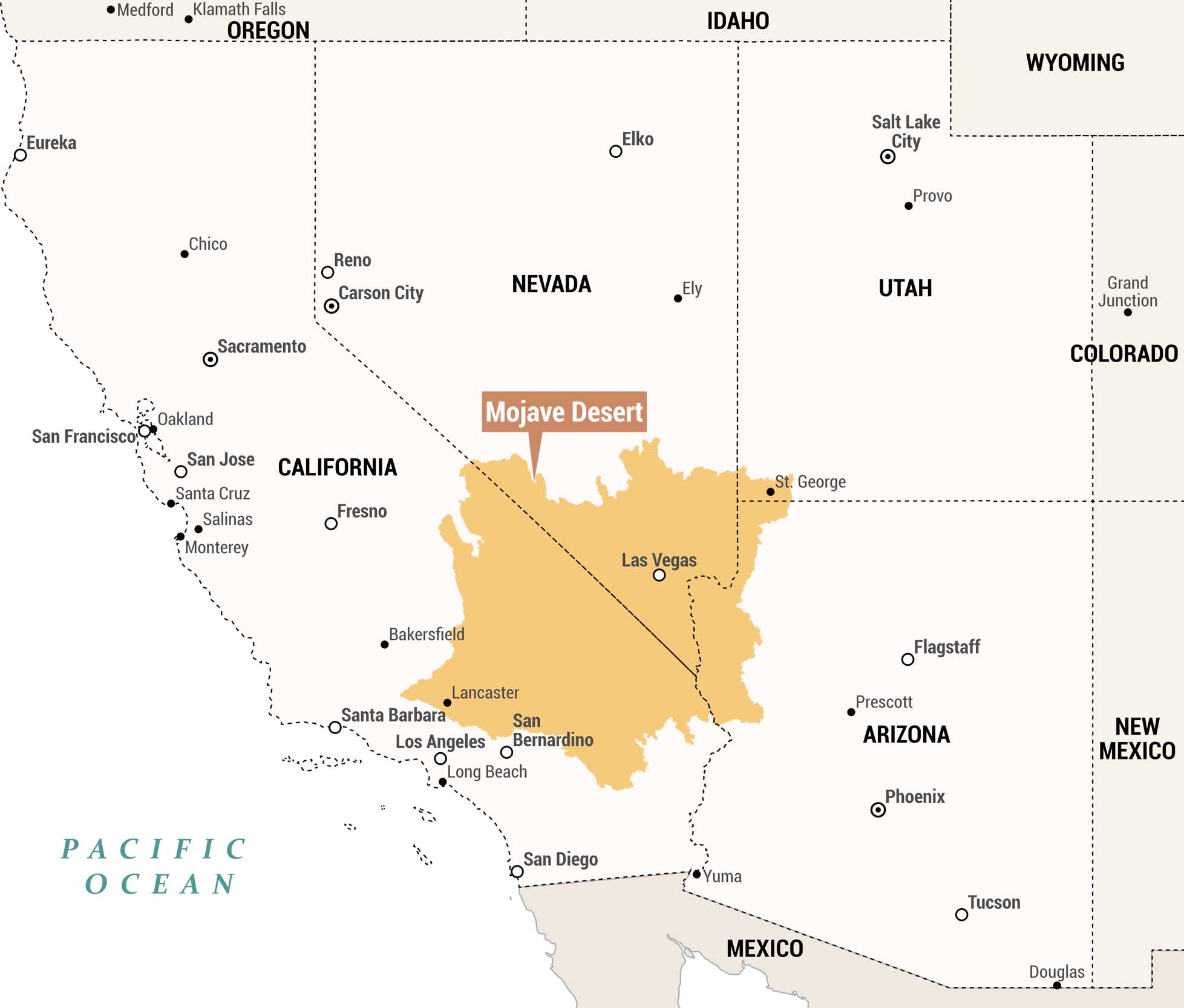
We created this regional map to highlight the Mojave Desert in orange. The Mojave Desert spans parts of southeastern California and southern Nevada. We included broad multi-state context with major cities and surrounding states.
Map Information
On the Map
Main Feature: Mojave Desert (covering portions of California, Nevada, Utah, and Arizona) Cities within Mojave Desert: Las Vegas, San Bernardino, Lancaster, St. George States: California, Nevada, Oregon, Idaho, Wyoming, Utah, Colorado, Arizona, New Mexico Surrounding Cities/Towns: Medford, Klamath Falls, Eureka, Chico, Sacramento, Oakland, San Francisco, San Jose, Santa Cruz, Salinas, Monterey, Fresno, Bakersfield, Santa Barbara, Los Angeles, Long Beach, San Diego, Reno, Carson City, Elko, Ely, Salt Lake City, Provo, St. George, Grand Junction, Flagstaff, Prescott, Phoenix, Tucson, Yuma, Douglas Bodies of Water: Pacific OceanReferences
Natural Region Maps
Geographic landforms, wilderness zones, deserts, mountain ranges, and terrain.