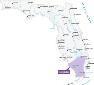
Okefenokee Swamp Map
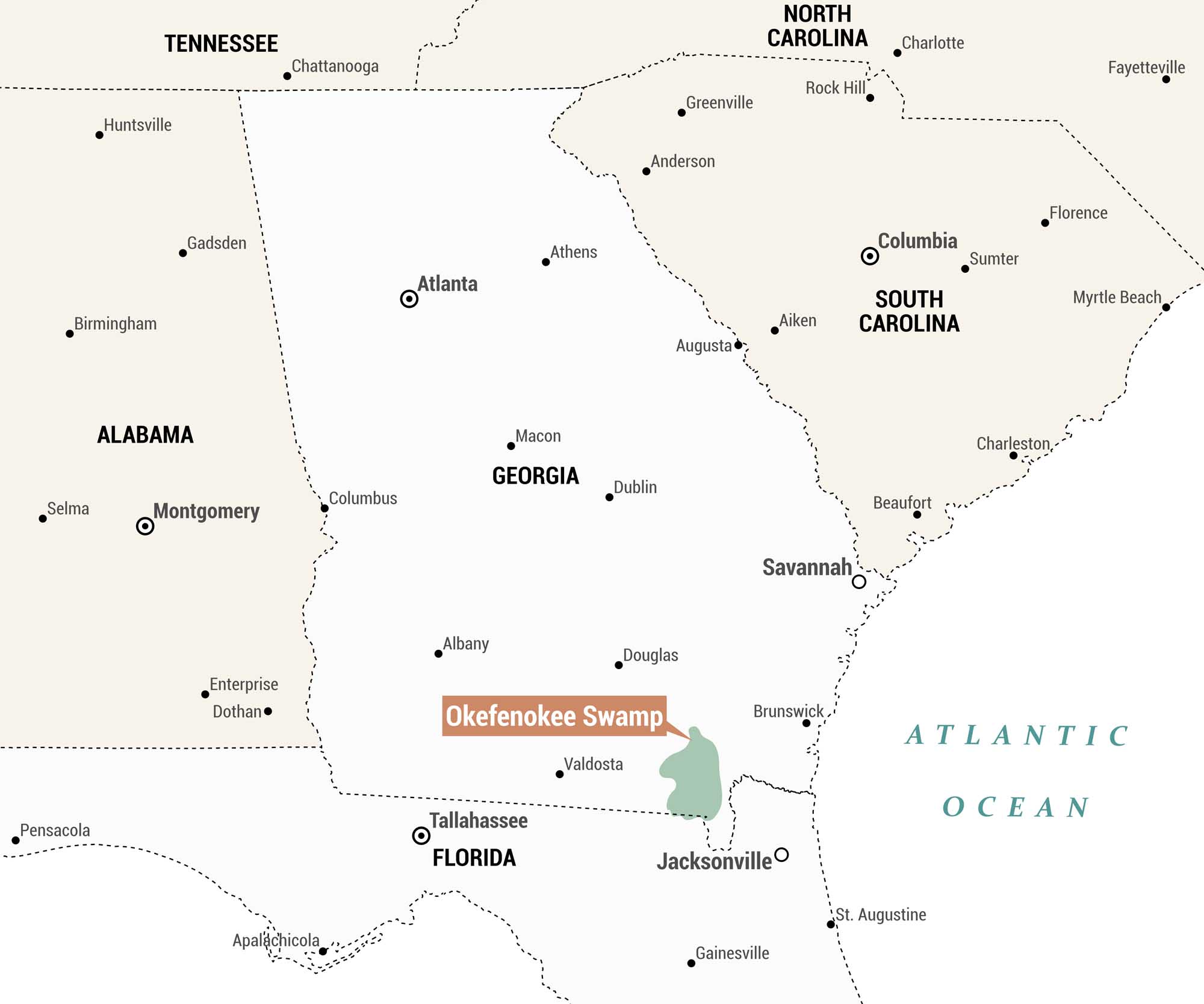
This is a regional reference map highlighting the Okefenokee Swamp. It’s one of the largest freshwater wetlands in North America, located in the southeastern corner of Georgia near the Florida border. The swamp is shaded in green and sits just northwest of Jacksonville, Florida.
Map Information
On the Map
States: Georgia, Florida, Alabama, Tennessee, North Carolina, South Carolina Nearby Cities (closest to the swamp): Valdosta, Brunswick, Jacksonville, Douglas Other Cities/Towns: Atlanta, Savannah, Albany, Columbus, Macon, Dublin, Augusta, Athens, Montgomery, Birmingham, Huntsville, Gadsden, Selma, Enterprise, Dothan, Chattanooga, Tallahassee, Gainesville, Apalachicola, Pensacola, Columbia, Charleston, Beaufort, Greenville, Anderson, Rock Hill, Charlotte, Aiken, Sumter, Myrtle Beach, Florence, Fayetteville, St. Augustine Bodies of Water: Atlantic OceanNatural Region Maps
Geographic landforms, wilderness zones, deserts, mountain ranges, and terrain.