Map of San Antonio, Texas
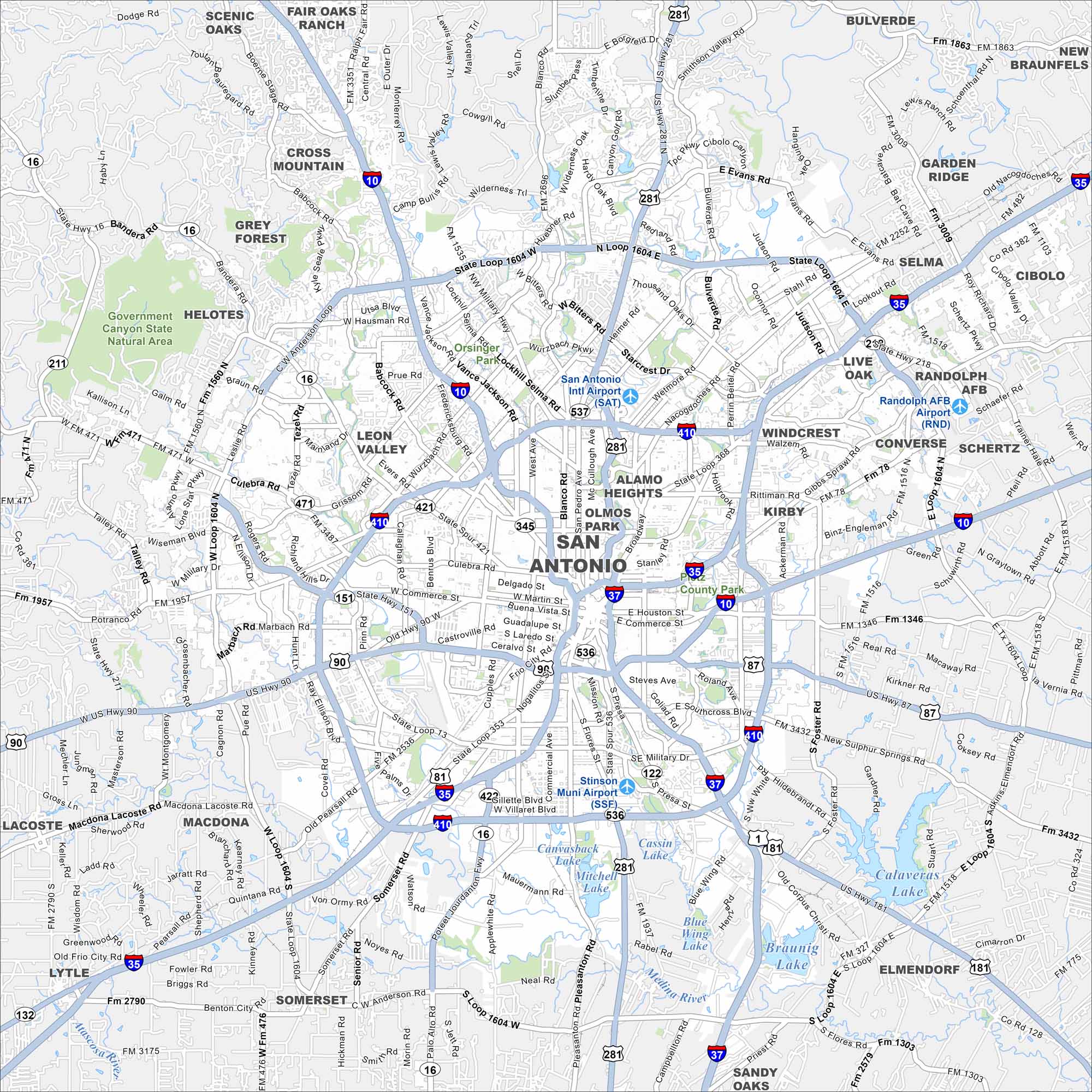
San Antonio is famous for the Alamo and its River Walk. Our map highlights downtown streets, historic neighborhoods, and cultural landmarks.
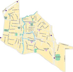
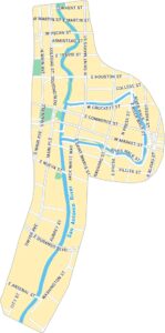
San Antonio Neighborhood Maps
See our neighborhood maps for a closer look of the city.
Map Information
On the Map
Interstates/Highways: I-10, I-35, I-37, I-410, US Hwy 81, US Hwy 87, US Hwy 90, US Hwy 281, State Rte 16, State Rte 46, State Rte 87, State Rte 151, State Rte 211 Major Roads: Loop 1604, Loop 410, Wurzbach Pkwy, Anderson Loop, Military Dr, Babcock Rd, Culebra Rd, Fredericksburg Rd, Blanco Rd, Bandera Rd, Broadway, Potranco Rd, Marbach Rd, Pearsall Rd, Roosevelt Ave, Goliad Rd, Foster Rd, Graytown Rd, Abbott Rd, Walzem Rd Airports: San Antonio Intl Airport (SAT), Randolph AFB Airport (RND), Stinson Muni Airport (SSF) Lakes and Reservoirs: Calaveras Lake, Braunig Lake, Mitchell Lake, Cassin Lake, Canvasback Lake, Blue Wing Lake Major Rivers: Medina River Parks and Preserves: Government Canyon State Natural Area Nearby Communities: Scenic Oaks, Fair Oaks Ranch, Cross Mountain, Grey Forest, Helotes, Leon Valley, Alamo Heights, Olmos Park, Windcrest, Kirby, Converse, Live Oak, Selma, Garden Ridge, Schertz, Cibolo, New Braunfels, Bulverde, Saint Hedwig, Elmendorf, Sandy Oaks, Somerset, Lytle, Macdona, LacosteTexas State Maps
Scan our maps of the massive southern state of Texas.


City Maps of Texas
Explore our map collection of Texas cities.


