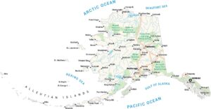
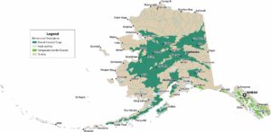
Alaska National Parks and Forests Map
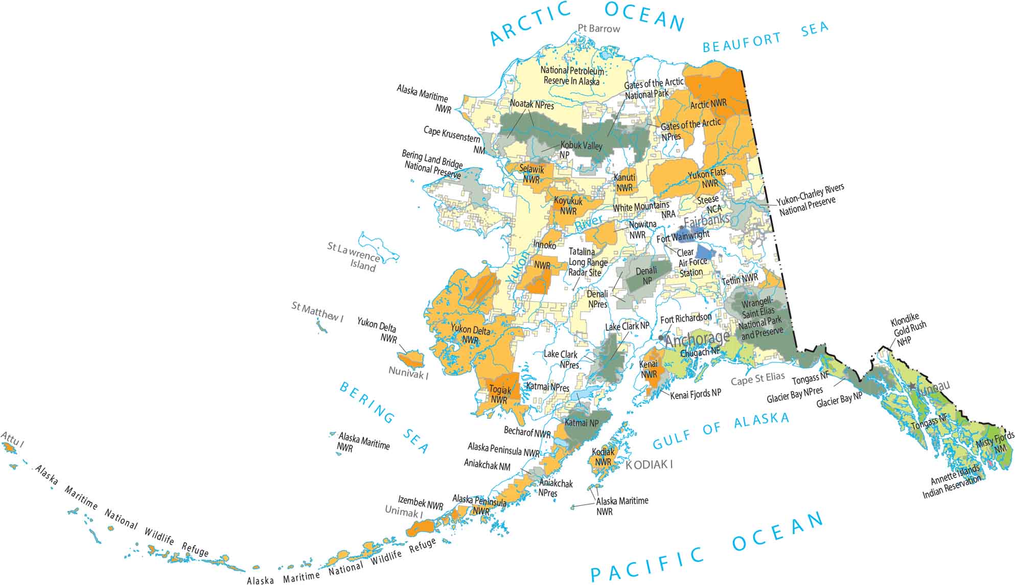
National parks and forests dominate much of Alaska. For instance, Denali National Park stands out near the state’s highest terrain. Large regions remain completely undeveloped. Our map shows massive protected areas broken only by rivers and coastlines.
Map Information
On the Map
Alaska State Maps
Take a look at our Alaska state maps