Katmai National Park Map
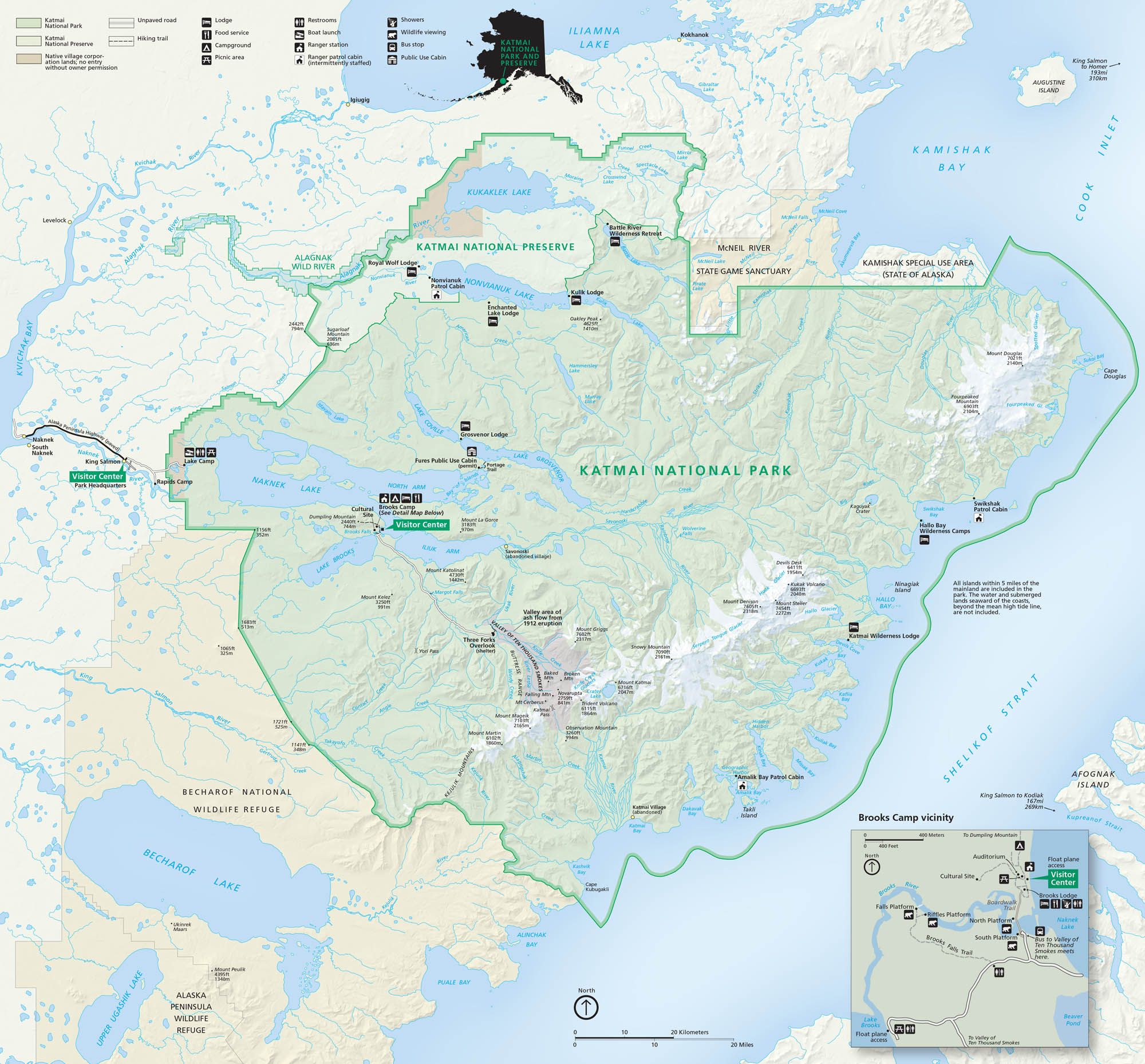
Our map of Katmai National Park guides you through Alaska’s wild volcanic country. The park, itself, holds the Valley of Ten Thousand Smokes, remote tundra, and famous bear-watching rivers.
Map Information
On the Map
Parks: Katmai National Park and Preserve, Alagnak Wild River, McNeil River State Game Sanctuary, Becharof National Wildlife Refuge Visitor Centers: Brooks Camp Visitor Center, King Salmon Visitor Center Lakes and Bays: Naknek Lake, Brooks Lake, Lake Coville, Lake Grosvenor, Nonvianuk Lake, Kukaklek Lake, Battle Lake, Iliamna Lake, Becharof Lake, Shelikof Strait, Cook Inlet, Kamishak Bay, Hallo Bay, Kukak Bay, Katmai Bay, Alagnak River, Savonoski River, King Salmon River, Ukak River Cities/Towns: King Salmon, Naknek, South Naknek, Levelock, Igiugig, Kokhanok, Port Alsworth, Kodiak Campgrounds and Lodges: Brooks Camp, Fure’s Cabin, Lake Camp, Kulik Lodge, Brooks Lodge, Enchanted Lake Lodge, Grosvenor Lodge, Royal Wolf Lodge, Katmai Wilderness Lodge, Hallo Bay Wilderness Camp Other Landmarks: Valley of Ten Thousand Smokes, Mount Katmai, Novarupta, Mount Griggs, Mount Mageik, Mount Martin, Mount Douglas, Knife Peak, Trident Volcano, Snowy Mountain, Mount Denison, Mount StellerNational Park Maps
Find maps of green spaces and national parks near you.


