Golden Gate Bridge Map
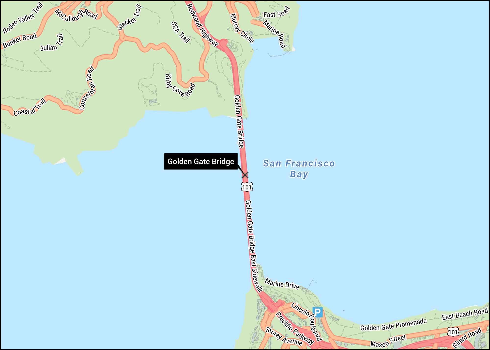
Behold. The Golden Gate Bridge spans the strait between San Francisco and Marin. Our Golden Gate Bridge map shows highways, roads, and paths.
Map Information
On the Map
Interstates/Highways: US Hwy 101 Major Roads: Golden Gate Bridge, Presidio Pkwy, Lincoln Blvd, Redwood Hwy, Bunker Rd, McCullough Rd, Conzelman Rd, Marine Dr, Storey Ave, Mason St, Girard Rd, East Beach Rd, Marina Rd, East Rd, Murray Circle Water Bodies: San Francisco Bay Other Landmarks: Golden Gate Bridge East Sidewalk, Golden Gate Promenade Trails: Coastal Trail, Julian Trail, Slacker Trail, SCA TrailTourist Maps in California
Discover all the prime locations with our tourist maps.